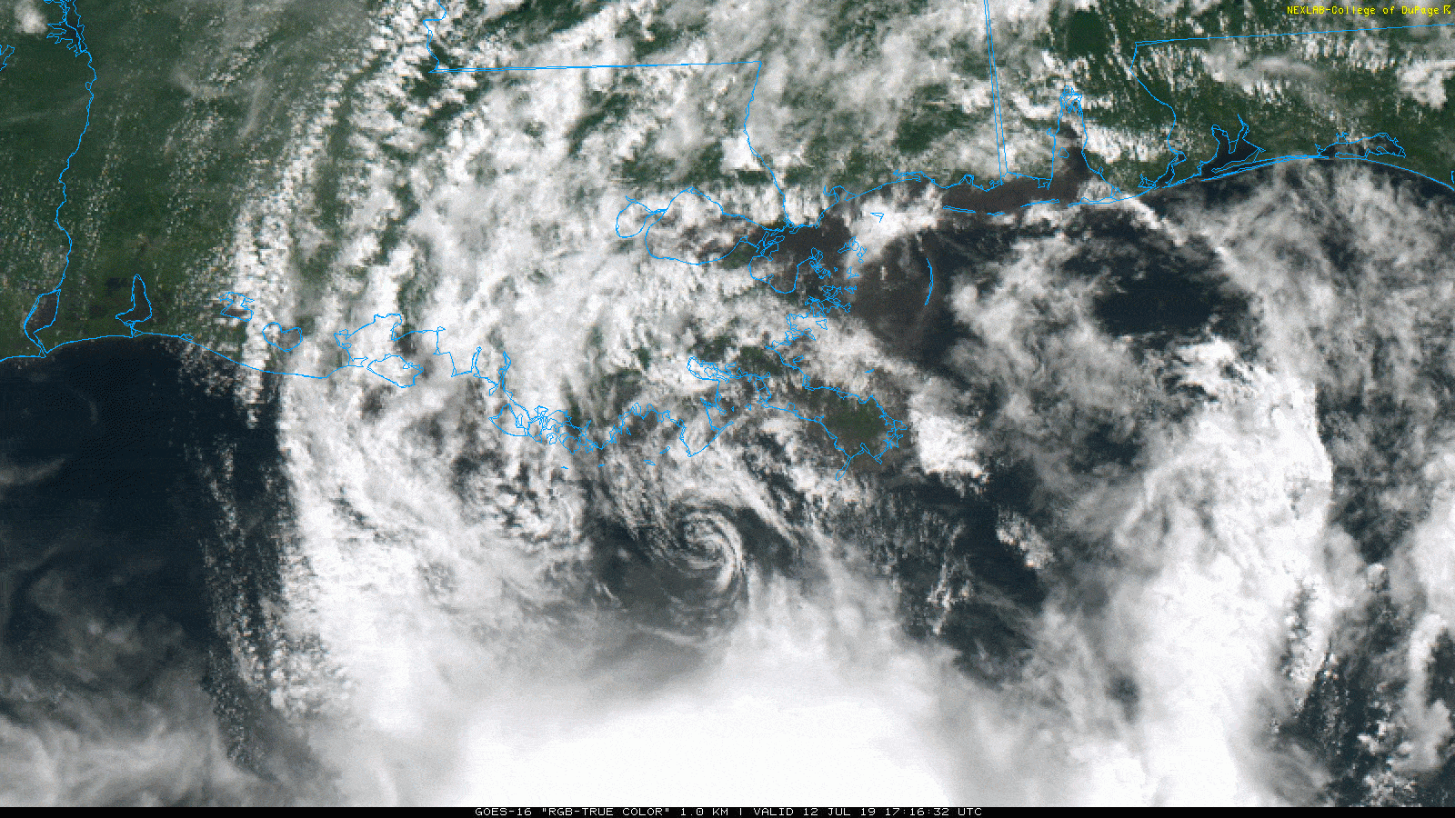
Tropical Storm Barry is flirting with hurricane intensity this morning south of Morgan City, LA. Maximum sustained winds are 70 mph, and it’s possible Barry could cross the finish line as a hurricane. Landfall is expected somewhere on the west side of Vermilion Bay, LA this afternoon.
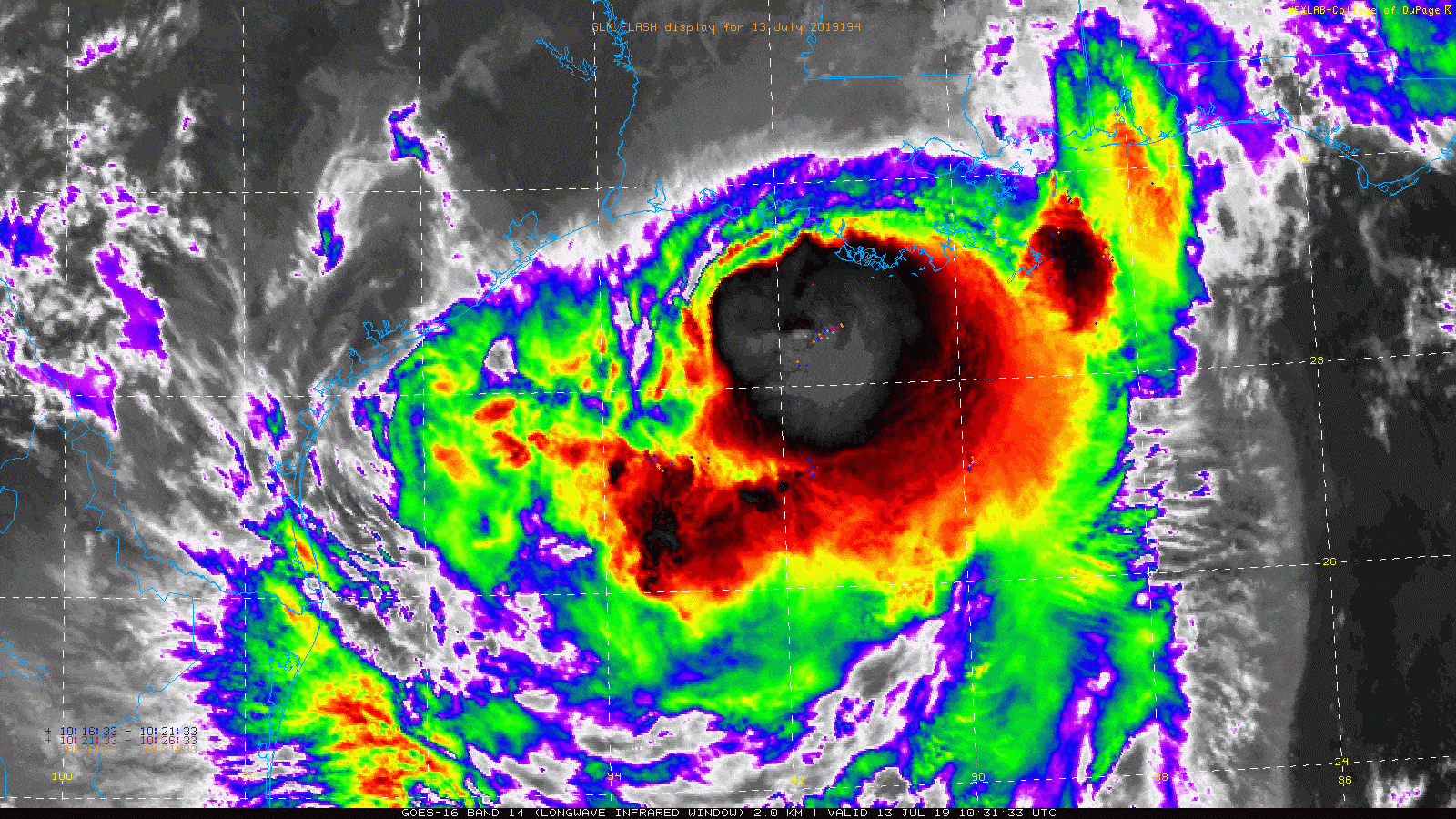
Moving forward, Barry will slowly move inland over Louisiana, and all those bright clouds that indicate thunderstorms are going to come ashore in Louisiana. It’s been mostly nuisance rain there so far, but it will escalate significant later today or tonight. Storm surge flooding is an ongoing issue across much of eastern Louisiana.
More than a dozen people stranded on rooftops in Terrebonne Parish are being rescued by the Coast Guard. https://t.co/t5cIy9rYXt
— NOLA.com (@NOLAnews) July 13, 2019
Significant storm #surge is pushing into the Atchafalaya basin south of Morgan City right now from #Barry. Winds gusting to 80 mph at the @noaaocean Eugene Island tide gauge with pressure down to 994 mb. #TropicalStormBarry #lawx pic.twitter.com/i7hDkJJ3k9
— Michael Lowry (@MichaelRLowry) July 13, 2019
We will continue to see these problems through the day, and then the rainfall will begin to cause problems tonight.
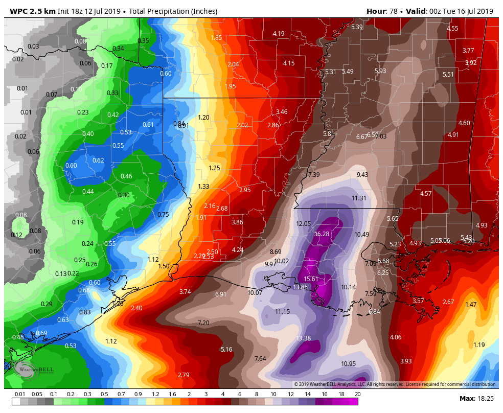
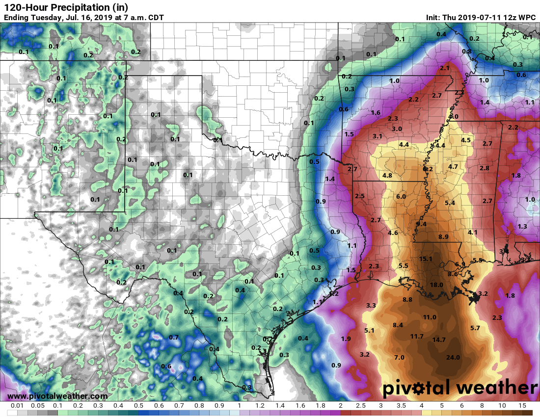
How much rain?
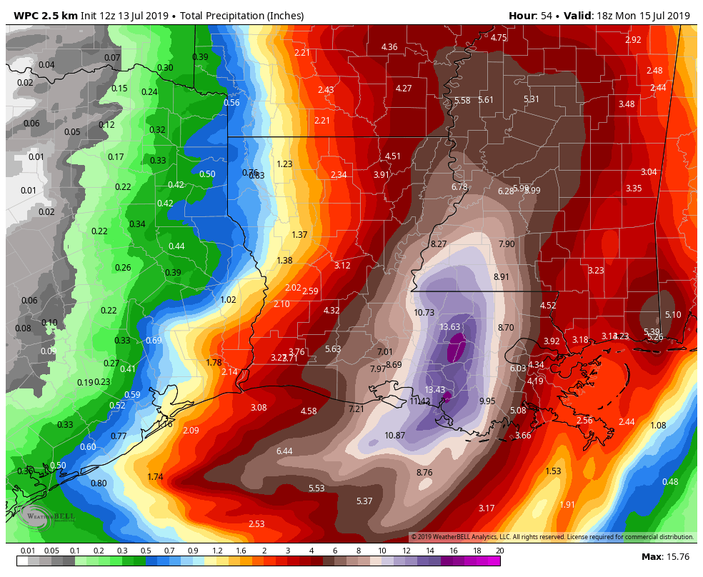
Well, according to the NWS Weather Prediction Center, most of eastern Louisiana should see four inches or more of rainfall, with the bullseye between Lafayette and New Orleans of 10 to 15 inches. This bullseye may end up near the Baton Rouge area.
This serves as a nice breakpoint for us to shift gears and talk about Texas. That official forecast shows 1 to 2 inches through Monday afternoon between Galveston and Beaumont, with lesser amounts north and west of there. Let’s break things down a bit.