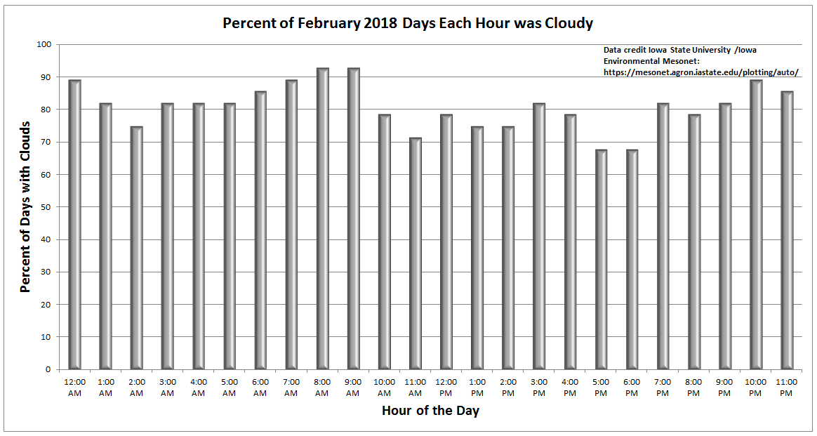
Thursday ended up being a beautiful day. It’s almost like we turned a page after February. With all the data from last month in, we can crunch some numbers now and tell you just how cloudy February ended up. Iowa State University’s Iowa Environmental Mesonet has a useful tool that takes every hourly observation and tells you what percentage had overcast conditions reported. Keep in mind that how hourly observations are taken has changed a bit over time, so there are likely inconsistencies from 1970s data to 2018 data. But since at least 1973, no February has been cloudier in Houston. Of all hourly observations last month, 81% had cloud cover reported.
The next closest February was 1989, when 65% of the month had cloud cover. What’s more interesting? February 2016 was the least cloudy February since at least 1973. So, of the last three Februaries, we’ve had both extremes recorded. Impressive.
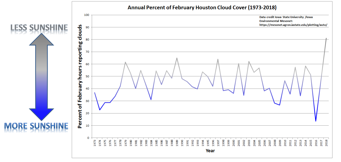
You can enlarge either image above by clicking on it. So, that was February. The responses I’ve seen from people have been impressively divided and partisan. Some of you absolutely loved that kind of February. Others were really struggling without sunshine. I fall about 80% of the way into the latter camp, but take what we can get before summer sets in, right?
Either way, we’ve turned the corner. Let’s run down the forecast.
Today & Saturday
We have the antithesis of February’s weather today. Expect ample sunshine and low humidity. We’ll generally top off in the lower or middle 70s this afternoon after a refreshing morning. “Perfect weather” is a very subjective definition, but I have to think today will come close to checking most of the boxes. Overnight lows tonight into Saturday morning could even be a couple degrees cooler than today. Expect some scattered 40s north and lower or middle 50s elsewhere (though milder at the beach).
Saturday looks fine for now. We’ll begin to notice clouds creeping in through the day as onshore flow kicks back in. If you live from about Sugar Land south and west, I wouldn’t be shocked to see a few showers or sprinkles pop up in the afternoon tomorrow. But I don’t think it would be anything too problematic. High temperatures Saturday will reach for the lower 70s once again. Most Saturday outdoor plans should be fine.

