After a clear and cold weekend, our concerns once again turn to the possibility of a winter storm in Houston—the third time we’ve worried about this kind of thing during the winter of 2017-2018. Fortunately, I’m also pretty confident this is the last time we’ll have to worry about this for this winter.
MLK Day
Fortunately, the inclement weather will hold off for today, allowing for pretty nice conditions across the region for the celebration of MLK Day. We can expect to see high temperatures in the low 60s, with partly sunny skies. Some scattered showers are possible later this afternoon and evening, as temperatures fall to around 50 degrees.
Tuesday
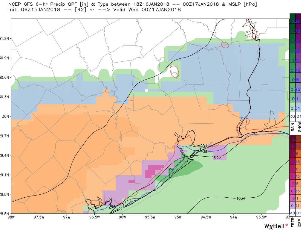
Everything changes on Tuesday as a strong cold front blows into Houston between midnight Monday, and sunrise on Tuesday. Light rain should follow behind this front. We’re not concerned about accumulations, with only a tenth or two of an inch of precipitation for most areas. But we are definitely concerned about the potential for rain turning into a wintry mix north and west of Houston on Tuesday morning (i.e. in the Brazos Valley and the Piney Woods regions), and moving southward into the Houston area later on Tuesday.
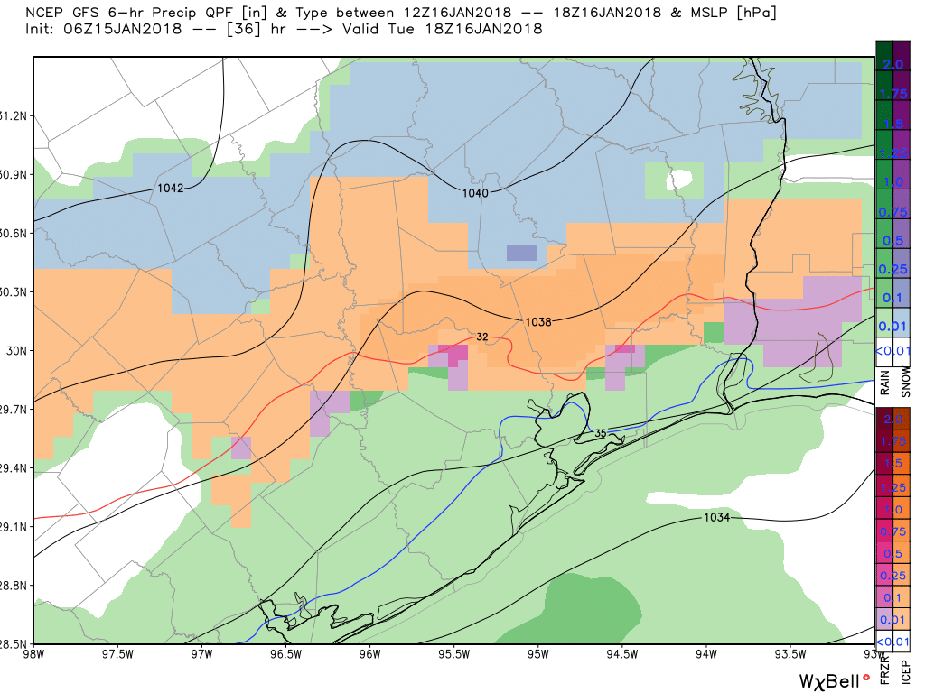
Expect temperatures to fall throughout the day on Tuesday as very cold air advects into the region behind the front. For Houston, we’re primarily concerned about precipitation that lingers into the afternoon and evening on Tuesday, when temperatures fall below freezing. Although the precipitation (rain, sleet, snow?) will be light, you’re going to want to check the weather and road conditions before venturing out on Tuesday evening or Wednesday morning. Overall I’m not too concerned as something like light sleet shouldn’t cause major problems. But we’re nonetheless watching this closely because of its trouble-making potential, and we’ll keep you updated. A winter weather advisory is in effect from 3am Tuesday until 6am Wednesday for the entire metro area.
The other big story for Tuesday night is low temperatures. Right now I expect we’ll see low 20s for inland areas, mid-20s for central parts of the Houston area, and upper-20s for the coast. Obviously you should take similar precautions as to what you did for the cold snap right at the beginning of the new year.