The cold front has moved off the coast this morning, and rain showers are following suit, with the bulk of the rain likely fully offshore by mid-morning. If they’re not already, skies will be clearing out today bringing some lovely, spring-like weather to the region for the next several days.
Tuesday
Cooler air will move into Houston later today, but highs should reach the lower 70s before it does so. Winds will be modest out of the northwest, and mostly clear skies will allow temperatures tonight to fall to around 40 degrees for far inland areas, and mid-50s along the coast.
Wednesday and Thursday
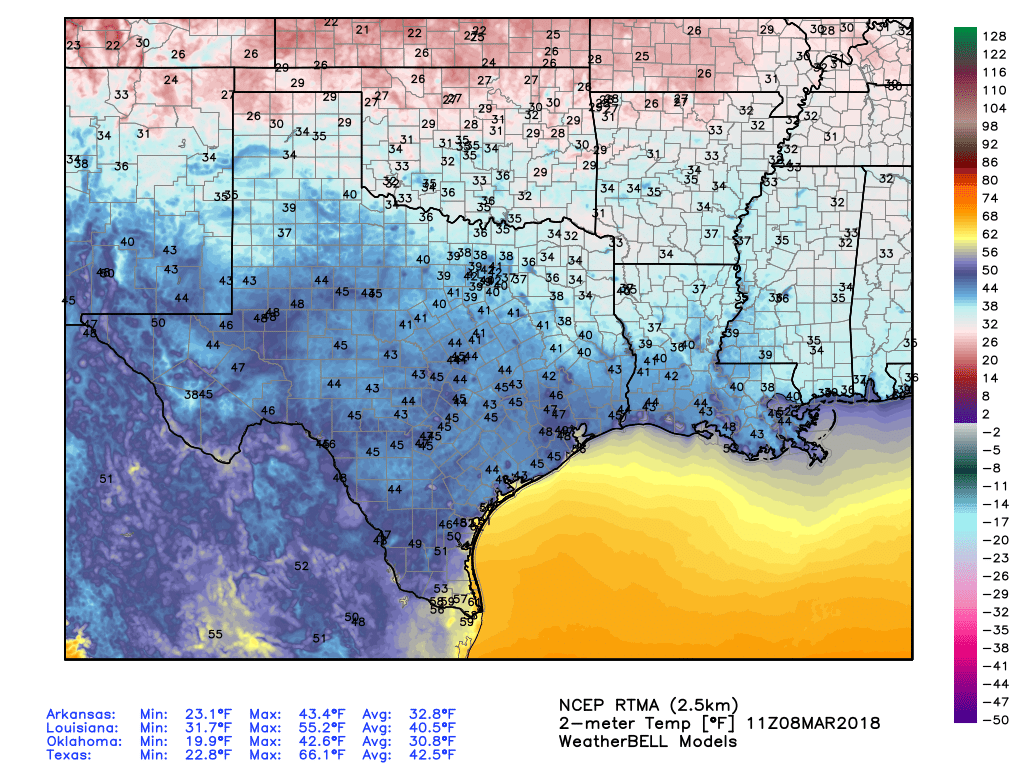
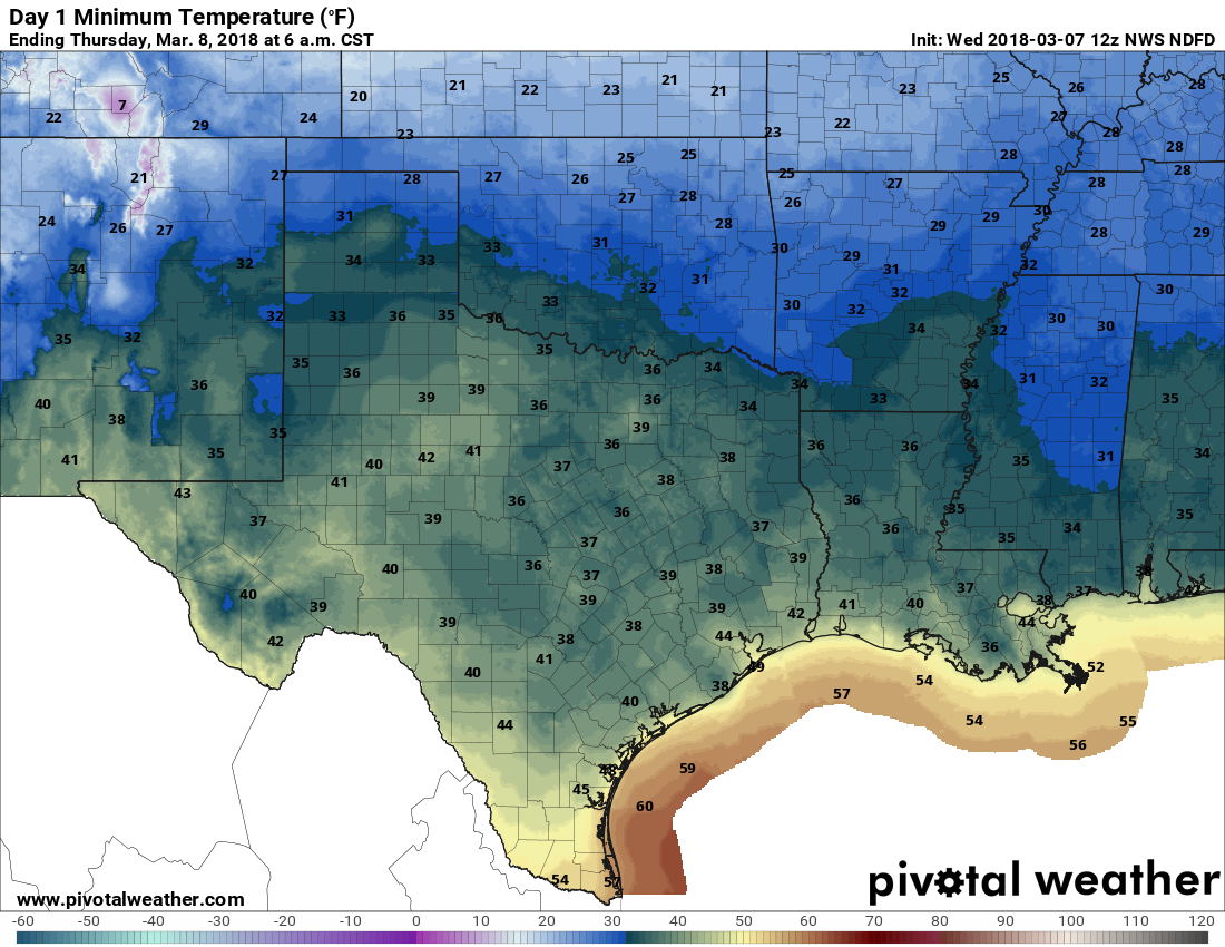
Very nice weather continues, with mostly sunny skies and highs in the upper 60s for the most part. Wednesday night/Thursday morning looks to be the coldest of the week, with far inland areas possibly seeing the upper 30s, and most of Houston solidly in the low- to mid-40s. By Thursday night conditions should be about 10 degrees warmer as some clouds are likely to move in during the overnight hours.
Friday
As the onshore flow resumes, we’ll begin to warm up, and humidity levels rise. Skies should still be partly sunny, with highs in the 70s.
Saturday and Sunday
We can’t rule out some scattered showers and thunderstorms on Saturday, as a weak disturbance moves in, but I think only 20 or 30 percent of the region will see rain. Expect cloudy skies and highs near 80. Another front should push into the area on Sunday, and right now I’m expecting partly to mostly sunny skies, with highs in the mid-70s. All in all, the second half of the weekend looks nicer than the start at this point.