This has been a rocking winter for H-town if you like snow or sleet. We had some surprise sleet across much of the area this morning, and if what we’re seeing is correct, we’ll be talking about some more surprise sleet or even snow this evening.
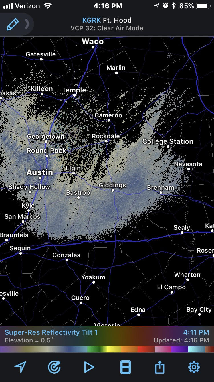
As of 4:15 PM Tuesday, some light snow is showing up on radar between Houston and Austin. Though that is likely not yet reaching the ground, as it slides east and organizes a bit more, we could see that change.
All of this is being driven by a pretty potent little disturbance a few thousand feet up that will help deliver snow or sleet to Florida and Georgia tomorrow and eventually New England on Thursday. That slides into Houston after 9-10 PM or so tonight.
I’ve been watching the HRRR model literally all day today, and with each run it has boosted or maintained its depiction of what happens over Houston as the disturbance exits tonight. The HRRR is a really short-term weather model that we use in the 0-18 hour timeframe for forecasting. By no means is it perfect, but it’s been tough to ignore the trend it has shown today, somewhat corroborated by some other modeling this afternoon.
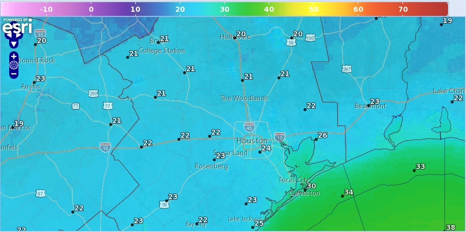
Here’s a forecasted radar depiction from the HRRR model this evening at 10 PM.
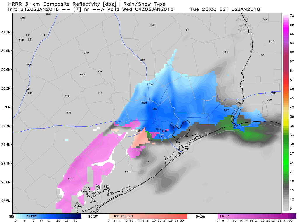
This shows a quick burst of snow or mixed snow/sleet as it moves through. The prime time for this to occur would be 7 PM-1 AM. After that, it will move offshore and skies will clear out allowing temperatures to plummet.
So what to expect?
- A brief (1-4 hour) burst of snow or sleet this evening is possible.
- Snow or sleet could actually come down at a healthy clip for a short time in a few places.
- Any accumulations would be minor and probably not cause severe problems for travel, but (there’s always a but) just keep in mind that this may occur tonight if you have to be on the roads after, say, 8 PM and drive with extra care just to be safe.
- With cold temperatures in place and several days of cold built up, if it were to snow a little heavier than expected, it could lead to a dusting on roads (similar to what we saw southeast of Houston this morning from the sleet).
- Any snow or sleet ends from northwest to southeast from 11 PM to 2 AM, with clearing overnight, followed by bitter cold overnight and Wednesday morning low temps in the Houston metro area. A hard freeze is likely over most of the metro area tonight.
Please share any of your observations tonight with us here, Facebook, or via Eric or Matt’s Twitter feeds!