Thanksgiving … is beginning to feel a lot like Christmas?

I will get to the outlook for later this month in a minute. Let’s start with today.

TODAY

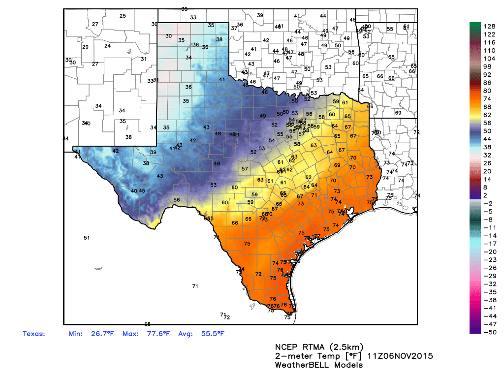
It’s a wonderfully cool start to the morning, with temperatures in the low 50s across most of the Houston area. We’ll have another dry, pleasant day with highs in the low 70s. Enjoy the splendid fall weather!
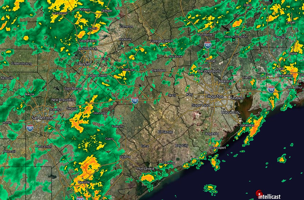
TUESDAY-WEDNESDAY

Beginning tonight we’ll see a return flow of more moist air from the Gulf of Mexico, allowing highs to rise into the upper-70s on Tuesday, and low-80s on Wednesday. Additionally Tuesday night’s low temperatures should fall only to around 70 degrees for much of the metro area. Blech! But it won’t last.

See full post

Rain possible later today as blustery front moves through

Houston remains, for the most part, a warm, humid city this morning. But that will soon change.

By around noon today much stronger winds will begin to bring drier air into the region, limiting highs this afternoon to the mid-60s with lower humidity. As the front moves in we may see some light- to moderate rain showers, but as I’ve been saying all week these rains are not going to produce any significant, widespread flooding. They also will not be continual, for hours on end. However they may be briefly intense. Some areas in West University Place received more than 2 inches of rain last night, while most of Houston saw little rain.

Texas is seeing scattered light- to moderate showers today and some of that should move into Houston later today. (Intellicast)

See full post

Much cooler air is coming, will begin arriving on Saturday

The forecast for Houston remains pretty much the same as I’ve been saying all week.

A weak cool front today, followed by a stronger front on Saturday, will bring Houston a good chance of light to moderate rain today, Saturday and Sunday morning. Accumulations for most areas — with the possible exception of areas far to the northwest such as College Station — are unlikely to exceed 1-2 inches. If that.

Rain seems most likely Saturday, from sunrise to early afternoon.

As the stronger cold front arrives on Saturday we’ll see increasing winds throughout the day, with gusts in the mid-20s possible during the afternoon and evening hours.

There's quite the temperature gradient across Texas this morning. That cooler air is one the way. (Weather Bell)
There’s quite the temperature gradient across Texas this morning. That cooler air is one the way. (Weather Bell)

See full post

Some cool weather, finally, on tap for Houston

Good morning, everyone.

As I’ve been saying for several days, the major threat for severe rainfall and thunderstorms will remain off to the northwest of the Houston metro area today through Saturday. I do not expect Houston to get more than 1 to 2 inches of rain during that time period, and it should come in the form of mostly light- to moderate rain.

The map below from NOAA shows the region of the state where the highest threat of damaging winds, isolated tornadoes and very high rainfall rates will come today along a cold front. Unfortunately for parts of central and northern Texas along the Interstate 35 corridor intense rains are possible today, along with some flooding.

Areas in yellow have a slight chance of severe weather today. (NOAA)

See full post