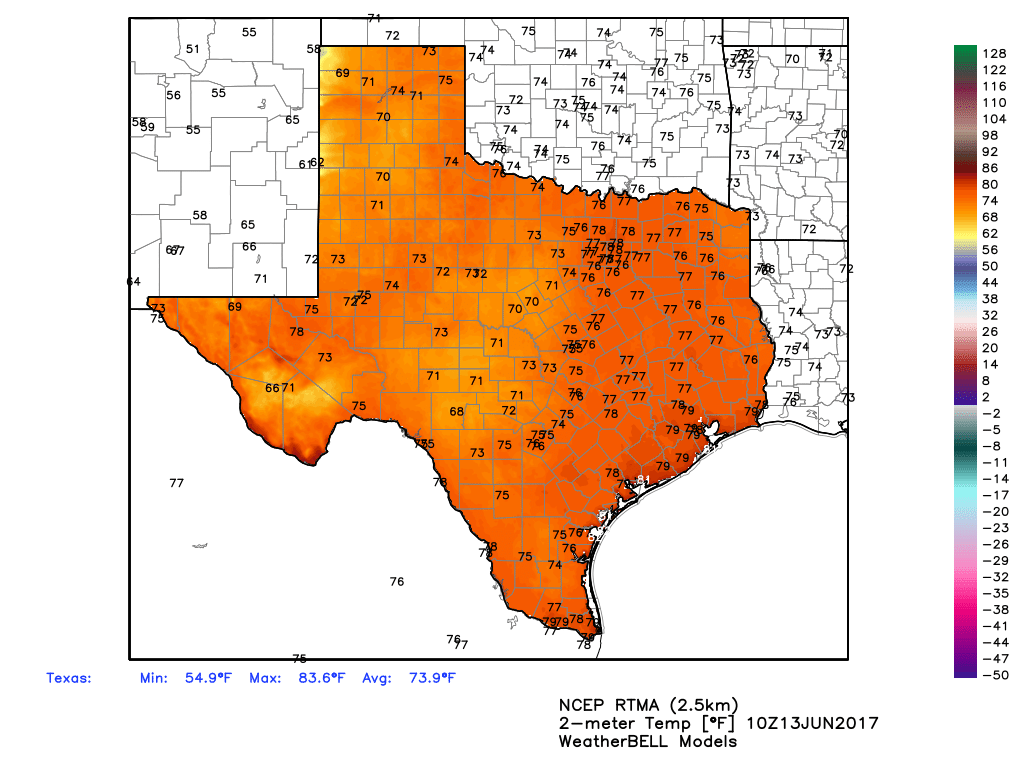
Houston is experiencing a typically steamy morning for this time of year, with lows in the upper 70s across most of the region. If you had forgotten, this is what summer feels like. And if I’m being honest, the lack of any real overnight cooling during summer is my least favorite part of the weather here.
Summer-time lows for Texas on Tuesday morning. (Weather Bell)
Tuesday and Wednesday
Warm, muggy conditions will continue for the region, with highs in the low 90s, and overnight low temperatures in the upper 70s. With decent atmospheric moisture levels, both days will probably see some scattered showers and thunderstorms during the afternoon and evening hours, but these will probably be short-lived.
Thursday through Saturday
As pressures rise, rain chances will go down toward the end of the work week. While I’m not entirely ruling out a chance of showers during the afternoon hours, for the most part these should be sunny, warm days in the low 90s, with warm nights.
Summer—steamy, humid, and hot—is finally here. Houston certainly enjoyed a nice reprieve last week, as Bush Intercontinental Airport recorded a streak of four mornings (Thursday through Sunday) of low temperatures ranging from 67 to 69 degrees. The monthly average temperature so far is about 2 degrees below normal.
But by Sunday afternoon it “felt” like summer outside, and that’s how conditions will remain for about the next three months, and of course we’re only going to get warmer as we get deeper into July and August.
Today
After several mostly sunny days, clouds will return to the forecast area today, and this will herald a pretty decent chance of rain. Moisture levels are higher to the east of Houston, so rain chances will be considerably higher to the east of Interstate 45 than to the west. So look for scattered showers for the eastern half of Houston, and fairly isolated showers to the west. Accumulations for the most part will be low, perhaps a tenth of an inch of rain or two. Highs today should be around 90 degrees, with muggy overnight lows in the upper 70s.
Tuesday
A similar day to Monday, although with a bit less moisture I’d expect a bit less rainfall coverage for the area. Humidity levels remain very high, with temperatures around 90 degrees and lows in the upper 70s.
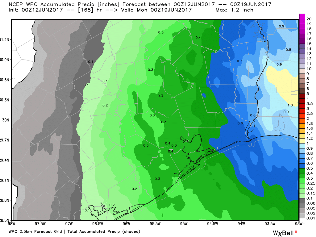
Don’t expect too much rain this week, as the 7-day NOAA forecast indicates. (Weather Bell)
Wednesday through Friday
Moisture levels will fall off some, which will leave us in a summer-like pattern for the region. This means partly to mostly sunny skies, with a slight chance of afternoon showers as the sea breeze moves in. Look for highs in the low 90s, and overnight low temperatures in the mid-70s.
Saturday and Sunday
Moisture levels don’t look particularly high, but the upper-level pattern suggests that some storms may be possible. For now I’d feel comfortable saying there’s a 20 to 30 percent chance of storms for Houston, but most likely we’re going to see warm, partly sunny days.
Tropical note
We’re now about a dozen days into the Atlantic hurricane season. So far conditions have been calm, but forecast models are hinting at some development in the Caribbean Sea this weekend that may eventually move into the Gulf of Mexico. I say this not to alarm you, but because some people may share forecasts about this system that show something developing near Texas. I’m not ruling that out, but there are quite a few factors weighing against this happening right now, so I wouldn’t be overly concerned. We’ll watch it and let you know if there’s anything that matters.
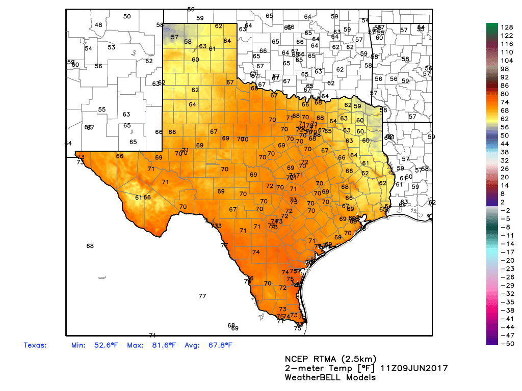
Houston is enjoying another really pleasant morning for June, with lows in the upper 60s in parts of the city, and ample dry air. Enjoy this fine weather for this time of year, because it will not last as we descend deeper into summer.
There are some very comfortable lows in east Texas this morning. (Weather Bell)
Friday
The easterly winds bringing dry air will eventually swing to out of the southeast by later today, but we should enjoy one more relatively dry day, with highs near 90 degrees, and overnight lows again in the upper 60s for inland areas, and lower 70s along the coast.
Saturday
Another nice, sunny day, with highs near 90 degrees and mostly sunny skies. Lows by Saturday night and into Sunday morning will be warmer, however, likely only falling into the low- to mid-70s.
Temperatures briefly reached the upper 60s this morning in parts of Houston, but what is more noticeable is the drier air. These pleasant conditions for June will continue for a few more days before more typical humidity returns to the area.
Thursday and Friday
Warm and sunny. With drier air and a northeasterly flow, we can expect highs in the low 90s, and overnight lows around 70 degrees. Again, the drier air should allow for more pleasant mornings and evenings. Contrast that to 16 years ago today, when Tropical Storm Allison returned to Houston on the night of the 8th and morning of the 8th, and deluged Houston.
Tropical Storm Allison returned to Houston 16 years ago, today. (NOAA)
Saturday and Sunday
We’ll remain mostly sunny, with highs around 90 degrees, but I expect humidity levels to begin rising again as winds shift out of the south. By Sunday this may allow for a few scattered showers to form during the afternoon hours, but for the most part we’re going to remain dry.
Monday
As an upper-level system moves into the area, we’re going to see some decent rain chances on Monday, but I’m not expecting anything extreme. Most likely a good chunk of the Houston area will see a few tenths of an inch of rain, while others see dark skies but no rain. More cloudy skies could limit highs to the upper 80s.
Tuesday and beyond
High pressure settles over the area, likely bringing high temperatures back into the lower 90s, and keeping lows warm in the mid-70s. This is what June in Houston often feels like in June, rather than the dry days we’re seeing now.