In brief: In today’s post we briefly discuss the ongoing ridge of high pressure dominating Houston’s weather. We also take a look at what’s happening in the Atlantic tropics (not much), and more interestingly talk about the AI model that performed exceptionally well during the 2025 Atlantic hurricane season.
Tropics update and AI model review
The short answer is that the Atlantic tropics are quiet. This is often the case for late June, when Atlantic sea surface temperatures are still warming toward their peak later this summer, and wind shear is fairly high. The other factor working against tropical storms and hurricanes at this time of year is Saharan dust, and there is plenty of it across the Atlantic basin right now. I would expect the Atlantic tropics to remain quiet through the end of June, and probably at least a week into July, if not longer.
Before moving on to the rest of today’s post, I did want to note one thing about hurricane models. Earlier this year the National Hurricane Center published its annual verification report for the 2025 Atlantic hurricane season. One of the questions this report answers concerns the performance of the various forecast models for the “track” of tropical systems. And last year there was a clear winner, Google’s DeepMind model which is based on artificial intelligence. For forecast periods of 12 hours to 4 days out, the model’s performance was better even than that of the National Hurricane Center and various consensus models. It’s quite striking.
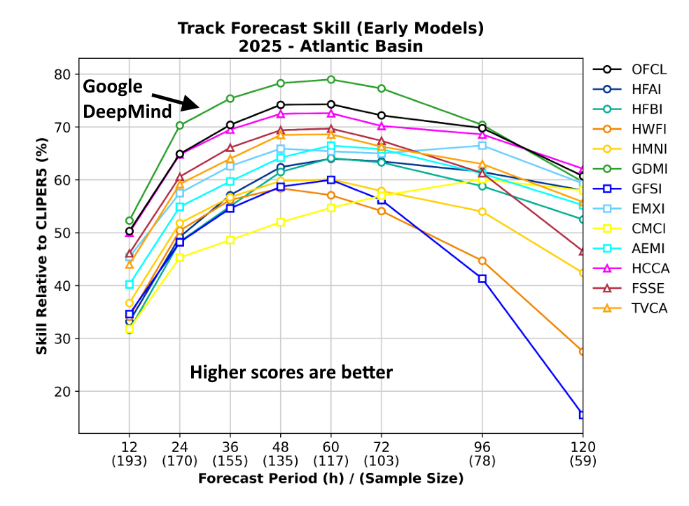
Our friend and colleague Michael Lowry has an excellent post explaining all of this on his “Eye on the Tropics” Substack, and it’s worth a read to put the performance of this AI model into perspective. Speaking for Matt and myself, we used Google’s model as part of our suite of tools last year, and obviously will continue to do so. I’m eager to see if it is a top performer again this year.
Wednesday, Thursday, and Friday
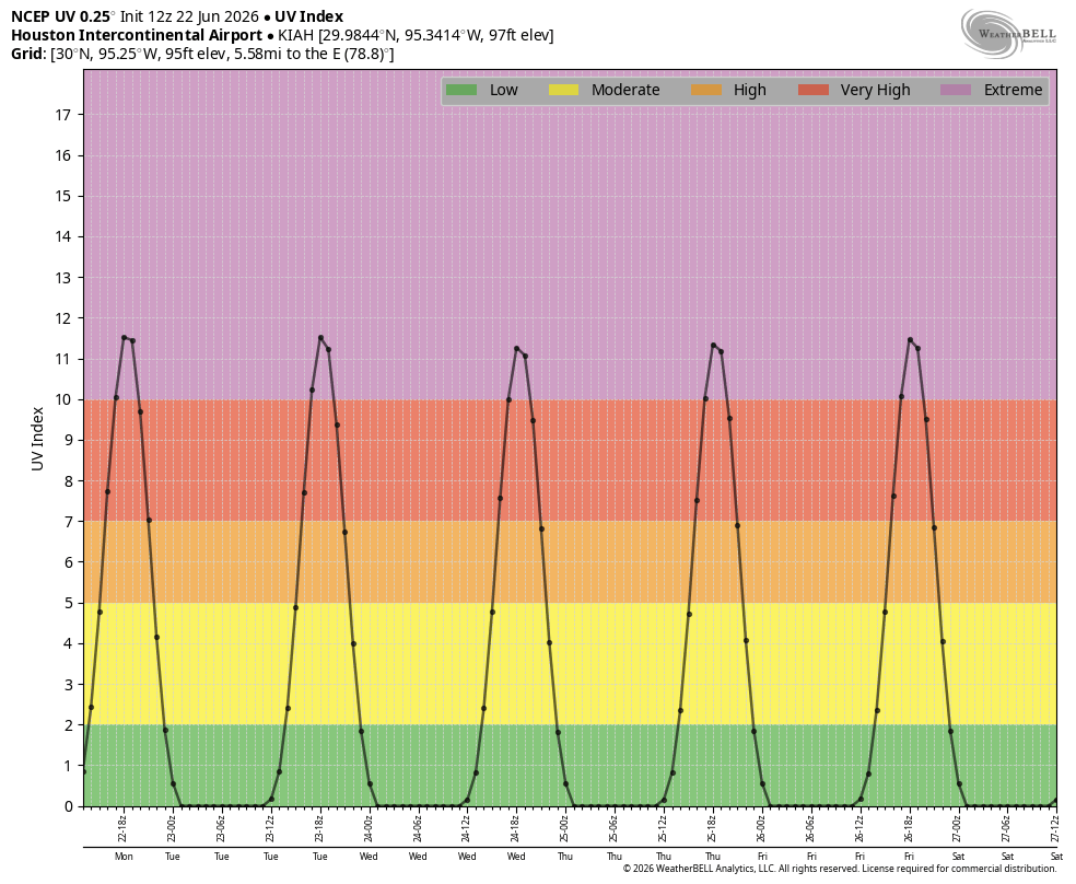
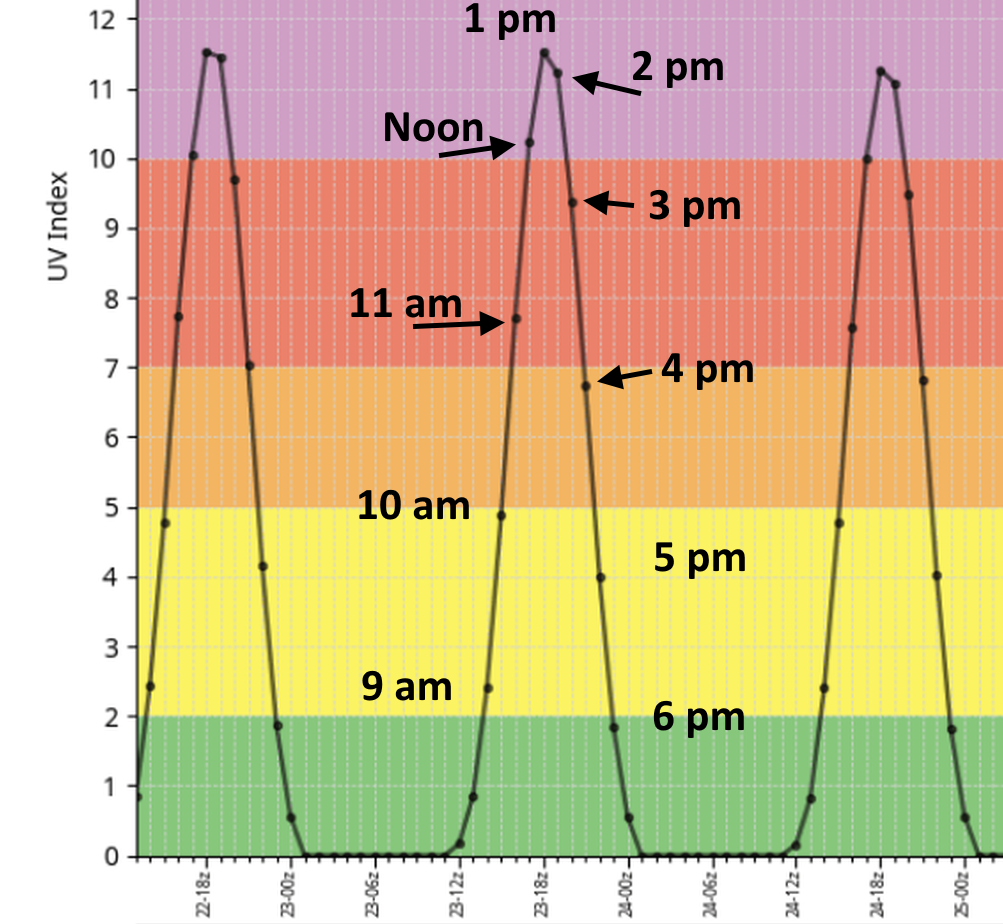
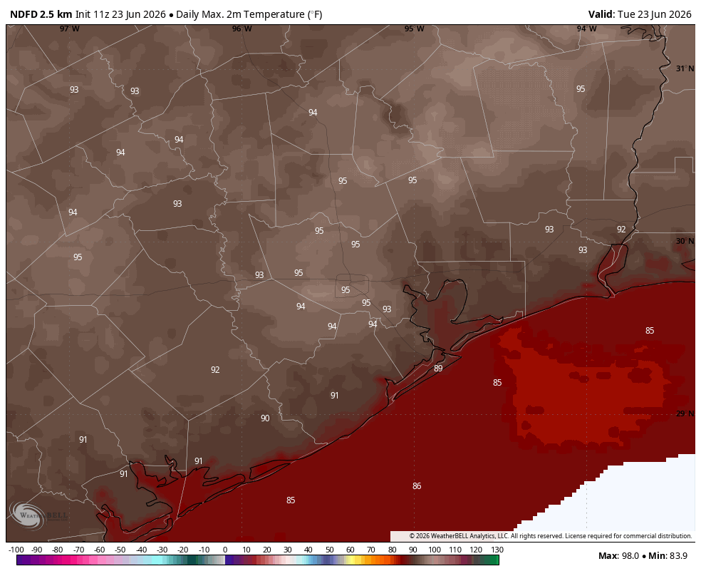
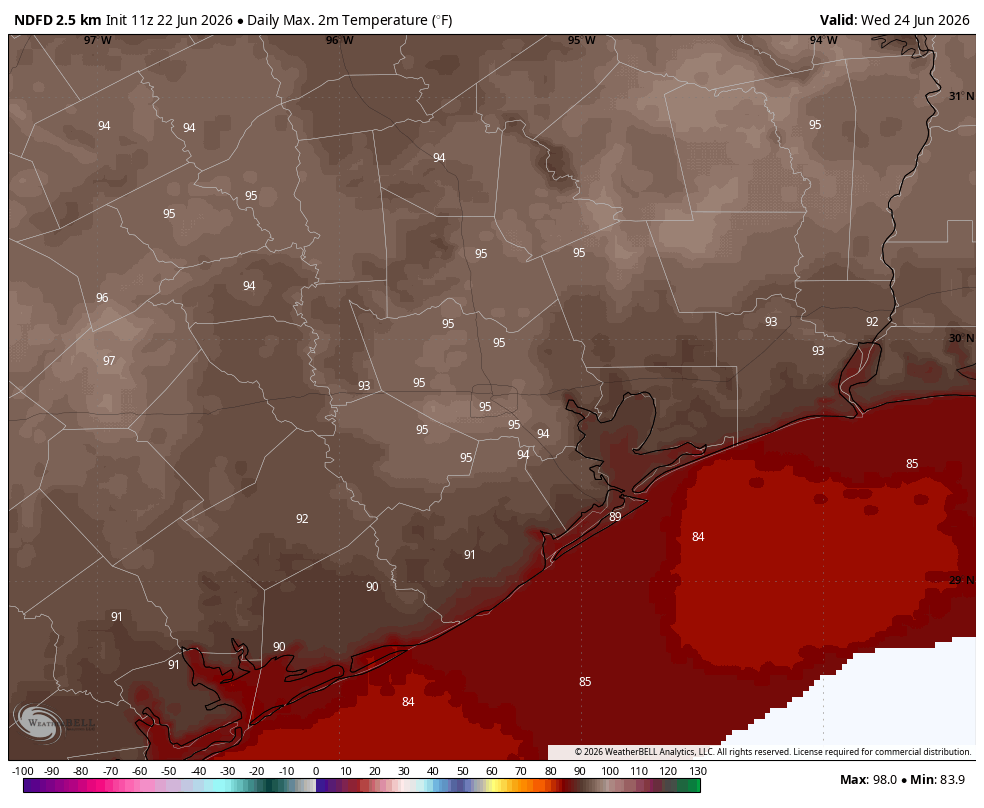
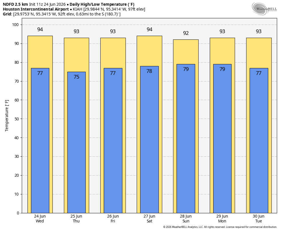
Back in Houston, our forecast has not changed much. Or rather, at all. A fairly strong ridge of high pressure remains in control of our weather for the time being. This will bring us mostly sunny skies, humidity, and hot temperatures. Highs for the rest of this week will be in the low- to mid-90s, with plenty of humidity. Overnight lows will generally drop into the mid- to upper-70s. Rain chances are basically zero. Winds will be calm in the morning, with moderately gusty conditions (up to 20 mph) during the afternoon. And that is basically it.
Saturday and Sunday
Are we expecting much change in the weather this weekend? In short, no. Perhaps we’ll see nighttime temperatures 1 to 2 degrees warmer, but it will be difficult to notice much difference.
Next week
Our sunny and hot weather continues into next week, but by Wednesday or so, some of our forecast models are indicating a turn toward a more typical summertime pattern, with a chance of afternoon showers and thunderstorms along the sea breeze. However, when we get into these persistent high pressure patterns it can be difficult to break them, so we’re offering no guarantees here.