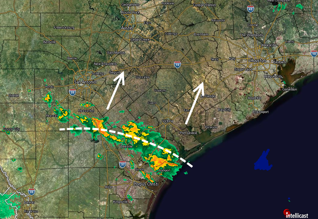
We’ve done OK today all things considered, with most areas of Houston receiving 0.5 to 2.0 inches of rain, and the heaviest concentrations clustered over west and southwest Harris County. So what’s next?
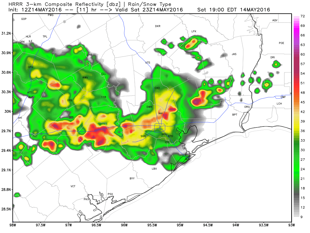
For some time we’ve been quite concerned about the potential for very heavy rain on Monday because atmospheric moisture levels were forecast to be quite high. And indeed that’s still a possibility. However now some guidance is suggesting that an upper-level storm system moving in from west Texas tonight will remain further to the south, around Matagorda Bay and points south.

So there are basically two scenarios: One in which the heaviest storms do track into the greater Houston area, and bring 2 to 4 inches of rain for much of the metro area beginning some time on Monday morning. Under another scenario the storms track further south, and the region sees weather more like today, or even a little bit more benign. In either case I think we’ll see drying conditions by the afternoon or, at the latest, early evening hours.
Which scenario happens? I am not confident to call it at this point, but I’ll have a full update in the morning when we have a better idea of what’s going to happen.
Posted at 8:10pm CT Sunday by Eric Berger