Good morning. Unfortunately the greater Houston region remains in an unsettled pattern, and the kinds of storms we’ve seen on Thursday and Friday afternoon and evening are likely again today—and possibly in even greater abundance.
There are two factors at play with our weather today. To start with we’re going to see a mostly sunny morning. This will lead to daytime heating, which in turn will help set up a sea breeze. This flow from the Gulf of Mexico should lead to the development of coastal showers early this afternoon, and we should see them move steadily inland. At the same time a weak, late-spring cool front will be moving down though Texas, southward toward Houston, bringing some additional instability with it. The weather concern is that the sea breeze and front essentially collide, in which case we’ll have a big party in the atmosphere for instability.
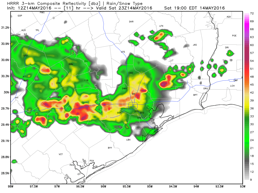
This means the potential for locally heavy rain, hail and possible severe thunderstorms, like we’ve seen the last couple of afternoons. Only potentially more widespread. Here’s how one model, the HRRR, suggests conditions will look at 6pm today.
The heaviest storms should burn themselves out with the loss of daytime heating by Saturday evening, but the potential for scattered showers will remain through the overnight hours. As ever, predicting precise timing and location of where the most severe storms will develop is simply not possible.
Sunday appears most likely to be a gray day, with some light rain possible. But I’m not expecting any gully washers during the day. However, as we’ve been discussing, the potential for heavy rain enters the picture Sunday night. Right now forecast models indicate the best chance of heavy rain is likely to come between sunrise Monday and sometime during the afternoon hours. I think most areas will see 1 to 3 inches of rain during this time period. While we can’t rule out the potential for significant flooding, that is mostly manageable. But of course we’ll have to watch this as more rain than this—which is certainly possible—could certainly make trouble.
Unstable weather will continue for most of next week. This is how it often goes in May, in Texas, with a moist unstable air mass overhead. Enjoy the rain now, because in some respects it beats the droughts we often must endure in July and August, when high pressure reigns.
I live in meyerland. Why hasn’t a flood warning been issued? The water is already over our sidewalk!!
It has, just a few minutes ago. See my new post.
Will Monday’s rains create a crisis similar to what happened on April 18, Eric?