After finding our way into the middle 50s yesterday afternoon, we’ve emerged from significant cold air for Houston to more standard cold air for Houston. And we’ll be warming up further this weekend. Let’s move into the details.
Today & Saturday
After our first four day streak of 30° or colder since 2011, we start today a bit milder. We’re starting Friday generally in the upper-30s or low-40s. We will warm up to the mid-50s this afternoon, or probably around to a couple degrees warmer than what we did on Thursday.
We’ve got clouds still moving across the area this morning.
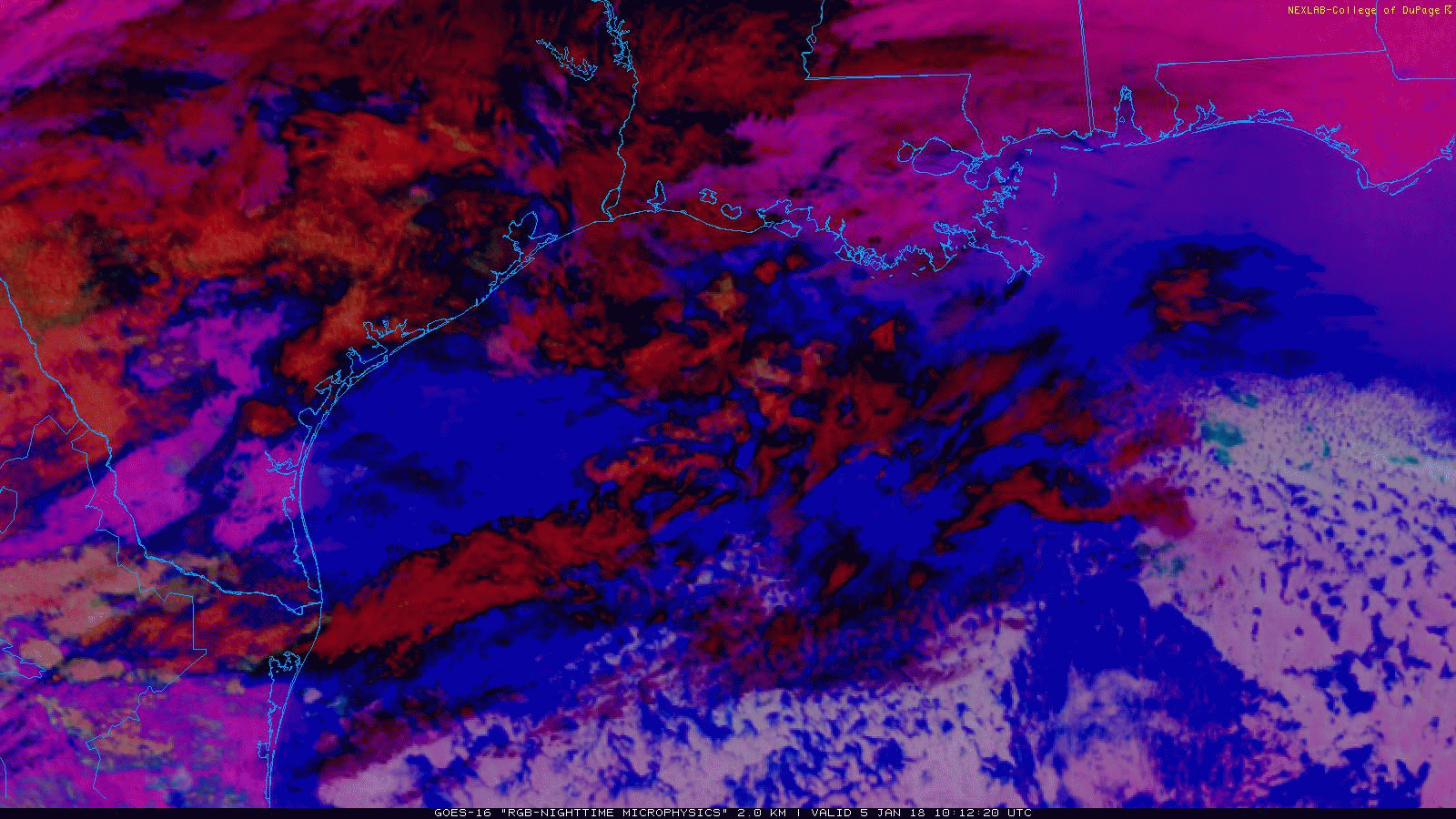
The clouds will be prevalent for a few hours this morning. There is some precipitation falling from them west of Houston, but it isn’t reaching the ground in most places. A stray sprinkle or ice pellet could fall this morning, but it won’t amount to anything. As the day goes on, we’ll see more sunshine, and it should end up a fairly nice afternoon.
We’ll continue with a theme of sunshine Saturday as well. Expect morning temperatures to start in the lower 40s and warm up to the low-60s tomorrow! If you’ve been waiting for a couple nice, fairly comfortable Houston winter days, Friday and Saturday will be acceptable.
Sunday
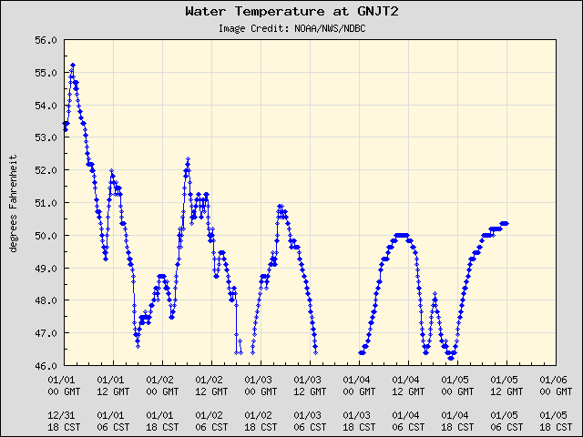
Onshore flow returns to the picture later Saturday into Sunday morning. Sunday will start with temperatures in the 50s and work on up to about 70 degrees or a little warmer. Water temperatures near the coast have dropped dramatically recently. The entrance to Galveston Bay is only around 50° this morning, and it has been in the mid to upper-40s at times this week.
Although water temperatures aren’t quite that cold offshore, with the increasing air temperatures and humidity passing over cooler water, we’ll likely see some dense fog develop, especially around Galveston Bay on Sunday. There could be a shower or two Sunday, but for the most part it looks to be a dry, mostly cloudy day.

Sunday night & Monday
It’s been an active winter for cold fronts, and that will continue Sunday night as our next front passes through. There will likely be a quick moving line of rain and thunderstorms as it moves across the region. Most places will see a quarter to half inch of rain on average from this, but a few spots, especially east of Houston, could see a bit more. The best rain chances look to be between Midnight and 6 AM in Houston.
Behind the front it will turn breezy and cooler. We’ll trade low-70s on Sunday for low-60s on Monday afternoon. The sun will be out Monday, and it should be a mostly nice day. Expect mid-40s in Houston on Monday night.
Rest of next week
We’ll warm back up fairly substantially after Tuesday, but it appears another cold front on Thursday or Friday will cut that down. Expect perhaps some showers or storms again with that (though it looks even a bit less impressive than Sunday night’s front). More importantly, for Houston Marathon participants, it will likely get a good bit cooler later Friday into the weekend. Eric went more in depth on this yesterday, and not much has changed overnight. He’ll be keeping you posted. In the meantime, enjoy the mostly nice weather the next few days!
Appreciate the direct, declarative and factual weather summaries! Goodbye to hype and drama. PS Looking back, Hurricane Harvey narratives were incisive and helpful.
Hello Matt,
Just how big of an effect do these cold fronts have on the water temperature in the northern Gulf of Mexico, especially Galveston Bay? Is sunlight intensity/daylight duration a bigger factor on upper Gulf waters? Is there a point where the water off of the Texas coast is chilly enough to in turn impact our weather here on the mainland?
Thanks for all you and Eric do; truly, expert and high-caliber reporting.
Hi Ryan,
Thanks! It can have a limited impact, but mostly near the coast. For one, particularly within a few miles of the water, those sorts of water temperatures can keep daytime temps lower than surrounding areas. Houston could hit 70, while Galveston maybe only hits 63 or 64 or so. If it got cold enough, it probably could impact us further, but the Gulf is fairly shallow off the Texas coast. So water temperatures can change a bit quicker there, than say 300 miles offshore, where it probably won’t change a ton. For example, a buoy about 70 miles south of Freeport is still at 71°. So when we inevitably warm up, Gulf temperatures closer to the coast will warm up pretty fast too. So in terms of impacts, they’re pretty limited to the nearshore areas than far inland. Any more meaningful impacts would likely be pretty short-lived. Hope this helps!
Can you elaborate more on 18Z GFS?
Thank you for the in-depth and informative answer, Matt! Good to finally know.
All the best,
Ryan