For Houston, the first half of September has been quite pleasant—with average temperatures running about 4 degrees below normal thanks to an early season cold front. Alas, the second half of the month probably will end up a few degrees above normal, as it doesn’t look like we’ll see another cold front for another 10 to 12 days, at least. Rain chances also return to the area after a long break.
Monday
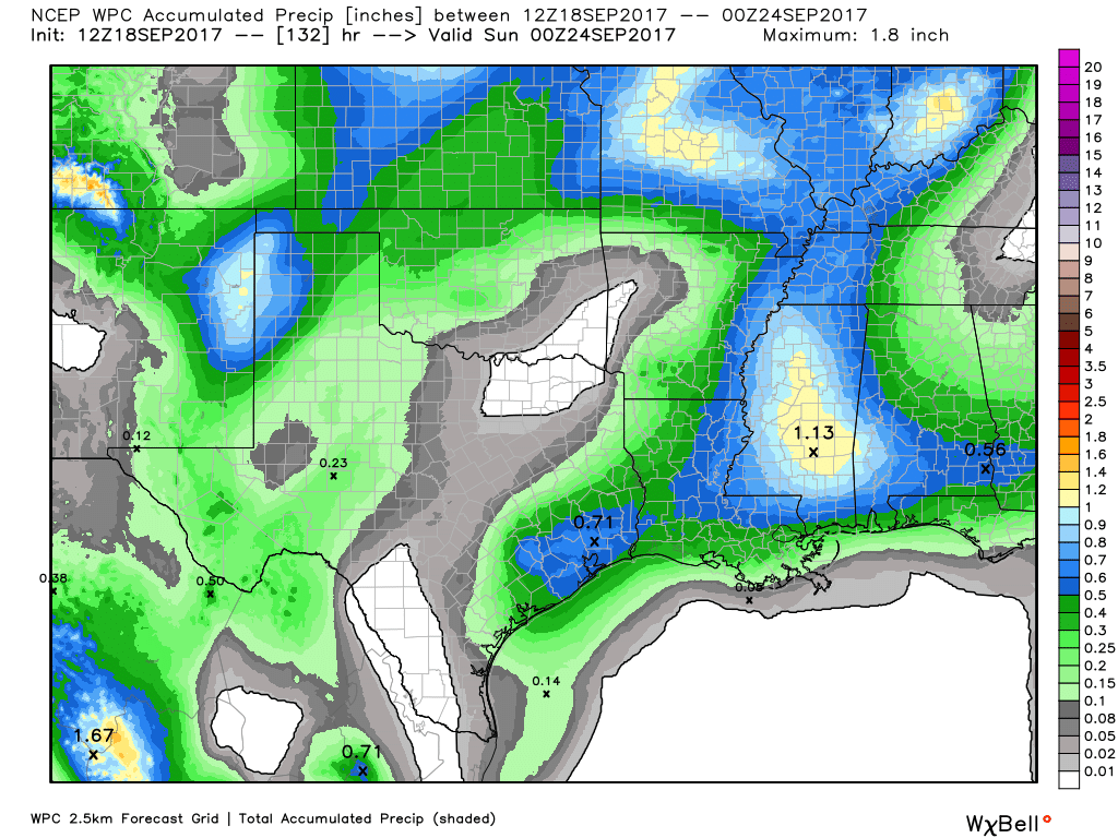
Today brings the region its best rain chances since Hurricane Harvey departed the area nearly three weeks ago as atmospheric moisture levels rise, and high pressure abates some. I don’t think this means more than scattered showers later today, but some areas could pick up a few tenths of an inch of rain. Highs in the low 90s.
Tuesday through Thursday
A more or less similar pattern continues with a moist atmosphere, and some moderate atmospheric disturbances pulsing through the area. This will lead to partly sunny days, with perhaps 40 to 50 percent of the area seeing light to moderate rain showers each day. Again, these are nothing to be concerned about from a flooding perspective, and area lawns and trees will be grateful. Highs around 90 degrees.
Friday through the weekend
High pressure may build back near the area, but probably not right on top of Houston. This may scale back rain showers a bit, but a chance will remain as high temperatures remain consistent near 90 degrees. In other words, this week’s weather probably won’t change much through the weekend.

Tropics
As mentioned Saturday, the Atlantic tropics remain sizzling hot in terms of activity, but we’re not seeing anything of concern for the Gulf of Mexico right now.
Hurricane Jose
This storm may bring some gusty winds to New York (on Tuesday) and Boston (on Wednesday and Thursday), but nothing particularly extreme. Rainfall may be a bigger concern, with some areas of eastern Long Island, Rhode Island, and southeastern Massachusetts getting as much as 5 inches of rain over the next several days. But Hurricane Jose is nonetheless expected to remain offshore, and its center should weaken over colder waters later this week.
Hurricane Maria
This storm now seems likely to bring more damaging winds to the Caribbean Islands, which were previously hit by Hurricane Irma. The Leeward Islands and Puerto Rico seem especially in line for significant effects between now and Wednesday, with a Category 3 or 4 hurricane landfall likely.
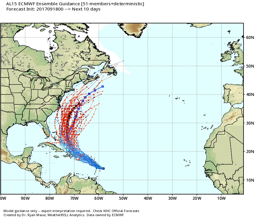
Longer-term, forecast models now generally agree that Maria will probably turn northward before reaching the continental United States. We’ll have to keep an eye on it for the US East Coast, however.
Please let us know as soon as you see any sign of the next cool front!
Scattered rain in Houston on Monday. Gosh this looks like another storm. Review your maps again buddy pls.
The heads up on Maria is much appreciated, Eric. Thank you again for your insight and detailed reports!
Thanks, Eric! Does the moderate rain showers include thunderstorms? Just planning the week for my dog that is terrified of thunder.
Thanks, Eric! Does moderate showers include thunderstorms? My dog becomes pretty destructive with the slightest sound of thunder so I’m trying to prep her accordingly this week.
Just curious if we can expect a warmer than average winter this season like we had last season. #longingforcoldweather
I have to admit to a bit of a cringe down the spine when I heard the rain hit the office window today – – and I didn’t flood.
Eric,
Looks like there might be a slight cool front moving in next weekend (Sept 30-ish) – any chance it sticks around for more than a few days? Too early to tell?