Good morning. The Houston area is sailing toward fairer weather—this weekend looks hot and sunny—but before that time we’ll face a couple of days with fairly healthy rain and thunderstorm chances. Also, with the school year ending, Matt and I will be convening our final Wednesday Weather discussion on Facebook at 10am CT today. Please join us. I’ll post a link to a YouTube version tomorrow morning if Facebook is not your thing.
Wednesday
Conditions this morning are quite fine for late May, with clear skies and temperatures lower than normal. Conroe got down to a spectacular 60 degrees with the region’s slightly drier air. However the sunshine is unlikely to last for most of Houston. Even though an upper-level level low pressure system is moving away from us, it should help pull an atmospheric disturbance into the area. What we think probably will happen is the development of storms west or northwest of Houston sometime this afternoon.

These storms will then sag and then (maybe?) weaken as the slide into the city during the late afternoon, evening, and overnight hours. NOAA’s severe weather outlook shows the higher risk to the west of Houston, with the threat of strong winds and hail. Rain accumulations will be less than half an inch for most, but areas under heavy thunderstorms will get more. Until storms develop today expect mostly sunny skies with highs near 90 degrees.
Thursday
A similar pattern could set up Thursday, with partly sunny skies in the morning giving way to the potential for storm development during the afternoon. This may be aided by the passage of a weak front—hard to call it a cold front as there won’t be much cooler air. Rain chances are around 50 percent for the region, with highs again going up to around 90 degrees.

Friday
As our atmosphere dries out, we can expect highs of around 90 degrees on Friday with mostly sunny skies. Lows Friday night may drop into the upper 60s for inland areas with the aid of drier air.
Saturday and Sunday
Look for a pleasant weekend to end May. We should see mostly sunny skies, highs of around 90 degrees, and lows around 70. The aforementioned drier air will help bring lows down a bit, and make for pleasant evening weather. We can’t rule out some isolated showers along the sea breeze during the afternoon, but at this point they seem unlikely.
Next week
Our pattern turns warmer and more humid next week, when I think we will start to see highs climb into the lower 90s with warmer nights. Rain chances are pretty low for most of next week.
Tropics
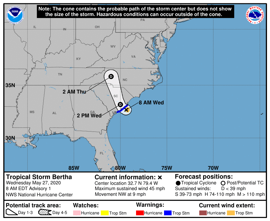
The Atlantic Hurricane season officially begins next Monday, and by then we’ll already have two named storms in the books, with Tropical Storm Bertha forming this morning off the coast of South Carolina. (It will soon move inland). If you hear some hype over the next few days about a hurricane forming in the Gulf of Mexico, that’s because the GFS model has started to forecast this possibility in about two weeks. When you hear this, just know that the GFS develops a lot of spurious storms in the Gulf in June, and this one probably won’t happen. If we have any credible inclination that it will, then we’ll certainly tell you about it.
Thank you for the forewarning. I always get nervous this time of year.
Hurricane season AND a pandemic. Oh, goody.
Remember to socially distance from the sick person next to you in the church hall you evacuated to in Waxahacie.
Having lived here all my life, hurricane season is a regular thing so you adapt to what you really need to pay attention to. Given the pandemic, I’m more focused on that for now but I’m sure “pandemic fatigue” is already a widespread thing.
An actual hurricane may give the news outlets something “new” to clamor about. Meanwhile, I’m just keeping calm, continue maintaining the pandemic/hurricane stockpile (one can do both), and chugging along.
Wednesday, Texas is going to look like an avocado.