The cold front is coming.
A fairly warm, muggy morning will give way to a northwesterly blast of air later today, reaching northwest parts of the area by 10 a.m. or so, moving through downtown around 11 a.m., and off the coast by or before 1 p.m.
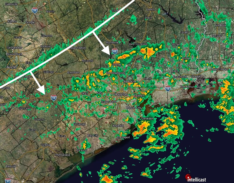
The scattered showers and thunderstorms ahead of the front should end with its passage, and will be replaced by winds that could gust up to 30 or even 35 mph. Temperatures should slowly fall through the afternoon hours, along with clearing skies, before plummeting tonight.
Lows tonight should be around 40 degrees in Houston, and in the upper 30s to the north. Highs on Sunday will be in the 50s with sunny skies, and lows on Monday morning should fall into the 30s for most areas except the immediate coast.
I don’t think Houston will see a freeze, but it’s certainly possible, especially for northern (i.e. Conroe) and western parts of the metro area.
Winter!
ugg. IDK where my long pants are. #Shorts&TanksRule
Finally! It feels so long overdue.
Most over used device in Texas is the “thermostat switch from cold to heat” and back
It’s true. We’ll be back to AC for a couple of days in the middle of next week.
Thank you. I appreciate your blog!
Winter? You can’t be serious. Houston doesn’t have “winter”. We have two seasons- oppressively hot season and not-quite-as-hot season. I’ve never seen -40F (or worse) wind chill here.
Rain seems to have moved through Ellington for now at least. Glad I checked the radar this morning our I would have been drenched a mile into my morning walk.
We do have 4 seasons: Spring; Summer; August; and Fall.
Winter is relative.
Winna be a comin’ ( in my New Hampshire accent)
Well, at least what passes for winter in SE Texas. 🙂