Good morning. A strong cold front remains on track for Houston later this afternoon and evening, which will bring a few sunny days and much drier and cooler air to the region. My only real concerns right now are the potential for scattered showers this evening along with the front, and breezy conditions overnight into Saturday.
Friday
Today’s the last hot day for awhile. High temperatures away from the coast should reach about 90 degrees, and this probably will be the last time this occurs in 2021. (Emphasis on probably). Skies will be partly sunny with light westerly winds. The front itself should reach northwest Harris County late this afternoon, perhaps around 4 to 6 pm, push into central Houston shortly thereafter, and reach the coast by 8 or 9 pm tonight.
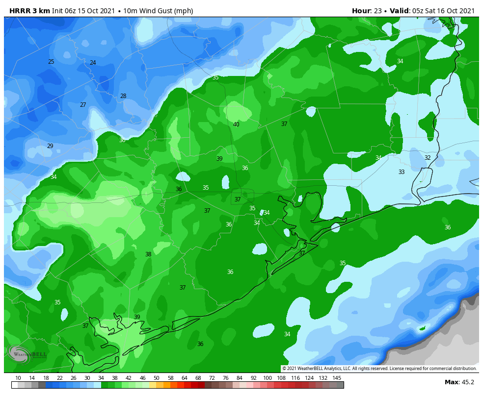
Some scattered showers will be possible inland this afternoon, and a broken line of storms may form as the front nears the coast due to the availability of more moisture in the atmosphere. In the front’s wake, winds will be gusty overnight, possibly reaching 30 mph or above. Temperatures will fall with the front and its northerly air, likely reaching the 50s by Saturday morning.
Saturday
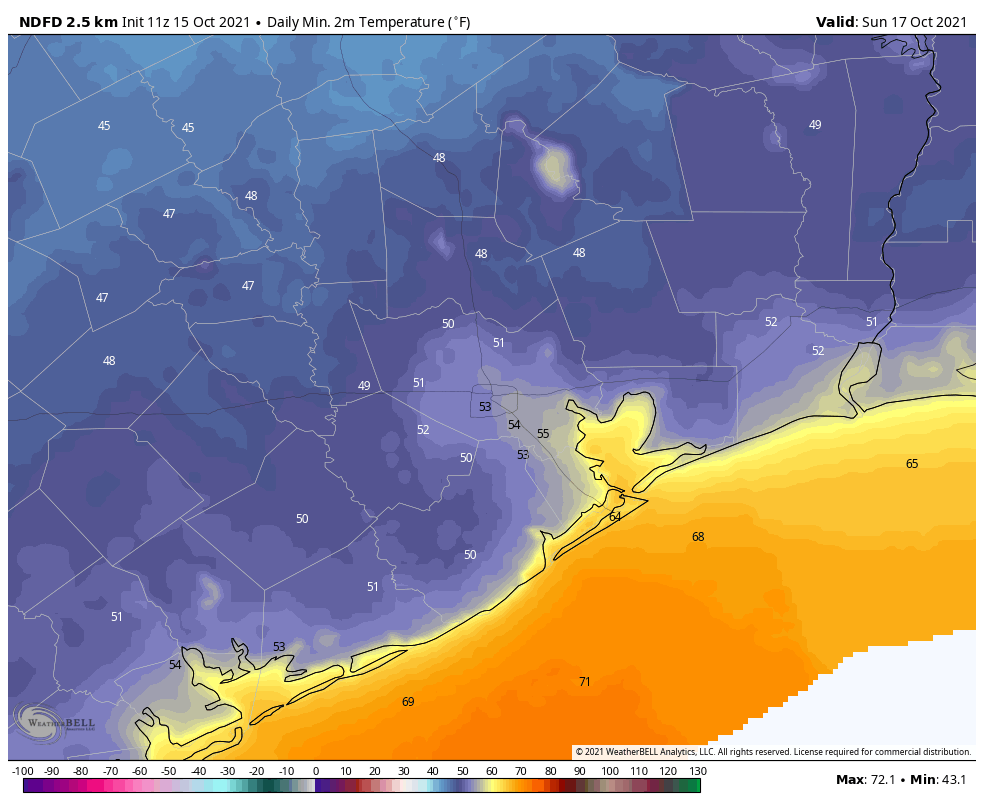
The strongest wind gusts will begin to fall back by sunrise, but we should still see breezy conditions on Saturday with gusts of about 20 mph from the north and northwest. Skies will be sunny, with highs in the mid-70s, and overnight lows on Saturday night will likely be the coldest for the region since April, with some inland areas reaching the 40s.
Sunday
Skies should be mostly sunny on Sunday, and with light winds this day should be nearly ideal for outdoor activities. Highs will be in the mid-70s and overnight lows probably a couple of degrees warmer than Saturday night.
Next week
We’ll see a gradual warm-up next week, with highs in the 70s again on Monday and possibly Tuesday before rising into the low- to mid-80s by Wednesday and Thursday. The models are about 50-50 on whether another cold front pushes into the region next Thurday or so, but regardless our next real chance of rainfall after this evening’s frontal passage probably will not come until that time frame.
It’s been a long, long summer as always Houston. So enjoy this weekend. You’ve earned it.
Not going to explain what happened yesterday and why it rained all over Houston when we were told otherwise?
You mad bruh?
Welcome to Houston.
“Rained all over Houston”?? We didn’t get any measurable precip yesterday in Clear Lake area. Actually was hoping for some as it’s been dry over the past week or two.
There has been a forecast rain for Houston in the past few days with the passage of the remnants of Hurricane Pamela passing northwest of Houston in Central Texas.
Rain was not unexpected:
Wednesday 6:14 am:
“Hurricane Pamela will make landfall in Mexico today and, traveling to the northeast, approach the Big Bend area early on Thursday. This will bring the potential for heavy rainfall into the state on Thursday, but we think the bulk of this activity will be in Central Texas, along the Interstate 35 corridor, where 2 to 4 inches of rain may fall. For the Houston area, I think most areas will see on the order of a tenth of an inch or two of rainfall, but we can[sic] rule out some isolated spots of heavier rainfall. This will otherwise be a mostly cloudy, humid day with highs in the upper 80s.”
Thursday 6:33 am:
“Radar this morning is lit up with showers from south central Texas through Brenham and College Station. These storms are moving slowly eastward this morning, and at the same time they’re also weakening somewhat. Based on short-term modeling, the biggest threat today for rain accumulations of 1 to 2 inches, or more, are areas such as Sealy and Rosenberg. Some lighter showers may progress into central Houston, but mostly the city will probably just see clouds.”
That is why they use words such as “probably” and “should.” Models and forecasts aren’t always 100% correct.
Rainfall like yesterday’s was only too welcome; our townhouse complex garden is looking fantastic and it needed another good watering. Even so, seriously looking forward to the cool front coming in later today – finally some good running weather! SCW is the bomb – we don’t even tune in to the talking heads anymore.
I love your parting comment-you’ve earned it! My thoughts exactly. Thanks guys for all you do. It is much appreciated and always highly anticipated.
I’m ready for zero rain for at least a week. And, bring on the cool dry air. The mud needs to dry out around here.
Have you us a forecast for a normal winter this year? I believe we had a light summer this year. Didn’t seem to have as many days in the high 90s or even 100+. Thankfully. So…any ideas on November thru March. Ha ha. Will not hold you responsible. :).