Good morning. We interrupt this lovely Sunday morning to bring you an update on the heavy rain chances we’ve been talking about for some time.
We’ll see fine weather today, and although Monday appears likely to be breezy with gusts up to 25 mph and cloudy, I don’t expect too much precipitation to fall. We’re going to have to wait for Tuesday, and more likely Tuesday night, for the action to begin. But first, a quick word about what’s driving this week’s heavy precipitation.
A very strong upper-level trough, an area of low pressure in the upper levels of the atmosphere, will move into Mexico this week. What’s so striking about this system is that it’s forecast to be as much as six standard deviations below normal, so these are really abnormally low pressures for March. Low pressure in the upper atmosphere allows air at the surface to rise. And generally more vigorous rising air leads to strong rain showers when there’s atmospheric moisture.
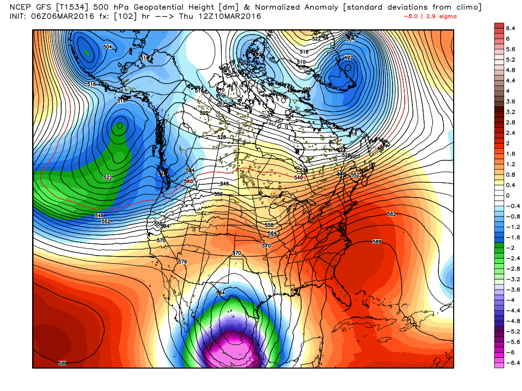
And there will be plenty of moisture along the Gulf of Mexico coast as disturbances rotate around this low and into the Texas and Louisiana coasts.
Right now it appears the heaviest rain will move into Texas on Tuesday night, after sunset, through most of the day on Wednesday. There’s a possibility of some let up in showers before more heavy rain returns on Friday, but in truth I don’t have much confidence in forecasting this yet. Essentially the ingredients will be in place for heavy rain across the greater Houston area from Tuesday afternoon through Friday.
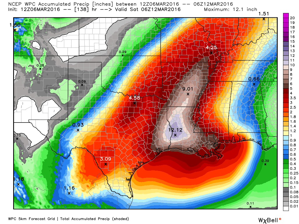
We should finally see the system move off by Friday night or next Saturday. Until that time be prepared for the possibility of heavy rainfall. My guess is that 3 to 10 inches of rain are possible during that time for most of Houston area. Depending on how much of that falls in a short period of time, we could definitely be looking at localized or even widespread flooding.
Matt and I will have you covered this week.
Thank you Eric and Matt!!! So grateful for this site. Btw Eric, your “Tale of Two Telescopes” was one of my favorite science articles ever written. So true – we need to consider human rights as we advance human knowledge. And Matt, thank you for pointing us towards that very informative article on the Ike Dike (or lack thereof). I’ve learned so much from both of you, and I tell all my friends about this site! Thank you.
Thank you!
Do you think this storm could disrupt air travel to/from Houston on Tuesday or Wednesday?
There’s definitely the potential for that, yes, from late Tuesday through Wednesday.
How’s the tornado threat for our area looking with this one?
The primary threat is heavy rain rather than tornadoes.
I’m traveling from Houston to Robinson, IL Tuesday. How will air travel be heading that direction if I’m flying out Tuesday morning?? Upper air disturbances?
Tuesday morning should be OK.
Shout out to Matt also Eric. You two work well together.
I guess I will hold off watering the yard!