Our lengthy stretch of stellar, stunning, <insert your favorite adjective here> weather will gradually wind down over the next couple days, as we return to more humid weather and some rain chances next week.
TODAY
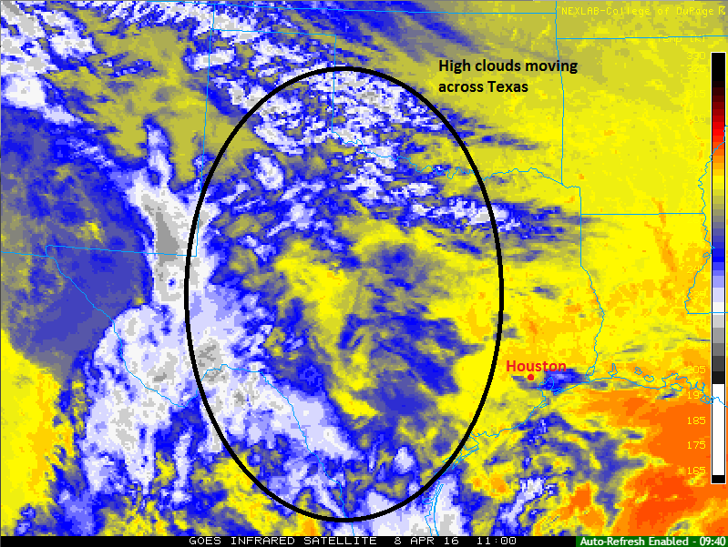
We’re starting off today pleasant again. Temperatures are generally in the mid 50s region-wide, though a few spots in the city are around 60°, particularly south and east of Downtown. High clouds will continue to stream across the region today.
As long as clouds aren’t too thick, we should manage around 80° or lower 80s again. Otherwise, we will be a couple degrees cooler. No issues though, with continued low humidity.
WEEKEND
After another relatively pleasant morning, Saturday should be similar to Friday, with sun and high clouds. Temperatures will again be contingent on how thick the cloud cover is, but we’ll likely be a few degrees cooler than Friday regardless; say upper 70s for now. I can’t fully rule out a shower tomorrow afternoon, but the odds would be very low. The best chance would be north and west of town.
On Sunday, onshore flow will have been established pretty persistently. This will bring warm, moist air off the Gulf, and the humidity will edge upwards. There will likely be some clouds around, mixed with sun. A chance of showers exists, but it is a low chance. Temperatures will press back to near 80 degrees.
NEXT WEEK
Monday will carry a low chance of showers, along with clouds and sun and temperatures again around 80°. If you’re attending the Astros home opener, I’d probably lean 60/40 on the roof being closed right now. Hopefully we get it open for a few games next week though.
Forecast confidence plunges Tuesday, Wednesday, and Thursday. I expect showers and storms to become more numerous, but the key to unlocking rain chances is trying to time upper level storm systems that we just can’t do 4+ days out (I’ve seen the heaviest rain shift 12 hours and 100 miles around Texas between weather model runs the last couple days). But I think there’s a good chance some heavy rain will return to the forecast for parts of the area midweek next week (though not every single day). Behind that, we should briefly return to nice spring weather and low humidity for late week. These “nice” windows of weather are going to get shorter and shorter as our typical summer pattern develops. Enjoy it while you still can.
MS-150
As Eric told you yesterday, mild temperatures are expected right now. No changes there or on the idea of a tail wind being dominant. However, the bigger issue may be rain. Some models indicate thunderstorms next Sunday between Houston and Austin. This is very much a “let’s wait and see” forecast right now. All options are still on the table, so stay tuned!
I appreciate the good job on the forecasts. But I would like to see, in addition to temperature and rain forecast, information about wind speed and direction in the forecast. Thanks.
Noted, thanks for the suggestion.