Well, it had to happen eventually. On Monday the high temperature at Bush Intercontinental Airport, the city’s official weather station, hit 90 degrees. For me, this represents the beginning of summer, at least psychologically. Thankfully, since this is May, we’ll probably still see a couple of more moderate fronts to bring some drier air into the region, including one later today. In terms of climatology, on average, the city’s first 90-degree day comes around the beginning of May, so we’re right on schedule this year.
Tuesday
The aforementioned front will arrive in central Houston around noon, and should push off the coast during the late afternoon hours. A broken line of showers and thunderstorms will accompany the front, and some of these could be briefly intense. However, the dynamics for stronger storms are much more favorable to our east, over Louisiana. Probably about half of the Houston region will see rain, with totals of one to two tenths of an inch of rain for most.
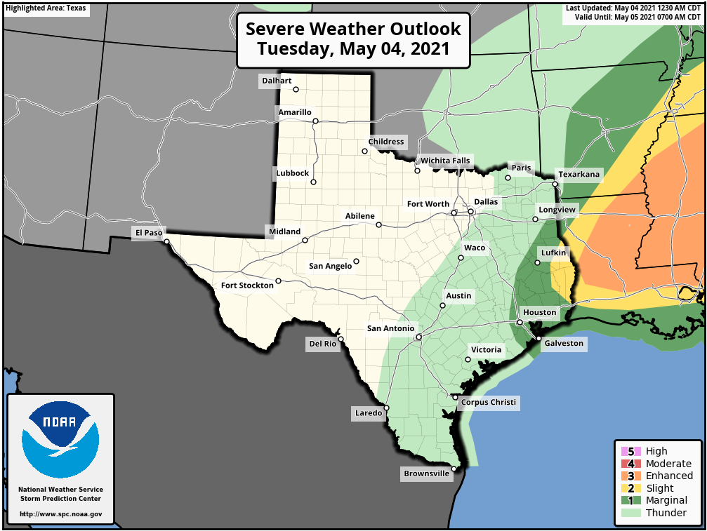
After highs reach the mid-80s, beneath mostly cloudy skies today, lows will drop into the low 60s overnight. Winds will blow out of the north at about 10 mph overnight, continuing to bring drier air into the region.
Wednesday, Thursday, and Friday
As high pressure settles over the upper Texas Gulf coast we will see a string of mostly sunny days with pleasantly dry air. Look for highs in the mid-80s, and lows generally in the 60s. These will be mornings and evenings to really savor the outdoors.
Saturday, Sunday, and beyond
The onshore flow will resume this weekend, but right now the most likely outcome will simply be an uptick in cloud cover, rather than any meaningful rain chances. Highs will depend on how much sunshine breaks through, but I suspect both days will likely reach the upper 80s, with warm nights.
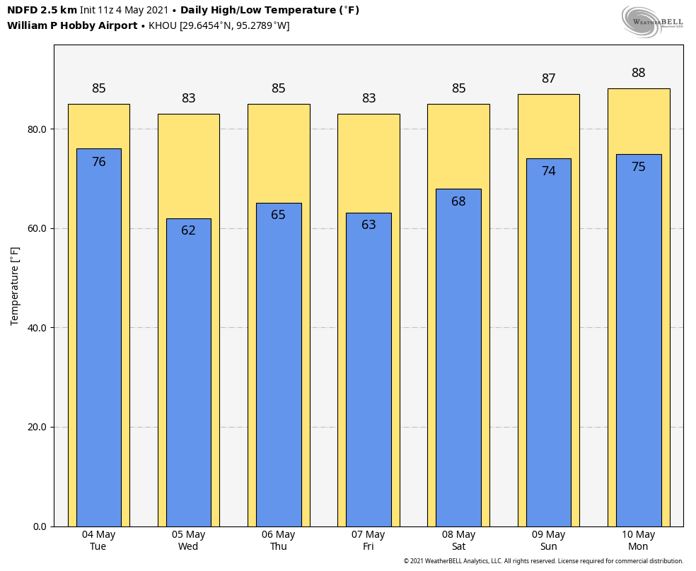
Beyond the weekend the forecast may see additional warming—back to the 90s, perhaps?—into Monday and Tuesday. Rain chances start to tick up by Tuesday or so, but there’s no clear signal in the models for what that really means other than departing high pressure will make the atmosphere less stable.