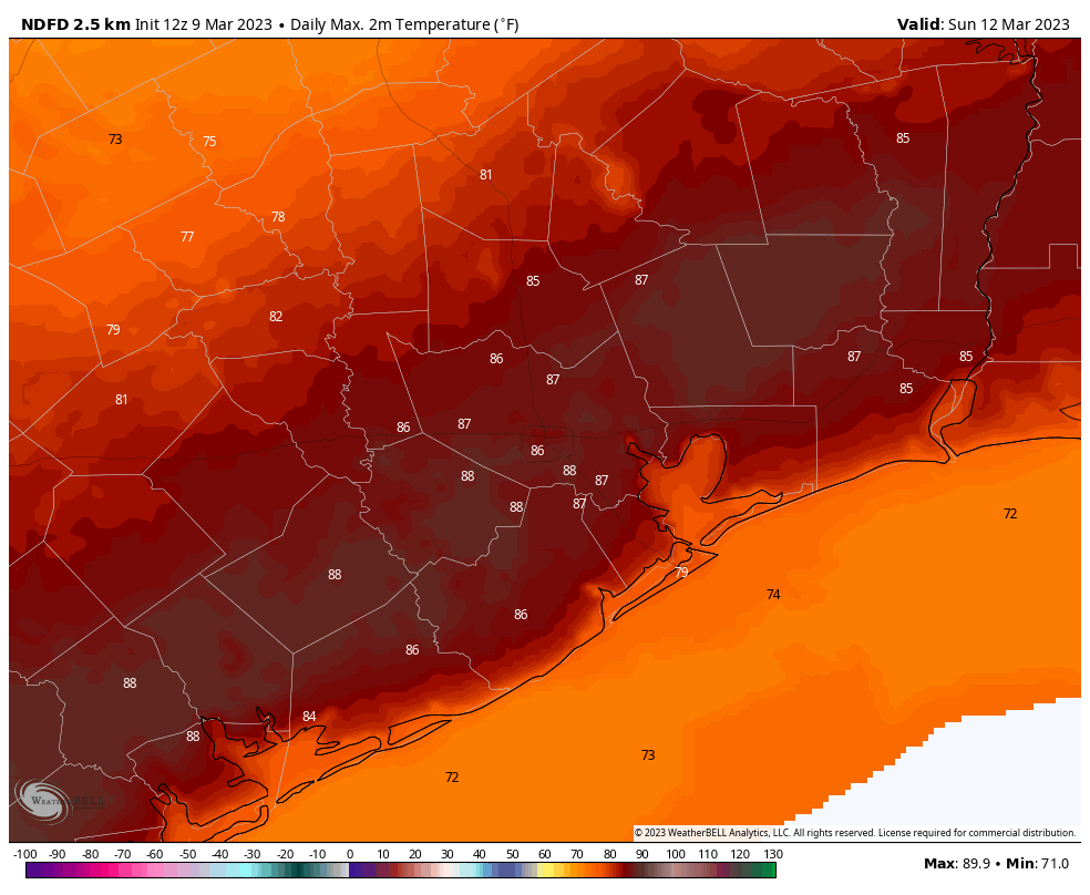
Houston will face four more warm days before a cold front arrives on Sunday afternoon or evening to bring a semblance of normalcy back to our weather. Until then the major question mark is just how warm conditions will get on Sunday, just ahead of the front. Some parts of the metro area have a chance to hit 90 degrees for the first time in 2023.
Thursday

Today will be similar to the rest of the days this week, which is to say we’re starting off with a humid morning and some patchy fog in coastal areas. Skies are mostly cloudy this morning, but should give way to partly sunny skies later this afternoon. High temperatures will reach the mid-80s, with light southerly winds.
For those venturing out to the Houston Livestock Show and Rodeo, we again have no concerns for the weather outside. It will be pleasant this evening, with temperatures in the 70s. Winds may gust to about 15 mph. Low temperatures tonight will do their usual thing of late, which means they’ll drop to around 70 degrees, or slightly lower.
Friday
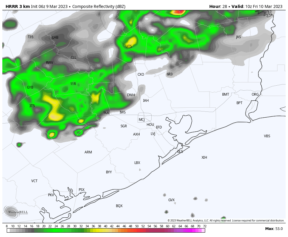
A (very) weak cold front is going to approach our region from the northwest on Friday, and while this will bring storms to the west and northwest of the Houston metro area, I think these showers will die out before reaching Katy or The Woodlands. This front will bring a smidgen of dry air into the area, but it won’t have too much of a sensible effect. The bottom line, I think, is that highs may top out in the low 80s instead of mid-80s, with temperatures Friday night dropping into the mid-60s. Skies will be mostly cloudy.
Saturday
Skies will gradually become partly sunny on Saturday, and this will be a warm day with highs in the mid-80s.
Sunday
This is the first day of 2023 that I would explicitly say is going to be hot. Ahead of the next front we’re going to see a warm westerly flow, and this will be noticeably with gusty westerly winds. Depending on how much sunshine our area sees, high temperatures for some inland areas may hit 90 degrees. A front arrives on Sunday afternoon or evening, and this will (finally?) usher in some cooler and drier air into the region. The front’s passage will likely be dry. Lows drop into the upper 50s.
Next week
We’ll see a few days with partly sunny skies and highs in the 70s, with lows in the 50s next week before a warm-up. Then another front probably will arrive on Thursday or Thursday night, and the good news is that, for now, this one looks like to carry a better chance of rain with it. We’re too far out to parse details, but an inch or so of rainfall sure would be welcome after our recent warm and dry period.


Perhaps the Ides of March will bring us cooler temps. No one with sanity would wish 90 degrees in early March.
90 degrees in March? Can’t wait to see what it will be like in July.
July will be hot, because it’s July.
Kind of early to hit 90. I always like the periods in early autumn and late winter/early spring when I can have low utility bills, due to need for heat or AC.
can’t always get what you want
It’s the huge thermal mass that is the Gulf of Mexico.
Anything coming down the pipe about the shift from La Niña to a neutral or El Niño weather cycle? I would enjoy reading y’all’s analysis on how that shift will affect summer – hurricane season in particular – here in Houston.
Our earliest 90 degree day on record occurred on Febuary 20th 1986. The high was 91 at Bush Airport that day. It also hit 90 on February 22nd 1996, and 90 on Feburary 26 1940. Ridiculous early season heat is not very common but it has happened several times in the past. Doesn’t make it any less depressing for me when it does happen though.
It could be 2 things. Rain cooled air that collapses under the storm cuts off the supply of warm moist rising air. This causes storms to rain themselves out before reaching your area. Also a capping inversion can weaken or prevent storms from building at all. This means a thin layer of dry warm air in the mid levels of the atmosphere block the warm moist air from rising high enough to create rainstorms. Warm air has to be surrounded by cooler air to be able to continue rising. These 2 things can be very frustrating when you are in a drought. It can appear like your area is cursed lol
It’s heat from northeast Mexico as it warms up in the spring faster than the Gulf, causing a capping inversion, I think.
Yes you are correct. That hot air from the mountains of Mexico gets transported over Texas when low pressure systems swing across the country. Unfortunately that leads to many droughts in Texas.