Eric and I kid with each other often because I personally hate September more than August, whereas most rational people hate August. My reason for hating September is exactly what is happening this year. We got teased with fake fall weather this week, and what’s coming next week looks kind of like “August-lite” type weather. Alas, it won’t be quite as miserable as a typical August, but any dreams of autumn breezes and cooler days are on hold.
Today
Yesterday, we got some showers to drop rain for coastal areas. Parts of Galveston saw just shy of an inch, and rural portions of Brazoria and Matagorda Counties saw 1 to 3 inches. We even saw some rain west of Rosenberg back into Wharton County.
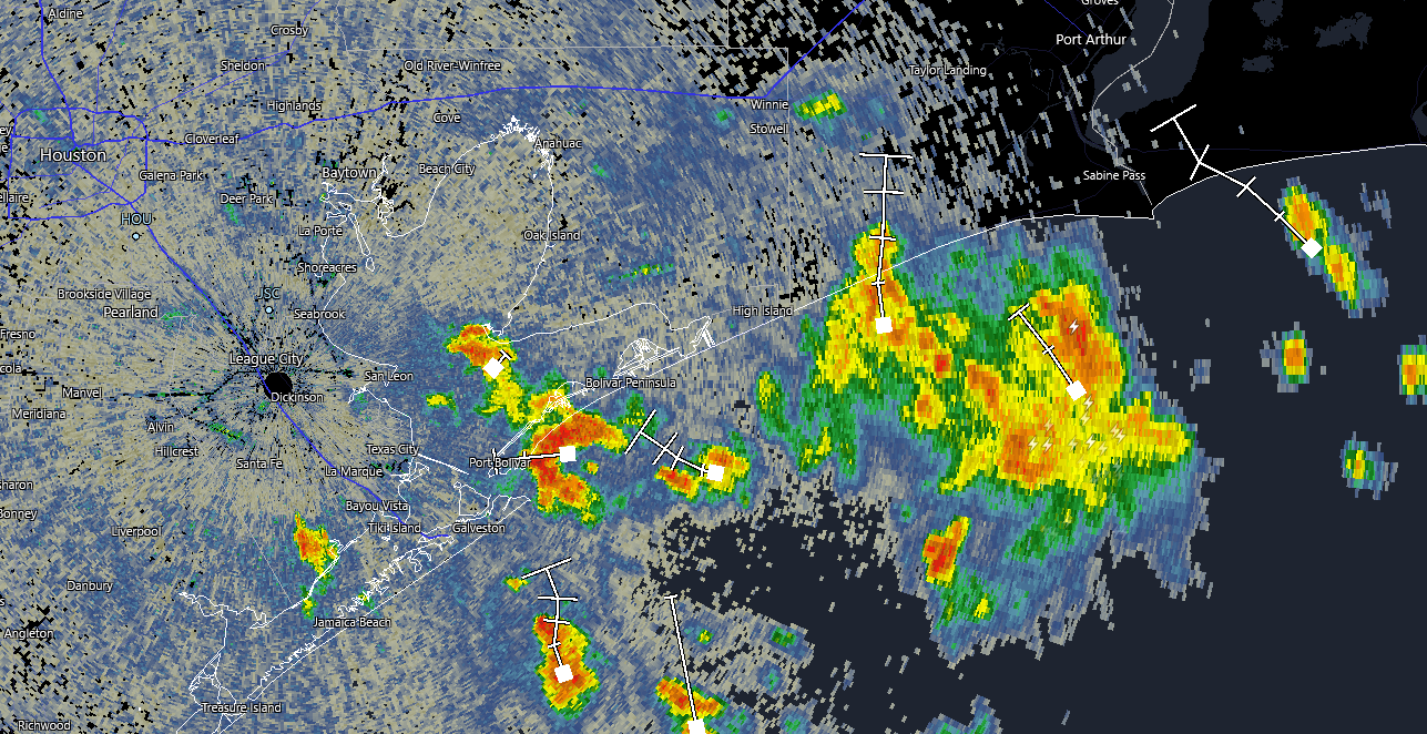
Today’s rain will be more spread out I think. We are initially seeing some scattered showers this morning near Bolivar and along the coast. The focus should remain in those areas for awhile, but inland areas will at least have a shot at showers this afternoon. The guidance for today is that you probably won’t see rain, but if you’re one of the lucky ones that do, it could rain hard for a brief period of time. Highs will be in the 80s or low 90s.
Weekend
Saturday looks a lot like today, with an isolated shower or storm possible almost anywhere, though the focus will be near the coast again and most inland communities will remain rain-free. Sunday should see rain chances dwindle a bit, so even fewer places will see a shower or storm. Both days should be in the low-90s on average. Morning lows will be in the 70s, and winds this weekend should be out of the southeast around 5 to 15 mph, or a bit gusty over the water.
Next week
Second Summer is here. Monday through Wednesday won’t have zero rain chances, but they’ll be low. Look for a lot of sun and a lot of heat. After morning lows in the low-70s, we’re probably looking at successive days in the mid-90s.
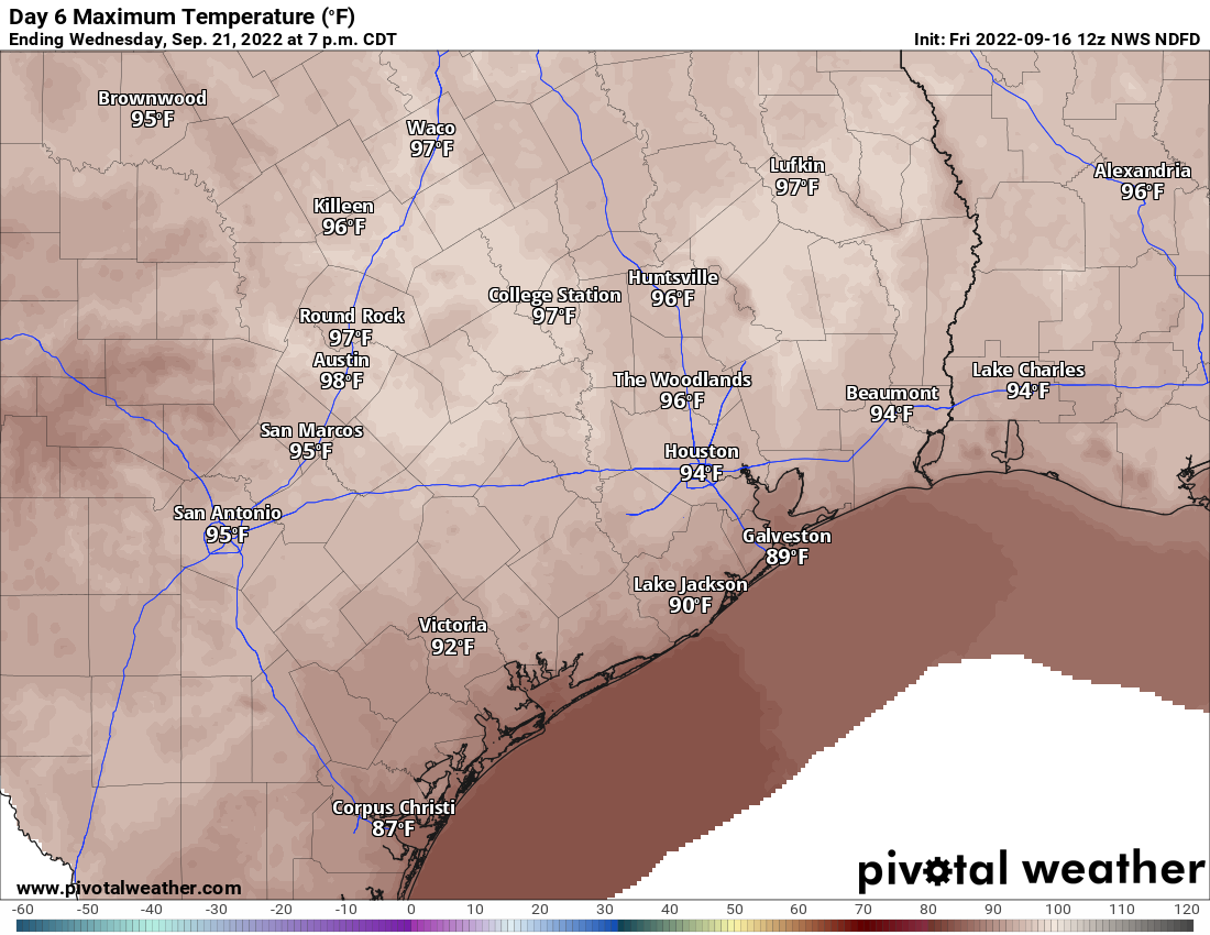
Right now, it looks like the ridge over us will peak on Wednesday, but heat will linger into Thursday and Friday also. Record highs next week are generally 96-100 degrees, so we will be flirting on the lower end of that. Don’t look for much relief before next weekend. The earliest we could see our next cold front is probably not until sometime the week of the 26th.
Tropical Storm Fiona
Let’s talk about Fiona. I’ll answer the obvious question right away: Fiona is not expected to make it to Texas or the Gulf at this time. Still, it’s something to at least keep an eye on in case things change.
Fiona has a good bit of thunderstorm activity with it, but one thing is for sure: It’s lopsided, with most storms on the east side and very little on the west side. Thus, Fiona is one disorganized storm.
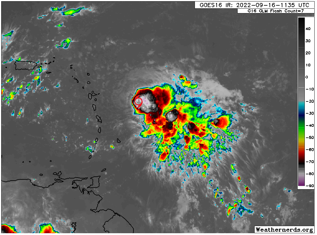
Fiona is expected to move into the northern half of the Lesser Antilles later today, bringing rain and gusty winds. It will then likely bring rough weather to the Virgin Islands and Puerto Rico later tomorrow into Sunday.
Fiona currently has maximum winds of 50 mph. As it moves into the islands, it is not expected to strengthen a whole lot more. It may gather some steam later this weekend, but that’s a big question mark. The current National Hurricane Center forecast brings it to Hispaniola by Monday.

From Hispaniola, the forecast gets more difficult. A vast majority of models turn Fiona northwest or north at this point, eventually strengthening it enough near the Bahamas to turn it out to sea. However, given land interaction, it’s plausible to think Fiona will struggle a bit in the coming days. Personally, Matt is leaning toward Fiona following the southern fringe of the NHC cone above. This still turns it more northwest near Cuba, but maybe not as soon as we’d like. On the flip side, it’s possible to think there’s enough land interaction to weaken Fiona substantially at some point, perhaps to the point of no return. But never count any system out in September in the southwest Atlantic or Caribbean so we’ll see.
All this is a long way of saying: Fiona will probably turn north or meet its demise before getting to the Gulf, but there’s enough uncertainty regarding the different puzzle pieces to impact this storm that it’s prudent to check back in on Monday and see where we stand. We’ll have more then.

If it does somehow make it into the Gulf… what are the chances it comes to Texas vs other areas of the Gulf?
Sad, don’t be sad.
Irrelevant question. It’s not coming into the Gulf.
Very, very low. I still would expect it to turn before it got here.
I tried to read your post without singing Lyle Lovett in the back of my head. It was impossible.
https://dai.ly/x2k0pz
And, just like that…we’re back to OG weather (Original Grossness, in this case).
Back to normal humidity this morning, and it sprinkled on me on 10 this morning near the galleria. GROSS.
I also loath September. The promise of cooler things to come, then WHAM heat! Just Kidding! UGH.
How about loathe. Sigh.
“My reason for hating September is exactly what is happening this year.” I call it Seasonal Adiabatic Confusion.
Matt: In the map of today’s post, the southern fringe is a line touching Eastern Cuba on Wednesday and pointing towards the central Gulf. Your post says the ridge over us should peak Wednesday.
Question (and please tell me I’m wrong): will the high pressure, that blocks tropical storms, be retreating come Friday and beyond, leaving us exposed?
Could it? possibly, but thats over a week away and weather patterns change.
It will be weakening in place, more than retreating. So we have a good 2-3 more days on top of Wednesday to deal with it. My feeling is that it will be enough to slow Fiona down enough to be “captured” and pulled away, even in a weak scenario.
Thanks Matt
I’m with you…September is the cruelest month. August? I expect the heat (but this August? Wowee…my power bill went DOWN). September is all tease and no real change. I tell newbies “the real break comes at Halloween” and I’ve generally not been wrong in that guidance.
Thanks for the Fiona updates. It’s good signal to stick to YOUR forecasts in the coming 10 days…
It would be better if we would get more focused on rain chances and why last week we had so much buzz about them and now no more! This has been happening all year. Kind of annoying.
I did a little research after yesterday’s bummer cast regarding more heat and no rain next week ….it seems that the line of arid climate for North America has moved east. Traditionally for 150 years it was right around 100 degrees west longitude. Now it’s probably around 97 degrees west longitude – maybe 150 miles west of Houston. Reason: that two degF of warming since 1870. As others have noted, Houston seems hotter, drier than it used to be. As the winters are unpredictably cold – who can forget the Valentines cold front of 2021 – there’s little to like of the climate here. Say San Antonio with more humidity and mosquitoes.
Given that it has been raining strongly for an hour and the water in my Bellaire backyard is now six inches deep, I am not worried about West Texas weather at the moment. Maybe next week.
For those of us that have experienced fall as it should be, September is a kick in the nuts here and, certainly, worse than August from that standpoint. For those that grew up in this nonsense, it is understandable they don’t discern the difference.
October can sometimes be almost just as frustrating as September. A cool front in early October can lead to a week or more of summer like heat and humidity through mid October. That’s why November is the month I look forward to more.
September is supposed to be wet. What is going on in the forecast next week with the whole south and southeast US, apart from Florida, completely dry?
Wacky pattern right now. Record heat in parts of the South next week. I think the whole global pattern is being shaken up a bit with all the typhoons that have been at work in the western Pacific, including the one with remnants headed for Alaska. You don’t put a generational storm into Alaska without weird downstream consequences.