In brief: One more chance at scattered storms exists today in Houston, followed by a quiet, hot weekend. We’ll get some classic early summer fare before our next chance at storms and a possible cool front later next week.
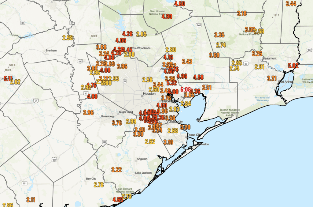
Most parts of the Houston area have seen a pretty good week in the rainfall department. Everyone has seen about a half inch to an inch of rain, with a couple exceptions near Wharton, College Station, and the East End of Galveston onto the Bolivar Peninsula.
Three areas really stood out this week. The area just north of Baytown and west of Mont Belvieu saw over 6 inches of rain. Pearland also got close to 6 inches of rainfall in spots. It’s likely that Liverpool in Brazoria County may have seen even higher totals this week. The area just south of Lake Livingston also saw nearly 6 inches of rain. So, your mileage definitely varies, but all in all a beneficial week of rainfall here.
Today
We have one “kinda sorta” chance of rain today. This should not be anything organized; just heating of the day random pop-up downpours. Most places will probably be dry today, but those that see a downpour could snag a quick quarter to half inch of additional rainfall or even a bit more along with some thunder and lightning. Otherwise, expect decreasing clouds and highs well into the 80s. All good for the Dash match tonight.
Saturday and Sunday
Both days may start off with clouds but transition to sunshine. Expect warm, humid conditions all weekend. Highs will be in the mid to upper-80s, with lows around 70 degrees. MS150 riders will get the tailwind this weekend at least, out of the southeast 5 to 15 mph or so. An isolated downpour can’t be entirely ruled out for the weekend, especially on Sunday, but it seems highly unlikely. Conditions look all good for the SaberCats or Dynamo matches Saturday.
Monday and Tuesday
I would expect more of the same for the start of next week: Clouds to sun, highs in the upper-80s and lows in the low to mid-70s. We do have a chance at 90 degrees on Tuesday.

Wednesday and onward
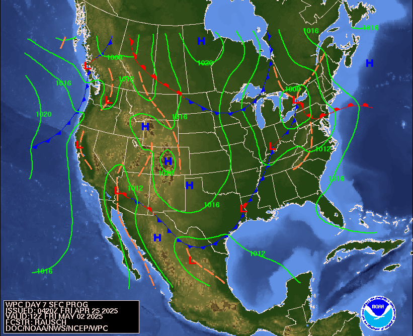
Conditions get more unsettled Wednesday and Thursday with scattered showers and thunderstorms possible. We’ll see about risks for heavy rain or any severe weather; it’s too soon to say at the moment, but it would seem we will get a couple rounds of storms in the area. We could see a push of drier air follow a cool front on Thursday, which could set up a nice end of the week. Fingers crossed.


Interesting that I can’t get here except for the link on the email. Could be related to the almost 6” of rain this week. I was going to ask for the rain to stop, but I’ve learned over the years not to request that.
whew
so glad to see SCW is up 😀
It’s pretty sad that this was supposedly posted at 7.08am, but it finally appears now. The quality of the hosting site (big dinosaur is extinct) is very questionable, considering all of the outages and constant delays.
Nice to see that I wasn’t the only one who just now got today’s post. This happens quite often for me.