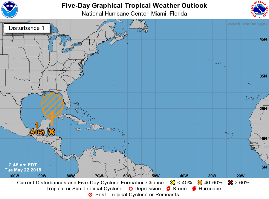
Houston saw another good round of rain showers on Monday, with the region generally receiving a few hundredths of an inch to as much as two inches over the Galena Park area. Prospects for a sunny weekend are looking up. While the National Hurricane Center predicts a system moving into the Gulf of Mexico has a 40 percent chance of becoming a depression or tropical storm, as we’ll discuss below it’s unlikely that Houston will see significant effects.
Tuesday
Moisture levels have fallen, but overall the pattern should be similar today across the Houston area as Monday. A partly sunny start to the morning should give way to mostly cloudy skies later, as temperatures warm into the 80s, and begin to generate scattered showers. Overall, I expect coverage to be less than on Monday, and for accumulations to be less as well. However we should still see a few heavy thunderstorms, with attendant winds and lightning. High temperatures will probably be about 90 degrees, and rains should end by around sunset as temperatures begin to fall.

Wednesday
A bit warmer, and a bit drier, as Houston begins to feel the influence of high pressure building from the west. Skies should be partly sunny, with a few scattered showers, and high temperatures generally in the low 90s.
Thursday, Friday, and Saturday
Toward the end of this week a low pressure system will move into the central or eastern Gulf of Mexico, and it’s likely that the bulk of the rainfall associated with this low will remain there. Under the most likely scenario, a tropical system or a depression develops late this week and moves into the northern Gulf of Mexico coast, probably near the Mississippi River delta. This will bring a large amount of rain to that area, and parts east. Houston should be on the periphery of any activity.
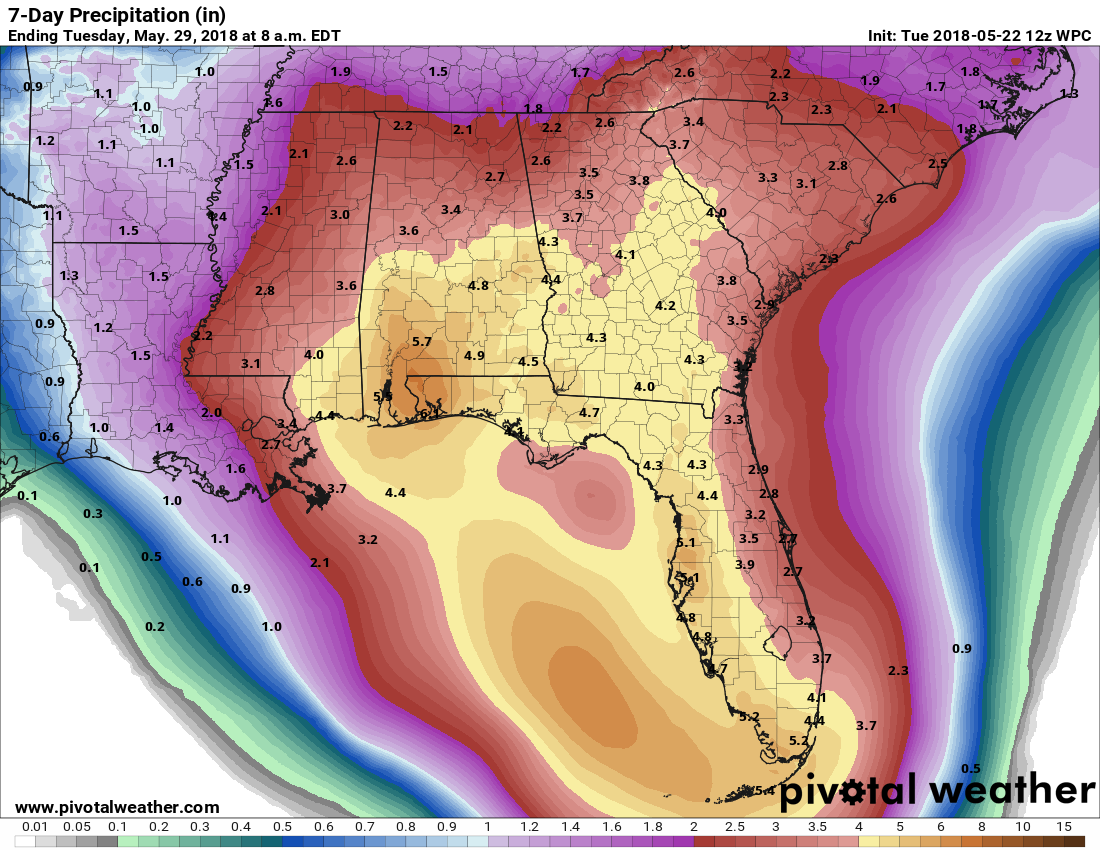
For Houston, this probably means that we’ll see partly to mostly sunny days to end the week, with the possibility of some scattered showers or thunderstorms. Highs should be in the low 90s. If the storm takes a more westward track—always possible but we don’t anticipate it at this time—Houston could see more rain.
Sunday and Monday
At this point the second half of Memorial Day weekend looks mostly sunny, and warm, with only very slight rain chances. Could see warmer weather into the mid-90s early next week.
Great article in the Chronicle!
Here is the link for those who missed it. Unsure if it is behind a paywall.
https://www.houstonchronicle.com/news/article/A-conversation-with-Space-City-Weather-founder-12926870.php
Could you provide the link? pretty please 🙂
Thanks, guys, for the 1.2″ of rain at my house yesterday. I was afraid we would have to start docking your pay to cover the cost of watering our yards. But since you came through, we can avoid doing that – – for now.
What do you guys think about New Orleans? I’ve got a weekend planned there with a concert, but trying to decide if Memorial Day weekend is just going to be a big mess there. Thanks for any insight.
Euro has invest 90L crashing into NOLA. Eric, if it goes into NOLA per the 12Z Euro solution, what does it mean for Houston?
Eric, Matt,
You guys do indeed have a great weather website!
Thanks for all the hard work!
Thanks for the great info too!
You guys have a new fan!
Our weather service we use at work has it going into Apalachicola 3AM Sunday as a weak tropical storm. They were pretty much right about Harvey.
What weather service is it? If you don’t mind sharing.
Leaving out of Galveston for 5 day cruise, stopping in Cozumel on Saturday, returning home Monday am. This is my first cruise and wonder how this system will affect it?