Aside from the local excitement over Tropical Storm Cindy, the 2017 Atlantic Hurricane Season has been a quiet one for Texas. That’s not surprising, as about 90 percent of all tropical activity during a given season occurs after this point during hurricane season. Basically, then, June and July are often just a prelude for the heart of hurricane season—August and September. And as we get close to August this year, a key signal suggests busier days may lie just ahead.
One measure of this activity in the atmosphere is “potential velocity,” which is rather complicated to compute, but essentially this is a useful indicator of rising air and a better chance for tropical systems to form. In the graphic below, we can see the potential velocity (VP) anomaly for this week (top), and the first week of August (bottom). Note the dramatic shift from a positive anomaly (which is bad for hurricanes) to a negative one over the tropical Atlantic, between Africa and the United States.
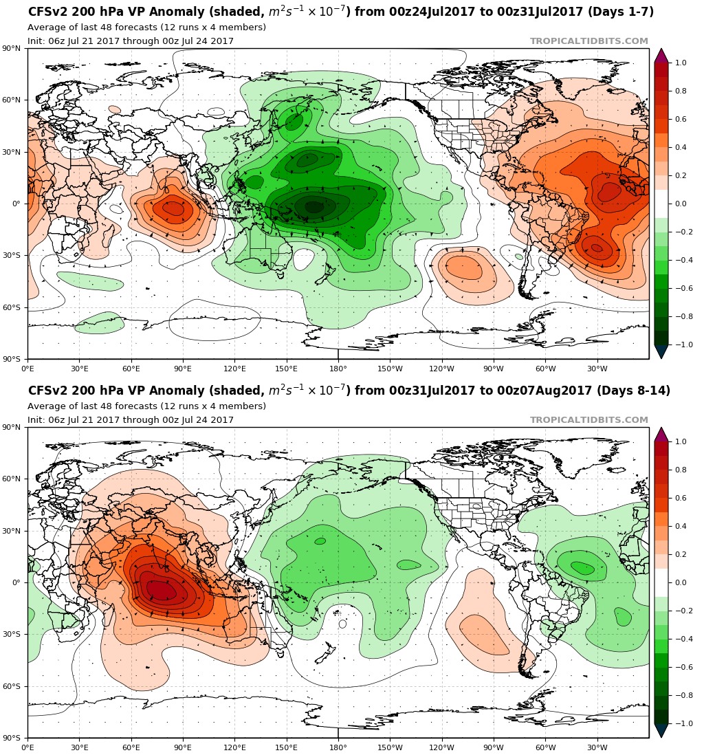
This does not guarantee the development of a hurricane by any means. But it does suggest that as we approach the traditional peak of hurricane season, meteorological factors may also be improving for storm formation. In any case, it is the time to make your final preparations for hurricane season. Now, onto the forecast.
Monday through Friday
In truth, right now there isn’t much to say about this week’s forecast. The combination of drier air moving into the area, along with slightly higher pressures building this week, should effectively preclude the development of rain showers for most of us in the Houston area. I think we’re looking at a 10 to 20 percent chance of rain most days, likely driven by the sea breeze during the afternoon and evening hours.
As it’s late July, the absence of rain showers means mostly sunny skies, and in turn that means hot temperatures. Look for highs in the mid- to upper-90s, and lows in the upper 70s for inland areas, and around 80 degrees closer to the coast. Summer, baby.
Saturday and Sunday
The forecast for the weekend is not entirely clear. The most likely outcome would seem to be a continuation of our hot, summertime weather. However, by Saturday or so, the upper Texas coast may be far enough away from a ridge of high pressure over the western United States to allow for some scattered to widespread rain showers, which would limit temperatures to the lower 90s. But this is a low confidence weekend forecast, for now.
Posted at 7:10am CT on Monday by Eric
What about all the Saharan dust? Do the forecasts have it clearing out enough to facilitate storm development?
Most likely it will abate some as we get into August, yes.