Not much has changed since yesterday’s forecast. In about a week’s time, give or take, it appears that a large amount of Arctic air will spill into the Midwestern United States. What’s not clear is whether that air will be shunted off to the east, or whether much of it will continue moving southward into Texas. For the marathon’s purposes, it may not matter a whole lot.
After that feature, during the second half of next week, the models bring a somewhat warmer air mass into the eastern United States, including Texas. However by the weekend of the marathon it appears that air, too, has moved on, which would leave conditions cooler than normal.
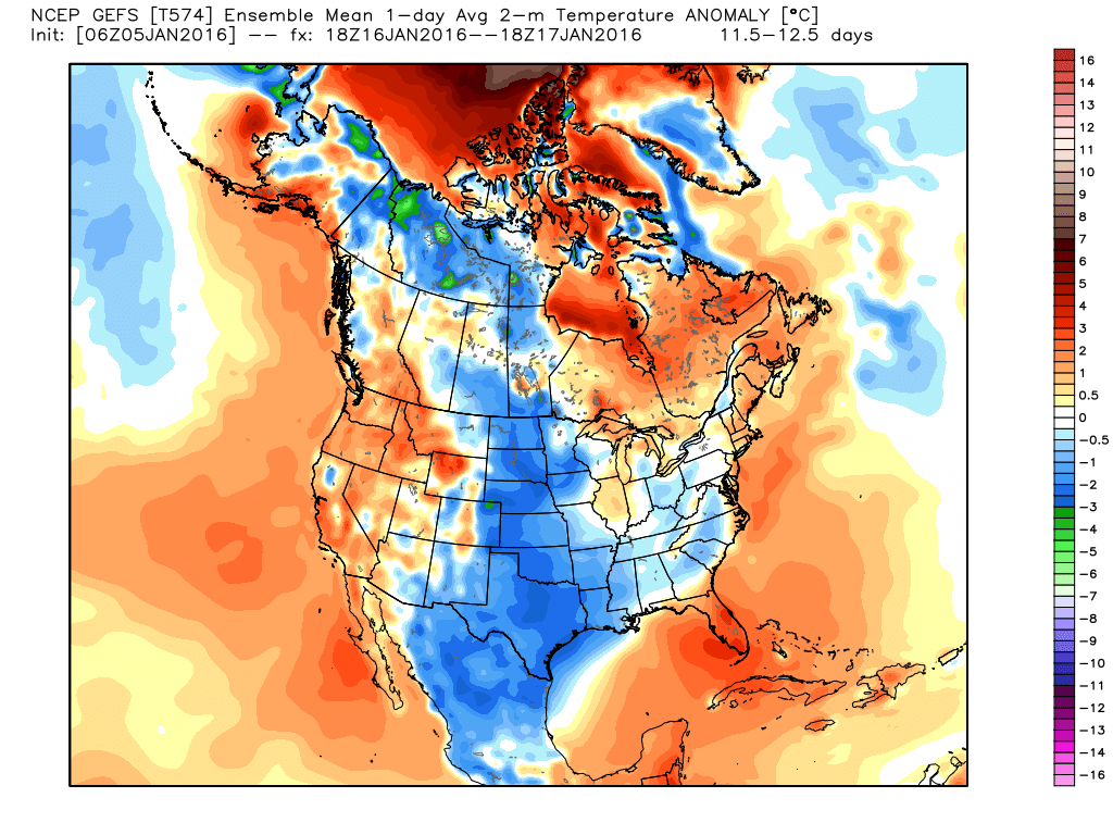
Here’s how the GFS model suggests conditions will be between noon Saturday, January 16th, and Sunday, the 17th. The model is suggesting temperatures 3 to 5 degrees Fahrenheit below normal for Texas, including Houston.
In looking at the ensemble members of the European model, more than two thirds also favor cooler-than normal weather for the weekend of the Houston marathon. Is that an ironclad guarantee? No, of course not. But I think we can reasonably say temperatures will not be exceptionally warm (i.e. morning lows greater than 60 degrees).
Here, then, is my latest forecast for conditions on the starting line of the 2016 Houston Marathon.
Temperature
Race-time temperatures will be near normal (low- to mid-40s), or below normal.
Confidence: Medium
Precipitation
There is a decent chance of light precipitation, depending on the location of low pressure systems.
Confidence: Very Low
Winds
It is difficult to make any predictions about winds at 13 days out.
Confidence: Very low
For daily marathon weather updates be sure to subscribe to this blog (box on right-side of this page, follow me on Twitter, or like my Facebook weather page.)