This week has not been oppressively hot and humid, but it still has been rather toasty for the end of September. That’s not going to change anytime soon unfortunately.
Today
The amount of moisture available in the atmosphere today will be a good bit more than what was available yesterday, which means we should see at least a smattering of some showers and storms pop up through the day. Radar already shows some showers this morning south of Houston toward Lake Jackson and Angleton.
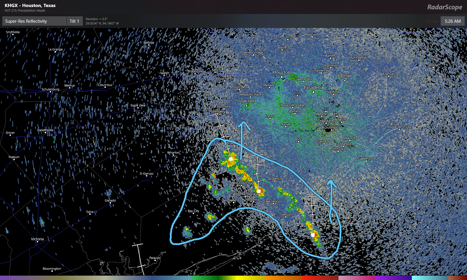
Based on this and weather modeling, the highest rain chances today should be south and west of Houston, though everyone has at least a chance of a shower. Outside of that, it will be partly sunny and continued hot. Look for high temperatures near 90 degrees.
Weekend
Moisture levels will slowly drop this weekend, but with onshore flow continuing, we have to at least mention a passing shower or storm Saturday and Sunday afternoons. If you’ve got outdoor plans this weekend, you should be able to go forward with them without much issue. You may encounter a brief downpour but probably nothing worse. Daytime highs will likely be up around 90 again. Nighttime lows, which have actually not been too bad (in the low-70s) this week will likely creep back into at least the mid-70s inland and warmer at the coast.

Next week
While we could see a spotty shower or storm next week, our thinking right now is that things will be mainly dry and hot through Thursday. We should expect days near 90 and nights near 75 degrees. Extended summer seems to be in control.
Front?
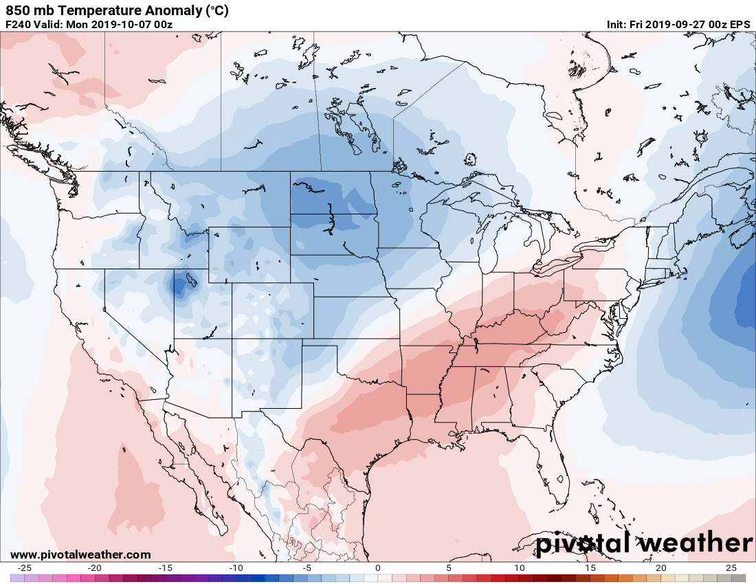
Right now, we don’t see strong signs of a true autumn cold front over the next 7 to 10 days unfortunately. We have held on to some hope that perhaps next weekend a front could make inroads into Texas finally, and there are still a couple models showing it. But the reality is that those are not terribly reliable. In looking at typically more reliable European ensemble data, roughly 75% of the 51 “members” of this ensemble show a cold front by about October 8th.
We continue to see some bouncing back and forth within modeling, but if I were assigning odds on which date we will see our first true front (low of 65° or cooler), here is how I would do so:
Through October 4th: < 1%
October 5-7: 15%
October 8-10: 40%
October 11-13: 35%
October 14+: ~10%
That adds up to 100. I think the most likely range for that cold front is October 8-13 right now. Sadly, if you had asked me two days ago, I probably would have given you 30 percent or higher on October 5-7, so the trends have not been in the right direction this week. Hopefully this can advance forward in the days ahead.
Tropics
Tropical Storm Karen is expected to fall apart east of Florida over by Sunday night.
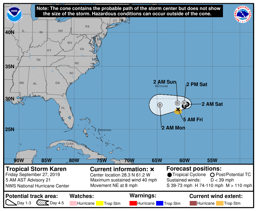
There are no systems of note behind Karen for us to watch at this time, and we are inside the window where risk of tropical activity on the Texas coast historically plummets. We would like to see that first cold front to be sure, but at the least, there is nothing at all in modeling right now that sets off any alarm bells for Texas.
Matt,
What’s happening with the drought conditions in TX?
Well, they’ve obviously improved in our neck of the woods and out toward Beaumont. But they are stable to worse as you go farther inland into Texas. A fair bit of “extreme drought” popping up around parts of central Texas. https://droughtmonitor.unl.edu/CurrentMap/StateDroughtMonitor.aspx?TX
Can you speak to what conditions it will take to get widespread drought relief across central TX?
We’re on the severe end of the drought spectrum just northwest of Houston (haven’t seen rain since June), and it’s frustrating that all people care about is cold fronts when I have pastures dying and cattle to feed. A major cold front that drops temps will suppress grass growth, even if we do finally get rain.
Two ways I see it: The most effective way would need a Pacific tropical system to curve up through Mexico and into Texas, ideally interacting with a cold front over the state. That would get you rain…albeit potentially too much too fast, so be careful what you wish for there. The other way would be a slow moving or stalled cold front without a tropical system involved. In that case, you’d get waves of repetitive showers and storms, and hopefully not too much too fast. I think that’s ideal. So you’re still rooting for a cold front, but one that sort of either drags its feet or stalls as it comes toward SE Texas.
Can you explain the significance of the cold front negatively affecting the possibility of a hurricane arrival please?
A cold front would basically force a hurricane to be directed off to our east. You can still get that to happen in many ways without a front, but a front would virtually guarantee the end of hurricane season here. That said, don’t read into this like I’m saying we have to have a front to stop watching the tropics. We’re in good shape right now. But it would just be icing on the cake to get a front in here.
Sorry to everyone dreaming of scarves and pumpkin spice lattes, but our new pool is almost ready to swim in and we are holding on to the 90s!
Let’s have some good weather drama!!!!
Front front front front!!
OMG. I so need a cold front, Matty. Bring it!
Hi Matt,
Quick couple of questions about the models meteorologists use: I assume there’s an “American” model(s), but we often hear of the “European Model”, and it’s almost always noted that it’s more reliable. Could you give a brief, laymen’s description of these two models, and, why the American model(s) are not as accurate? And if they aren’t as accurate (on average) as the European models, why do we continue to use them? Why isn’t the American Model tweaked or adjusted for accuracy?
Thanks for any explanation!
Partial response, but I’m sure Eric/Matt could provide additional info: https://cliffmass.blogspot.com/2019/04/us-numerical-weather-prediction-darkest.html
I’ve inquired about this as well (albeit, maybe not here). I’ve received several pieces of information: Europe has put more money into their models, thus making them much more reliable. Each model is more reliable with regard to certain aspects (one might be better at hurricane path, another at intensity, yet another at precipitation, etc). Allegedly that’s why they use multiple models, sometimes average data, apply knowledge to data, etc.
Regardless of this, it really does beg the question of why the US model(s) can’t be improved to be more reliable.
The “GFS” is the American model, and it has recently been improved:
https://www.noaa.gov/media-release/noaa-upgrades-us-global-weather-forecast-model
Jason (and others): Some good answers here so far. As is almost the case with any topic, “it’s complicated.” When you’re forecasting in the near-term, there are a bunch of models to choose from, including the European (Euro) and the GFS FV3 (American), in addition to a bunch of other models tuned to finer details that can be resolved in the near-term. Once you get out past day 3, you’re mostly using American & Euro. There are also models from Canada, the UK, Japan, etc., but for the sake of time and simplicity, we focus on the American & Euro. The American is run by NOAA here in the US and the Euro is run by a govt/university consortium in Europe (ECMWF). The European model has been run with superior computing power and a more robust/sophisticated initialization scheme. To get a good weather model, you need to initialize it (the initial snapshot you’re basing the entire forecast off of) well, and the Europeans have done outstanding work with that. The US has struggled, and they did some work to try and improve this recently but to limited success; the new FV3 which was put into operation earlier this year is still struggling to beat the Europeans. Future iterations of American weather modeling should be much more competitive though. To be frank, we use it because we have to. UK data is tough to get in a format that’s useful, and the Canadians have had problems of their own with how their model handles US weather. We shouldn’t use just one model though. Every forecaster is different. I use the European (specifically its 51 member ensemble, which takes the model and runs it with slightly tweaked initial conditions 51 different times) as sort of a baseline, adjusted based on my experience and understanding of model biases. Then I look at the American model for any sign of potential problems in that forecast and assess how to adjust my forecast. Perfect? No. But it works for me. Another forecaster will give you an entirely different answer though, which is the beautiful thing about weather forecasting: We’ve all got our own approaches and methods! Anyway, I hope this helps. Modeling is hard to do, and we’re committed to doing better in the US now (yes, with the support of Congress and $$$ to back it up). But it’s going to take years, if not a decade+ to catch up to Europe.
And if I am not mistaken when the NOAA/NWS dropped the Bay City weather station our forecasting resolution dropped considerably. We are between the next nearest data generating stations: Corpus and Lake Charles.
I think you’re referencing daily weather balloon launches? I’m not sure if/when Bay City was used, but the two nearest daily launches are indeed at Lake Charles and Corpus, as you note. While that’s an annoying issue, it should not seriously damage forecasting ability here. The satellite and other remote sensing technology we have today is incredible compared to even 10 years ago. So it becomes less a problem and more just a nuisance.
Great explanation Matt. Much appreciated.
I recently read a very good treatment of the history of modern meteorology and the development of the weather modeling systems in use today. It provides a very thorough explanation of why the European model is so much better than the rest. Very, very approachable writing for this layman. Highly recommended.
https://www.amazon.com/Weather-Machine-How-Into-Future-ebook/dp/B01N17CYXK
Have we set any kind of a record for sustained heat, or are we likely to?
Our latest first low temp of 65F or cooler is October 13, so it’s gonna be close.
Does the late cold front portend a mild to hot winter? These mosquitoes are HORRIBLE and we need the cold to kill them off. Any long-term forecasts predicting a cold winter?
I have bad news for you – it never gets cold enough here to kill off mosquitoes. Not sustained cold anyhow. Also, https://blog.chron.com/sciguy/2014/01/one-great-thing-about-the-hard-freeze-is-that-its-going-to-kill-all-the-mosquitoes-right/
True, but it does get cold enough to restrict their presence somewhat.
Cold front timing, to my knowledge, does not have any bearing on the subsequent winter. So don’t read into things too much with a late front. Most long-term forecasts I’ve seen suggest a near-average winter. So we’ll see.
Well at least it looks like the cold is starting to build in Canada. The northern rockies are getting a blizzard snow storm this weekend, so it’s only a matter of time before it starts to reach south Texas.
Once we get past the instability of transition I look at Alaska’s weather. We tend to get what they get about 7-10 days later. Cold there, cooler here. Hot there, hotter here. Doesn’t always work but it can be a pretty good predictor.
That reminds me of when I was a kid in Pittsburgh. We always figured that whatever weather Chicago got, we got similar a day or two later. It was pretty accurate. But right now I’m rooting for cold weather in Alaska!
Looking at your map, doesn’t look like the arctic oscillations have begun in an extreme negative phase just yet, so yes, no cold fronts to speak of any time soon. The heat ridge around Anchorage seems encouraging though, but sadly, deep negative phases only happen every thirty years.
Arctic Oscillation is only a slight contributor to cold. We’ve had plenty of cold fronts with a +AO. It does increase risks of colder weather though when negative, yes.