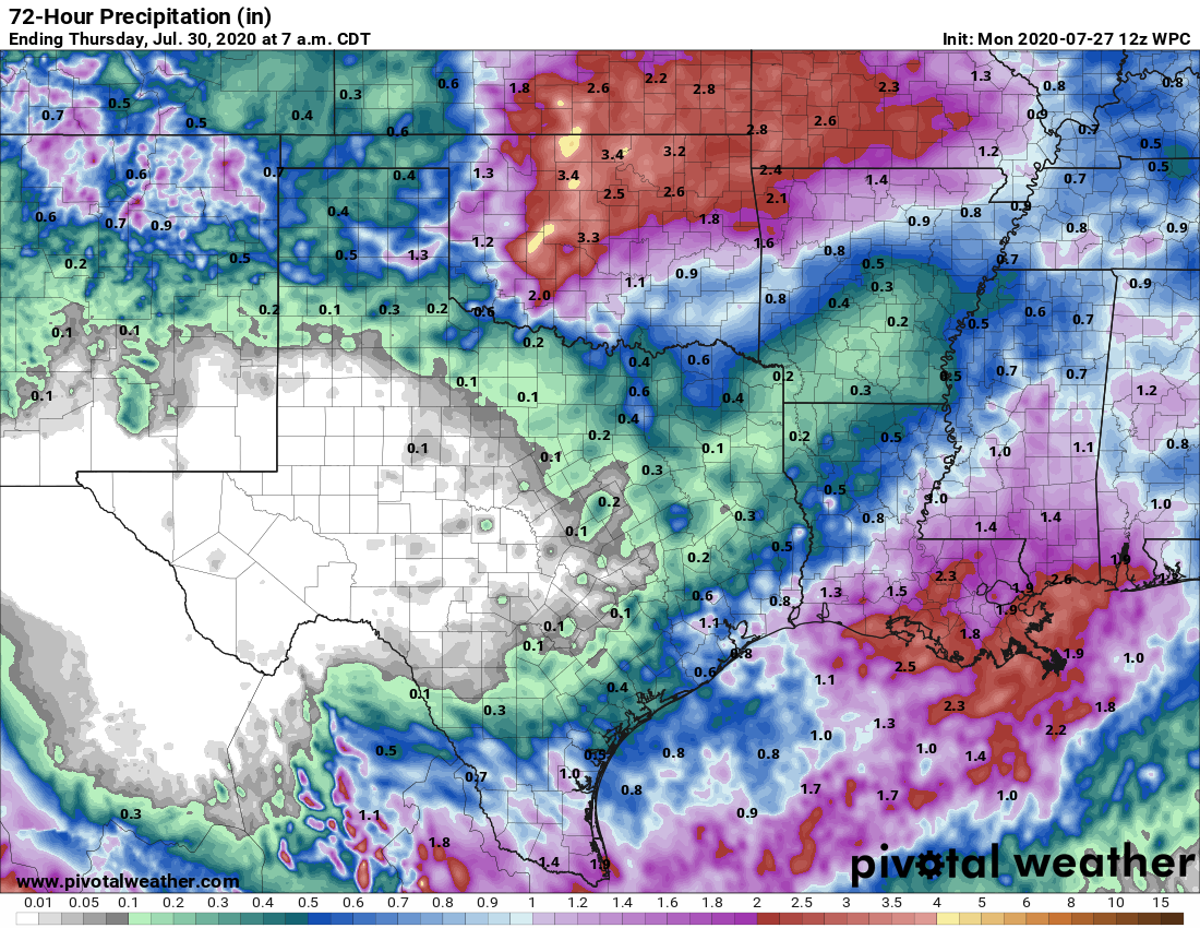
As expected, Houston saw periodic heavy rainfall this weekend from the outer bands of Hurricane Hanna, but totals were more than manageable. The heaviest rains came near the center of the storm, which moved inland near Port Mansfield and proceeded to drop as much as 15 inches of rainfall over South Texas, leading to widespread flooding. Hanna has now become a depression in northern Mexico and should dissipate today. Despite our region’s dynamic weather over the last week, we have more to come.
Monday
For the next couple of days our weather will be determined, to some extent, by “cutoff low” in the upper atmosphere. Presently this atmospheric disturbance is east of Houston, producing widespread showers over southwestern Louisiana and over the Gulf of Mexico. This upper low should slowly sag toward Texas, bringing a healthy—50 percent chance of rain—later today. Some of these storms could briefly produce heavy rainfall and lightning. The potential for showers and thunderstorms this afternoon should help limit high temperatures to about 90 degrees, with partly sunny skies. Winds will be light for most of the day and rain chances should slacken overnight—but not entirely go away.
Tuesday
This should be another day like Monday, with the atmospheric disturbance again influencing our weather. Storms likely will again develop over parts of the metro area during the late morning hours, and into the afternoon. These storms will have the potential to produce locally heavy rainfall but should be progressive enough to not lead to flooding. An unsettled atmosphere should again limit high temperatures to about 90 degrees.

Wednesday
By the middle of the week the upper-level low pressure system will likely have dragged itself away, to the southwest. However, the region will remain beneath a fairly moist atmosphere without enough high pressure to keep rain showers entirely away. A mix of clouds and showers should again help to limit highs to around 90 degrees.
Thursday and Friday
High pressure should begin to assert some control toward the end of the week, bringing a pair of sunnier days, and pushing high temperatures into the low- to mid-90s.
Saturday, Sunday, and beyond
It’s not entirely clear whether high pressure will hold sway over the region’s weather this weekend. At some point a front is likely to advance into Texas. Although it probably will stall out before reaching the Houston region—August begins this weekend after all—it could produce some storms on Sunday or Monday. The timing and details of this are all pretty fuzzy at this point so my best guess is partly to mostly sunny skies for this weekend, with fairly low rain chances.
Tropics
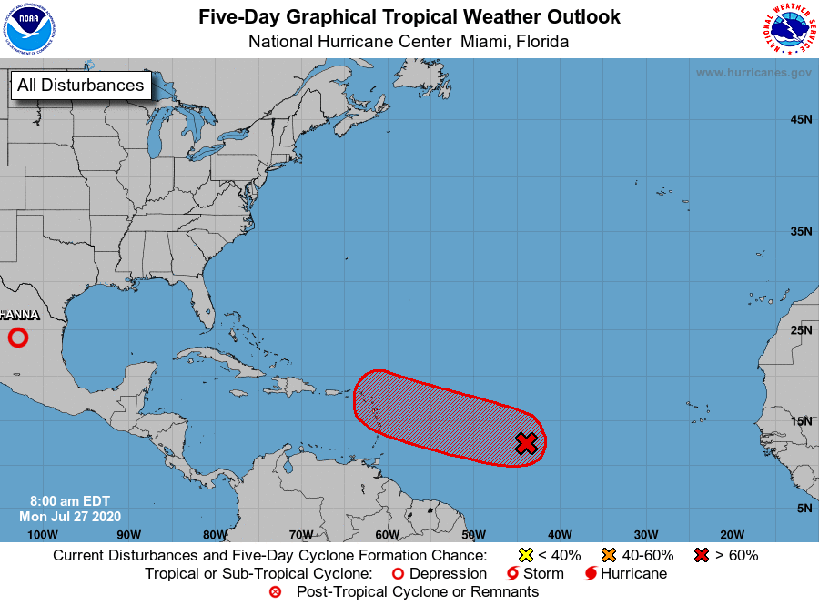
After Hanna’s demise we’re turning our eyes to the next tropical system out in the open Atlantic, which likely will become Tropical Storm Isaias (pronounced ees-ah-EE-ahs per the National Hurricane Center). While the preponderance of the modeling has the storm moving toward Puerto Rico and then curving north before reaching Florida, we cannot rule out a more westerly track that brings the system through the northern Caribbean Sea and potentially into the Gulf of Mexico. We’ll watch the system, but we’re not worried at this point.
Eric – Can you hold off on the rain until this evening? I’m having my A/C replaced today and I definitely don’t want it to stretch into tomorrow. Thanks! Oh, please keep it nice and cloudy, too.
Thanks for the thunderstorm cloud over my house around noon which produced no rain. House was starting to get a little toasty. Everything is “cool” now…..
Thanks for the phonetic spelling of Isaias. I was completely bumfuzzled on pronunciation.
,,,dang…I’m still “bumfuzzled”…I can’t get “yeeehaw” out of my head…
I’m thinking Old McDonald had a farm…
I would have thought it was “eye say us”. Why give storms names that are hard to pronounce AND spell? .
Who comes up with these names, anyway?
“NOAA’s National Hurricane Center does not control the naming of tropical storms. Instead, there is a strict procedure established by the World Meteorological Organization. For Atlantic hurricanes, there is a list of male and female names which are used on a six-year rotation. The only time that there is a change is if a storm is so deadly or costly that the future use of its name on a different storm would be inappropriate. In the event that more than twenty-one named tropical cyclones occur in a season, any additional storms will take names from the Greek alphabet.”
Just call it by its English translation: Isaiah
What has happened to Gonzalo?
Slammed into Venezuela and Grenada as a Tropical storm then pettered out
I can hope that Isaias fizzles out quickly so I don’t have to say its name.
Well that was a good weekend in The Woodlands. 0.5 inches on Saturday and 2+ inches on Sunday!! I don’t need to water the yard for at least another week!! This type of warm, wet tropical weather is the reason i moved to the Houston area! I do hope however to avoid a direct hit from a major hurricane this year.
Any storm that begins with I, A or H gives me the heebie-jeebies.