After the city of Galveston broke both its the daily (Dec. 13) and monthly (December) record high temperatures, reaching 81 degrees on Tuesday, the Houston area’s winter “heat” has broken—for now. We’ll have to wait until this weekend for a major cooldown.
Today
A moderate cool front has moved into the Gulf of Mexico, and northerly winds today should finally bring some significantly drier air into the region by this afternoon and evening, clearing skies. Highs today should climb into the upper 60s under mostly cloudy skies.
Thursday
Temperatures should fall into the upper 40s for most of Houston tonight, except for coastal areas, and Thursday should be another cooler day in the wake of last evening’s front. Highs will struggle to reach 60 degrees across much of the metro area. However onshore winds will return sometime later on Thursday, setting the stage for an unusually warm end to the week.
Friday and Saturday
As moisture returns, so will the humidity, and more potential problems from early morning fog. The region will also see some rain chances on Friday and Saturday, but I think we are only looking at fairly scattered, mostly very light rain.
High temperatures should rise into the mid- to upper-70s on both days under partly to mostly cloudy skies, and I think Saturday will probably be quite breezy as a strong wind establishes itself out of the south. Parts of Houston could see gusts around 20 mph. If you don’t like soupy weather in December, change is coming.
Sunday and beyond
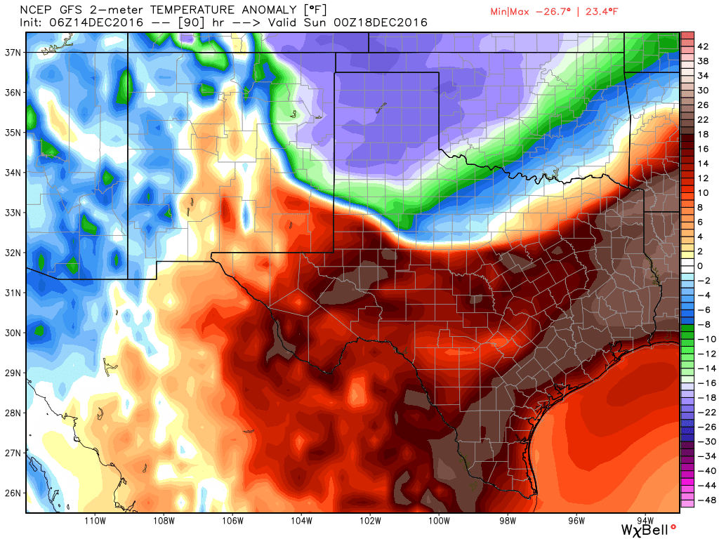
The timing is still slightly uncertain, but a strong cold front will approach Houston on Saturday night, and move through the region some time around midnight or during the pre-dawn hours on Sunday. I think we can expect a broken line of showers and thunderstorms with the front, but nothing too severe. A cooldown will begin immediately with the front’s passage, and Sunday will be a breezy and cold day, with daytime temperatures maybe reaching 50 degrees during the afternoon hours as skies clear out.
We’re watching for a possible freeze on Monday morning, although I think temperatures will probably remain at, or just above freezing for most of the metro area. Certainly areas to the west, north and northeast of Houston need be be prepared for the possibility, however.
Christmas
Cold weather will linger for much of the week leading up to Christmas, but what about the holiday itself? Right now the medium-range models indicate Houston could see a warm-up by next weekend. The question is when the next cold front makes it through, and right now this seems most likely shortly after Christmas. Therefore my forecast for Christmas Day remains much the same, with the greatest likelihood of near-normal or slightly above normal high temperatures in the 60s, less likely is conditions warmer than that in the 70s, and less likely still is a “cold” Christmas. Since we’re still 11 days away, remains plenty of time for this to change.
Posted at 6:40am CT on Wednesday by Eric