Good morning. Temperatures are quite a bit cooler, with much of the region having fallen to around 50 degrees, or lower. We’ll warm quickly, but a much stronger front looms Saturday night, with a freeze possible in Houston Monday morning as winter returns.
Today
As drier air continues to filter into the Houston region, we should see clearing skies today and cool temperatures. Expect highs generally in the upper 50s with moderate northerly winds, and another cool tonight with temperatures again falling to the upper 40s for inland areas, and lower 50s closer to the coast.
Friday and Saturday
The warmth returns with vengeance. Winds will gradually shift to the east and then from the south beginning Friday morning, and this onshore flow will push temperatures higher quickly. Under mostly cloudy skies look for highs in the mid-70s on Friday, with overnight lows in the upper 60s for inland areas and (unbelievably) lower 70s for coastal areas. This will probably make for cloudy conditions on Saturday morning.
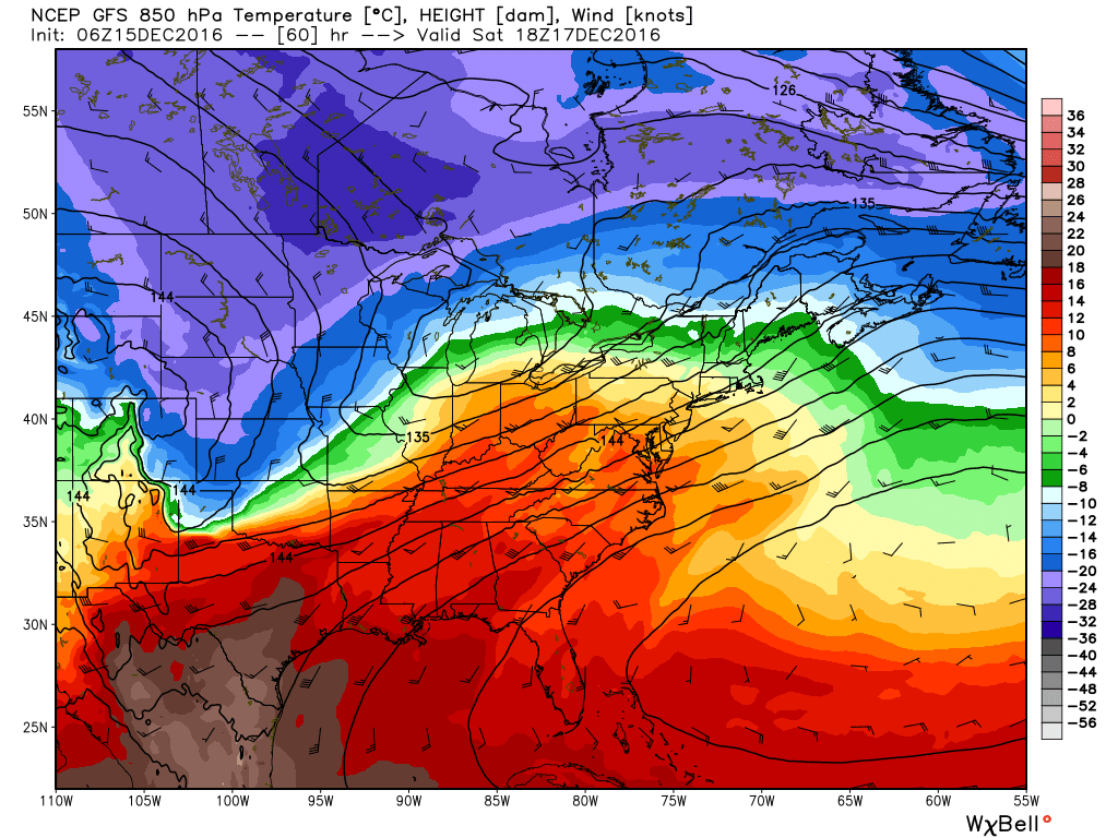
A very strong southwesterly flow will pick up later Friday and into Saturday, when high temperatures could rise as high as 80 degrees across the region. In addition Houston will see a slight chance of rain, and experience winds gusting as high as 30 mph along the coast, and slightly less for inland areas. Not a day for a picnic, I’m afraid.
Sunday and Monday
A very strong cold front will push towards Houston and likely reach the area before midnight on Saturday, or during the early morning hours Sunday. This is a real “blue norther” with much drier and colder air immediately blowing into the area. High temperatures on Sunday will struggle to reach the middle-40s, even as skies clear out. With the wind chill it will be a cold morning and most of the day.
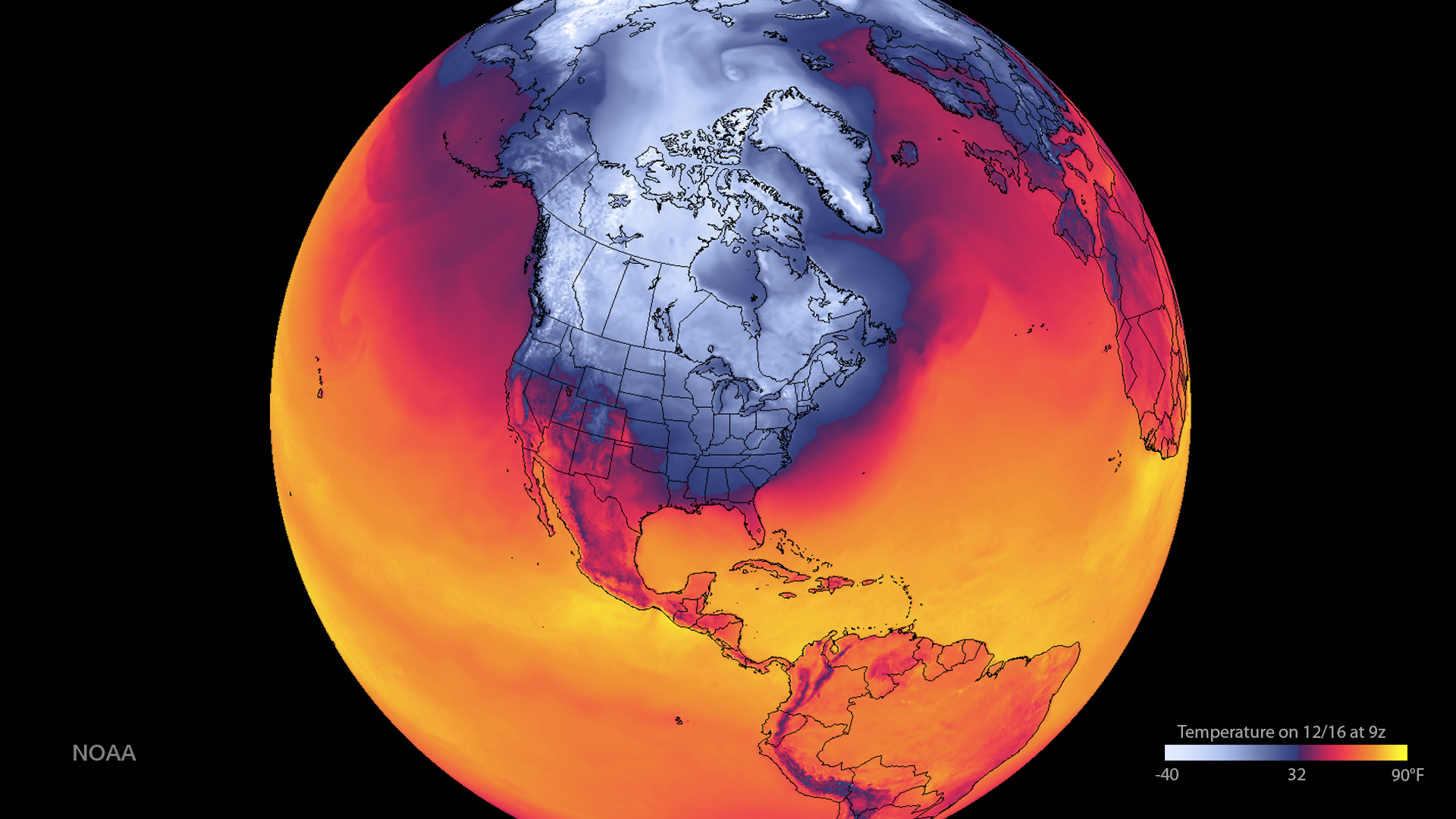
Much of the northern half of Houston, from Interstate 10 north, is at risk of a freeze on Monday morning. It would be the city’s first official freeze if temperatures dip down to 32 degrees at Bush Intercontinental Airport, but I’m not ready to guarantee that. As winds die down Monday it will be another cool day, with highs in the mid-40s.
Tuesday through Christmas
Tuesday should be cold again, with highs of around 50 degrees, before a couple of days with highs of around 60 degrees.
There remains some disagreement about conditions on Christmas morning and day. The GFS model now wants to bring through a fairly strong front on Christmas Eve, which would make for a cooler holiday, but the European model is not on board with that, at least not yet. It has a weaker front, not arriving until the day after Christmas. For now I’m still going to peg the most likely conditions as highs in the upper 60s, with a slight chance of rain. But by no means is this locked in.
Posted at 6:50am CT on Thursday by Eric
I haven’t lived in Houston very long. Are these types of dramatic temperature shifts normal winter weather for the area?
More or less, yes. Temperatures in December are often warm and a bit muggy because the Gulf of Mexico hasn’t cooled off that much. So when we get one of these Arctic fronts you can get a pretty wild temperature swing for a few days.
“when high temperatures could rise as high as 80 degrees across the region” – so a high of about 150°, then?
Deep winter is far preferable to “almost summer”- – at least, this time of the year.