Houston is enjoying another moderately cool morning, with lows generally in the 60s for most of the region. This brief respite from summer will gradually end today, but a stronger taste of fall arrives on Friday. The weekend looks pretty amazing after a breezy front blows through.
Wednesday
An easterly breeze will shift to come out of the south the morning, and this will herald the return of the onshore flow. Conditions today will still be fairly moderate, temperature-wise, with highs generally climbing into the mid-80s. However we’re not going to see as much cooling this evening with the absence of drier air. Lows for most of Houston probably will only get into the low- to mid-70s.
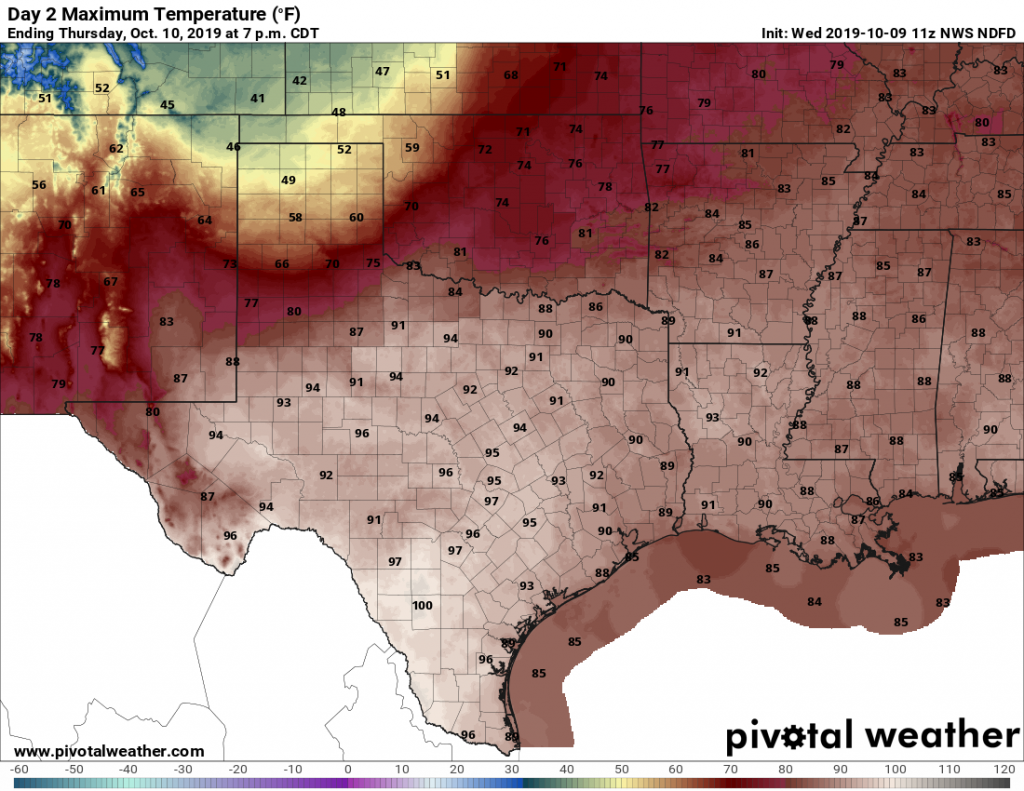
Thursday
Welcome back, summer! This will be a mostly sunny day, with high temperatures of around 90 degrees. Thursday night will be muggy, too, with lows on the mid- to upper-70s.
Friday
This day will have the week’s most dynamic weather. This will be a classic cold front passage, with a boundary barreling through the Houston region, likely during the morning hours. We can expect at least scattered, if not widespread, showers with the front, and perhaps a few thunderstorms. But they should pass pretty quickly as the front sweeps toward the coast by around noon or shortly thereafter.

Friday winds
Winds will pick up quickly as the front blows through, likely reaching about 20 mph in the city of Houston, and 25 to 30 mph along the coast, with potentially higher gusts—possibly to gale force offshore on Friday night. This could make for interesting conditions for the Harvest Moon Regatta, taking off from Lakewood Yacht Club.
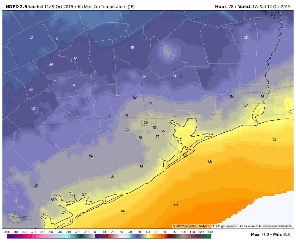
Saturday and Sunday
As the front blows itself out, conditions will settle down over the weekend. If you’ve been waiting for fall, the weekend will deliver, with highs in the 70s, sunny skies, and lows in the 50s. Saturday morning should provide the coolest weather.
Columbus Day
Clouds and the onshore flow resume later on Sunday or early Monday, so we can expect warmer and muggier conditions by Monday. Look for highs in the mid-80s, with warmer nights.
Next week
Next week looks to fall back into a late-summer pattern, with highs in the upper 80s to possibly 90 degrees. Rain chances will rise into the 30 to 40 percent range each day. Another, fairly weak front may try to work its way into the region by Thursday or so, but confidence in the forecast by then is pretty low.
I got one day without having to wipe down my car windows in the morning. This was pretty disappointing as fronts go… I guess it wasn’t 95 degrees yesterday but we have to be able to do better than this in mid-October. This is ridiculous.
Planning to cut my yard with scissors, please provide exact moment the rain will fall on Friday, duration and density of raindrops per square foot. Seriously…approaching the only time of the year I look forward to in Houston, our 3-4 days of Fall weather!
Expect a 6″ rainfall. The rain drops will be exactly 6″ apart!
Eric – would there be enough confidence in 2-3 days to issue a Wings Over Houston (shameless plug) forecast?
Also interested in your thoughts about what this winter (or, “what passes for winter in Houston”) might bring.
Did I miss the Imelda recap/lessons learned discussion?
no they never did one
These anemic, evanescent, “girly man” cool fronts aren’t doing it for me. Pleasant for a short while and then back to heat, humidity and swatting mosquitos. I’m ready for a genuine, hat-and-heavier-jacket whistlin’ Blue Norther!
Wait…isn’t it, “Indigenous Peoples Day” instead of Columbus Day? 😛 (Hint: Not in my world).
Stop looking for political validation on a weather web site and take your thinly-veiled race-baiting back to Click2Weather or the Chron where it belongs.
At least get the date right.,..it is next Monday…but I get it,..it wasn’t the point of your statement…
Going to be camping in Livingston the 17th -20 october. Good weather?