If you’ve been missing summer, you’re in luck. It returns for a one-day engagement Thursday with highs of around 90 degrees. My guess is that we’ve only got two or three days with 90-degree temperatures left in 2019, so if you really like the heat please get outside and enjoy it today. Cooler weather arrives Friday.
Thursday
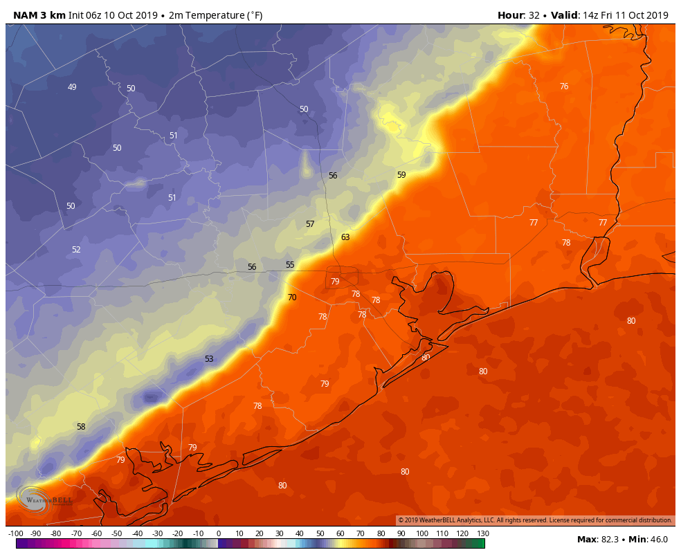
Today will be quite warm, with highs of 90 degrees in the city of Houston, and possibly mid-90s just to the west, in places like Katy. Mostly sunny skies will amplify the heat, and we’ll get no respite from the humidity as the sun goes down tonight. (Just as the Tampa Bay Rays will not get any respite from the Astros’ bats tonight).
Friday
But that all changes on Friday. A potent fall cold front has been sweeping down the central United States, and it will reach the Houston area on Friday morning. Areas such as College Station will likely see the frontal passage before sunrise, and it should move into central Houston by around 10am, and push off the coast around Noon. A broken line of light-to-moderate showers should accompany the frontal passage, but any storms should be short-lived.
Conditions after the front will be significantly drier, cooler, and gustier. We can’t entirely rule out some light rain after the front’s passage, but for the most part it will be just cloudy. With the lack of sunshine, and winds gusting to 25 mph (or higher, along the coast), you may well want a longer-sleeved shirt or light jacket on Friday afternoon and evening.

Saturday
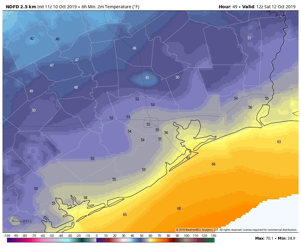
Lows on Saturday morning will be the coolest they have been since at least mid April, and possibly early April depending on how cool things get across the city. But generally, most everyone but the immediate coast will see lows in the 50s.
Overall, this will be a fairly cool day, with a persistent northerly breeze at 10 to 15 mph, partly sunny skies, and high temperatures in the low- to mid-70s. It will be excellent for doing any kind of yard work outside, cleaning out the garage, or what have you.
Sunday
Lows Sunday morning will be a few degrees warmer than Saturday morning, but much of the region should still dip into at least the upper 50s. Sunday will be a fine, mostly sunny day with high temperatures of around 80 degrees.
Next week
As we’ve discussed, next week will see the return of warmer weather, with perhaps 20 to 40 percent rain chances each day beginning Monday. A weak front may push into Houston by later Wednesday or Thursday, but at this point it doesn’t appear likely to pack too much oomph.
Thanks for the “refreshing” forecast. Let’s hope today’s heat will keep the Astros’ bats hot enough to win Game 5.
Thank you for the update. Loved the nod to the Astros.
I flew into Denver yesterday for a work conference and it was in the 80s, when I flew out early this morning it was 20 degrees and snowing. Glad I made it out before it got worse, this is one powerful front heading our way.
I lived in Denver for quite a while. The best one I remember for a Summer/Winter swing was September 1994. Sunday it was 96 degrees for the Broncos game. Monday the Rockies game was snow and in the 20s.
Go Stros.
A light jacket?! Long sleeves?! YAY!
Hey Eric, I see you got a reference and a tweet published in an NYT story about Nasa, SpaceX and their troubles:
https://www.nytimes.com/2019/10/10/science/nasa-spacex-elon-musk.html
Anyway, looking forward to some cool air tomorrow…
The wind today was steady and very annoying. It seems to be windier than it used to be.
Let’s go Astros!!!
Eric,
How about a (blatant plug here) Wings Over Houston forecast for next weekend?
Also, anything out there in terms of a “what passes for winter in Houston” forecast?
Was it supposed to rain this much? Coming down hard in Katy around i-10 and south to Westpark… I’d say it’s falling at a rate of 1 inch per hour but I’m not very good at gauging that. Perhaps I misread, but I thought we were getting light showers?