Houston’s weather will remain quiet, and mostly spring-like, until the arrival of a cold front this weekend brings a healthy chance of storms to the region. We’ll focus on that possibility in this forecast.
Wednesday
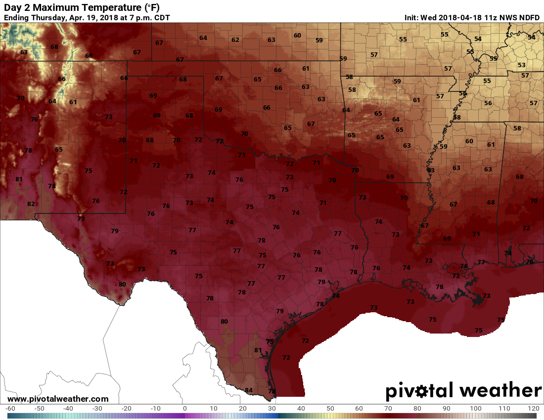
Highs today will be in the low 80s, with ample cloud cover as moisture streams into the region. Some (almost certainly very light) rain showers will be possible this afternoon, and during the overnight hours, as a cold front approaches Houston, and then pushes off the coast early on Thursday morning. Most areas probably won’t see rainfall, and those that do will only see slight accumulations.
Thursday
An exceptional day, with modest northerly winds, highs in the upper 70s, drier air, and sunny skies. Skip work, play hooky, plan an outdoor lunch—do whatever you need to do to spend this one soaking up springtime in Houston. Lows Thursday night will be in the 50s for inland areas, and lower 60s along the coast.
Friday
Another very nice day, with highs in the mid-70s, and partly sunny skies.

Saturday and Sunday
As has often been the case this spring, the nice weather comes during the week, and the cruddier conditions come over the weekend. Alas, that will be the case this weekend as well, with the onshore flow returning by late Friday or Saturday morning, and a fairly potent upper-level system moving down from the central plains.
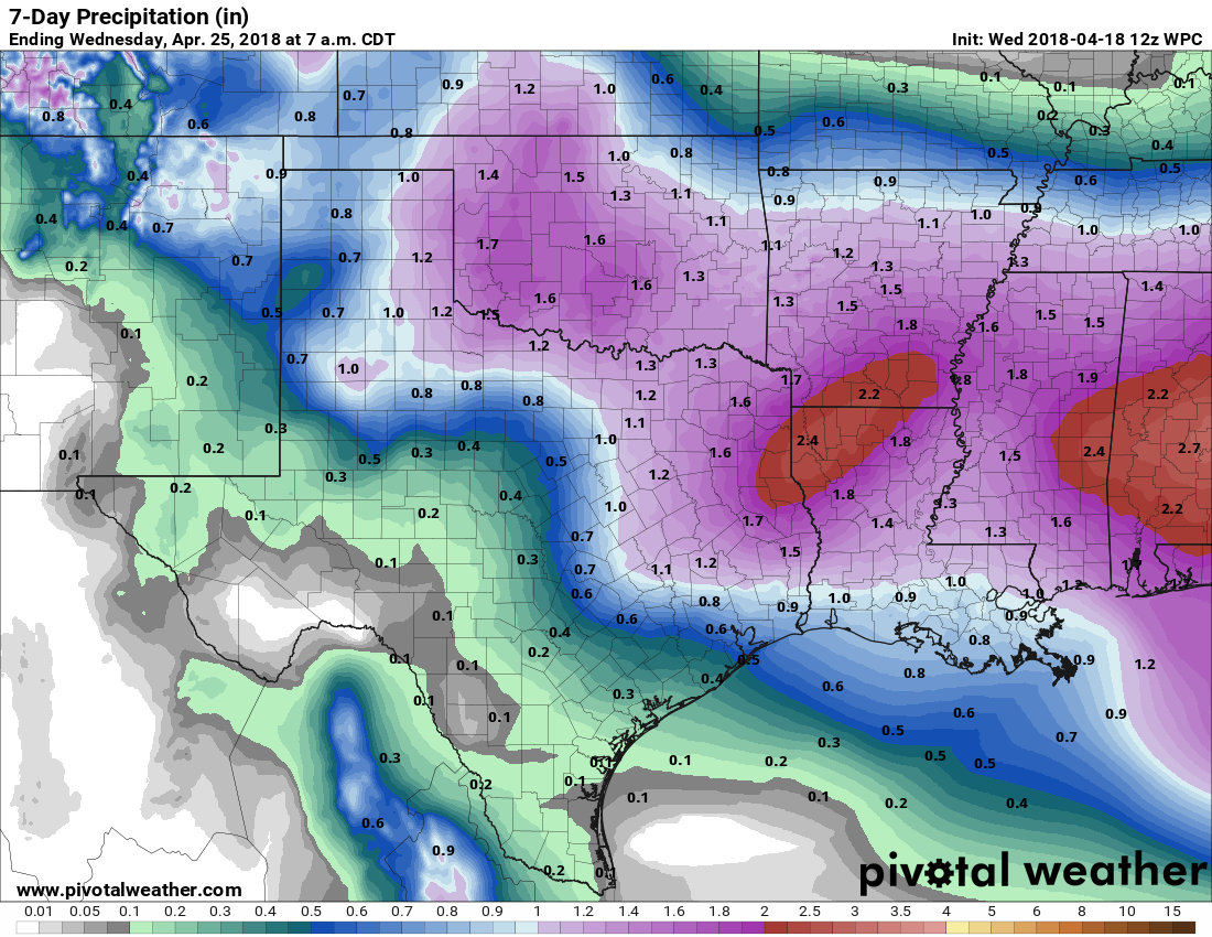
What this means for Houston is that Saturday will start out mostly cloudy, and we’re going to see increasing rain chances throughout the day. Showers and a few thunderstorms will be possible, with greater chances north of Interstate 10 than for southern areas. The possibility of severe weather will rise later in the day, and especially on Saturday night, as a cold front nears and then moves through the area. The finer details of this aren’t clear just yet, but I think its safe to say that a lot of Houston will see about one-half to one inch of rain from mid-morning Saturday to Sunday morning, with the possibility of severe weather during the overnight hours. Saturday probably won’t be washout for everyone, but any outdoor plans are definitely at risk.
I’d expect rain chances to end on Sunday morning, and the second half of the day has the chance to be pretty nice, with clearing skies and highs in the 70s.
Next week
The first half of next week looks really pleasant and spring-like, with highs in the upper 70s and lows in the upper 50s. Enjoy spring while you can!
Eric, what does your current forecast look like for next weekend for BPMS150 riders?
Interested in the LaGrange area forecast as well.
Thanks again.
Second Oscar’s question – MS 150 Rider here trying to figure out to drop some $$$ on rain gear. Help a rider out?
-Kate