In brief: Today’s post discusses our storm expectations for the next two days, with at least three distinct waves of severe weather possible for various parts of the Houston metro area. The bottom line is that it is important to remain weather aware through Wednesday.
Stormy pattern
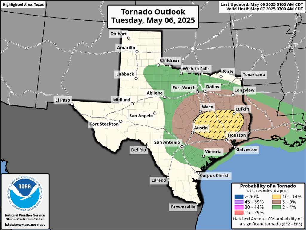
A sharp disturbance in the upper atmosphere will provide lift needed to support unsettled weather from today through Wednesday across the Houston region. Areas along and north of Interstate 10 will be most favored for severe storms today, but we cannot rule out strong thunderstorms anywhere in the region. Among the risks we are tracking:
- Heavy rainfall with high rates. Most of the greater Houston area is likely to receive 1 to 2 inches of rain, but there will be greater totals in some locations, and rain will be falling quickly enough to back up streets. For this reason we have put a Stage 1 flood alert in place through Wednesday evening.
- Tornadoes. The atmosphere, with plenty of instability as well as available energy (CAPE), will be capable of forming tornadoes. If they form, they could become fairly powerful tornadoes given the atmospheric conditions.
- Large hail. With previous storms we have already seen quarter-sized hail of late, and the atmosphere will be capable of supporting more large hail over the next two days.
- Damaging winds. Within stronger thunderstorms there will be the potential for damaging, straight-line winds. If possible, batten down loose outdoor items that don’t have much heft.
Timing of storms
Your best weapon for timing storms over the next two days will be a good radar app (RadarScope is one we like) to determine conditions nearby your location. However, generally, we expect a fairly calm morning. After that we should see at least three waves of storms:
Round one: By late Tuesday morning a line of storms, very likely with severe storms embedded, will be nearing the College Station area. This line should move into Montgomery County and points north by around noon, affecting the I-45 corridor (I’m concerned about areas including The Woodlands, Conroe, and Huntsville). At this time, we think most of these storms will be along and north of Interstate 10, but again we cannot rule out impacts further south, and closer to the coast.
Round two: Conditions may then calm down for a few hours this afternoon and early evening. However by around sunset I expect another line of storms to approach the Houston region from the northwest. I expect these to advance into the Houston metro area between 8 pm and midnight, but they may peter out before reaching the coast.
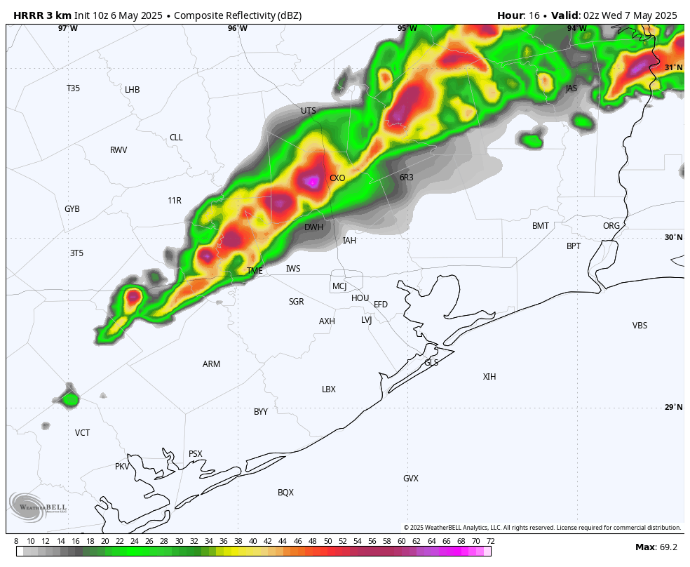
Round three: If you live near the coast you may be wondering, are we not going to see anything from all of this mess? Well, it’s possible that areas south of Interstate 10 will not see much action on Tuesday. However, most of our guidance shows another round of storms developing to the southwest of the region and advancing into the city. It appears as though these storms will reach the southern portion of the Houston metro area early on Wednesday morning, spreading into much of the metro area. Again, these storms also have the potential to produce severe weather and could make for a messy commute on Wednesday morning.
After this we may see additional rounds of development later on Wednesday, but nothing quite as severe. We shall see.
Tuesday and Wednesday
Temperatures on both days should be in the low- to mid-80s, with partly to mostly cloudy skies. Even when there aren’t storms, on Tuesday in particular, there will be a fairly pronounced southerly wind with gusts up to 25 mph or so. Nights will be warm.
Thursday and Friday
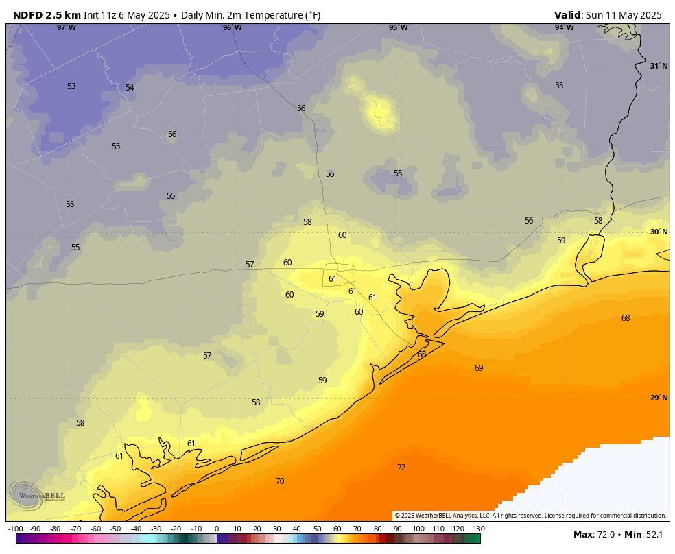
Although likely not severe, the rains may linger into Thursday as a weak front pushes into the area. Expect partly sunny skies on Thursday, with highs in the mid-80s, and mostly sunny skies on Friday with a high of around 80 degrees. With slightly drier air, we should see nighttime temperatures drop into the 60s.
Saturday and Sunday
We should have another exceptional weekend. Although I don’t expect the air to be as dry as last weekend, it still should be reasonably pleasant with highs around 80 degrees, or just a bit above that, and lows in the vicinity of 60 degrees in Houston, with a smattering of 50s possible for far inland areas. Sunshine will be abundant, with rain chances near nil.
Next week
Most of next week looks mostly sunny and hotter, with highs possibly reaching 90 degrees by mid-week. It might start to feel a bit like summer around these parts, so enjoy the weekend.
Next update
We will post again on this site no later than shortly after noon.

I think you mean sunset. … However by around sunrise I expect another line of storms to approach the Houston region from the northwest. I expect these to advance into the Houston metro area between 8 pm and midnight
Thanks, Betty!
I did indeed. Lovely to hear from you after all of these years!
Can someone explain why there seems to be a microclimate around FB County-Pecan Grove in particular- that causes storms to go around us? Happens enough that we call it “The PG Bubble”.
We feel the same here in Lindale Park (4 miles north of downtown Houston). I wonder if the tall buildings downtown plus all the high rise apartments going up in the Heights act like mountains protecting us.
It seems that Houston metro has a bubble around it. My guess is because of all the concrete, heat and too many (new) people.
Then how do you explain all the major flooding events we have had over the years? It’s all chance…
“too many (new) people.”
All the Californians need to go BACK where they came from. /s
It is surprising to me that you felt comfortable making that comment publicly.
This sounds really bad 😥
We already got a short downpour (20 minutes?) about 6.30am. On radar, it showed to move from the south. We see more moving up to us (Magnolia).
Mike I. at fox26news showed the “tornado possibility” imaging in motion for today. We are not happy that it shows a strong possibility for Montgomery county. 🫤
The water station above the woodlands forecasts 132 ft with 138 as the minor flood point. Doesn’t get there. The lake is of course releasing water. Is that to be believed?
On the brighter side, I won’t need to water my lawn for the rest of the week.
Happy about this too! Houston water is ridiculously overpriced.
You city people are ridiculous with your lawns. You should rarely have to water a lawn in this region. Stop over watering and let your roots grow deep. I’ve lived in this region my entire life and seldom have I ever needed to water a lawn (exceptional drought years like 2011 and even then not much) or fertilize it. Maybe some weed control but no need for fertilizer when the mower mulches and puts the nutrients back into the ground. Urbanization has bred the sensibilities out of the majority of our country.
Shaking your fist at the sky over urban lawns is the most rural “nothing to do” thing ever.
Not everyone has access or the means to live on rural land. What is even the point of this post.
He’s right (mostly). I live in the suburbs and my neighbors use tons of water, throw away tons of yard waste (which I collect for mulch), and use lots of chemicals. All of which shows utter lack of environmental sensibility.
Urbanites shake the fist at farmers and ranchers for using water to irrigate food for people while they use it to mow their lawns twice a week. We can all do better with water and fertilizer but it needs to start being addressed first in the places where it doesn’t produce anything.
Hey anti-rural, wrote … “Not everyone has access or the means to live on rural land.”
Yes, everyone has the access and means to live on rural property.
Everyone does. It’s a choice.
We did it over 12 years ago, and what a blessing to do so. No more noise, violence, “yard of the month” , HOA fees and hassles, and so on.
It’s easy … get a realtor or shop on har dot com, for property away from the city, buy it, sell your city house, and move!
Not everyone can afford to buy a lot large enough to build a house & its fittings, install a septic system, build a well house & dig a deep enough well, maintenance the dying trees around here, nettles, ivy & vegetation, live with the constant threat of power loss (esp when WFH), and/or maintenance a genny, deal with poor trash service, poor mail service, be flooded in without proper drainage, deal with critters (widows, moccasins & crows, esp in this part of Tx), and more.
And how about all the regular, nasty strong storms to the N of Houston – I don’t think so. There’s little to no maintenance as far as drainage goes, esp once you get outside Fort Bend & Harris – and all those slack waste dumping laws, esp for sewage.
So, time to be realistic. Not ideal to live near Road Kill Cafe Land.
So… why are complete strangers fighting online about lawn care?? LOL
Jason: bc grandpa aggie was trying to grind away his climate angst on the slickers & their sinful lawns
Buy an existing property with house, as we did (in Cypress and now Magnolia) with existing water well and septic system. Have NEVER had a problem.
All our pine trees are fine (60+ foot trees both in Cypress and Magnolia). Never an issue with vegetation. If so, horses would be complaining 🙂
Power loss? Nothing different than the possiblity in the city. It’s rare that it happens here.
Trash service? We can choose among 4+ services (maybe more, we’ve never had an issue). If service xxxx fails, you instantly switch to service yyyy the next month.
Never had mail service probs. Our carrier has been delivering for years (she’s consistent and personable … know us and our neighbors by first name). You’re probably referring to those city neighborhoods that have cluster mailboxes that theives hit constantly.
Drainage is fine out here. We are on a higher elevation than most of Harris county properties. We’ve never had a fllooding issue in all our years here.
And yea, if you’ve made a conscious choice to buy raw acreage with no infrastructure, then there is work to do. But even with that choice, it’s waaaaay better than living in the concrete jungle, five feet away from the next house 👍
Is there any chance the clouds and rain this morning will limit the instability and make things not as bad?
This morning’s report is a pleasure to read, even though the weather might not be a pleasure to experience. Thanks so much. Keep going.
So far we have been in between two rain areas. One lesser one around the Lake Charles area and a rather nasty one around Austin and north of College Station. Fingers crossed.
Yeah Houston seems once again firmly isolated from any storms.
Too early to call a forecast bust?
Probably. There’s a tornado watch in effect until 4:00PM, but I certainly wouldn’t mind declaring one.
I’m grateful that it’s hanging out to the NE of Houston, the radar looks like an xmas tree at a disco
Those poor people in its path are getting pounded
& sounds like a 1980’s typing class
Everything for the past month has been a forecast bust. We have gotten about 2 inches of rain in the past month or so, and some places in the Sugar Land area have gotten less than 1 inch I think. Why does everything go around west Houston??
Guess again…
Not related to our current weather but both the tropical Pacific and Atlantic SST anomalies are below average for a large portion of our oceans. Several degrees cooler over much of the main development region in the Atlantic. Certainly when compared to this time last year. It will be interesting to see how (if) this has an impact on our hurricane season.
I got the Radar Scope app this AM. Now I need to figure out how to work it!!!0