Clear skies have allowed temperatures to cool down this morning, and more importantly they’ve afforded most of the region a good view of the total lunar eclipse. The Earth passed between the Sun and Moon just as the Moon set, and Sun rose over southeast Texas on Wednesday morning.
Wednesday
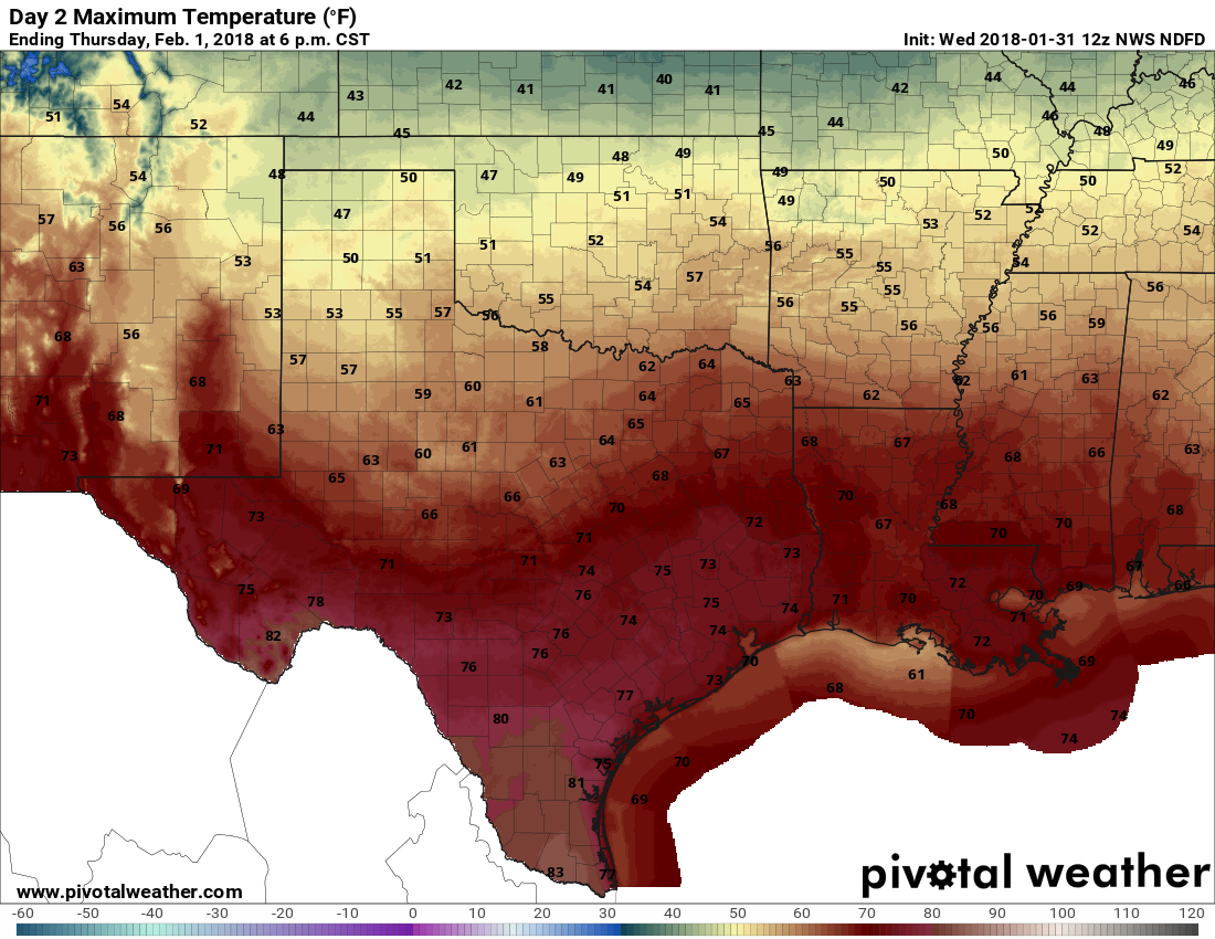
Southerly winds have returned to Houston, and this will allow temperatures to climb today to about 70 degrees under partly to mostly sunny skies. All in all, it should be a fairly pleasant day for the region, with temperatures tonight 10 to 15 degrees warmer than Tuesday night.
Thursday
Thursday will be even warmer, with highs in the mid-70s as southerly winds draw in warmth to the region. Some scattered, light showers are possible during the afternoon, evening, and overnight hours as a cool front approaches the area, and moves through. It should be off the coast before sunrise on Friday.
Friday
A much cooler day, with mostly cloudy skies and highs generally in the upper 50s. Winds will be out of the north, but I don’t think they’ll be too gusty like they are after some cold fronts we get. Lows Friday night should fall into the 40s for most of the region.

Saturday
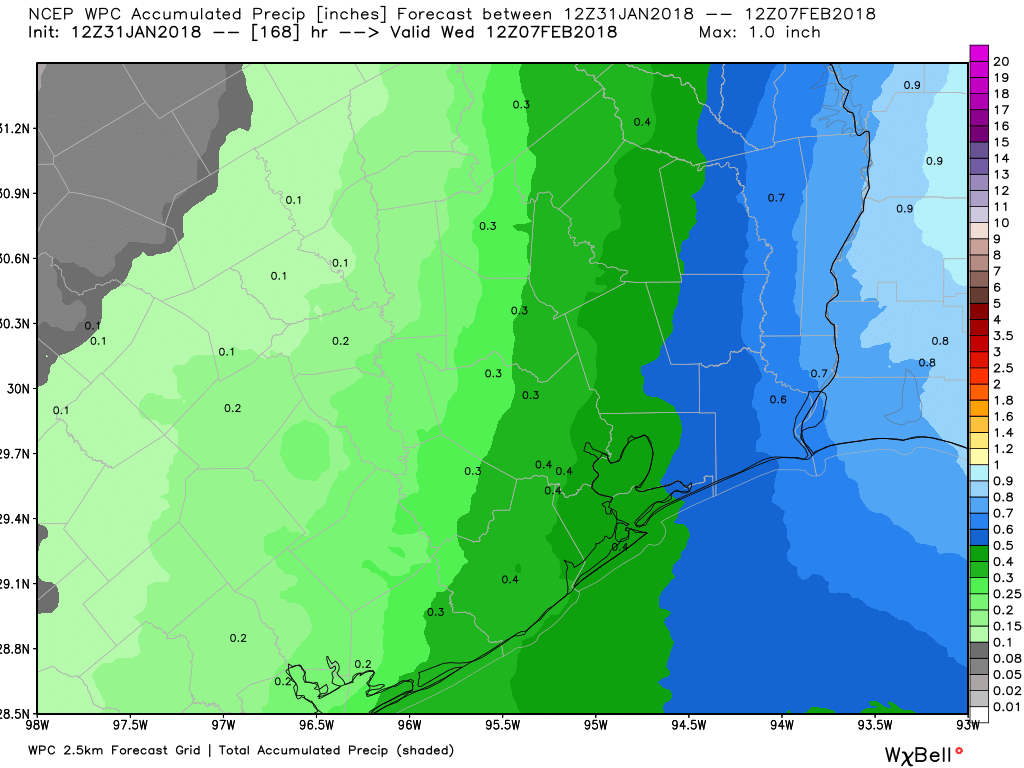
The aforementioned cold front won’t move too far into the Gulf of Mexico, and beginning on Friday night it should come dragging back toward the Texas coast. The combination of moisture with the front moving back toward the coast, an upper-level low pressure system, and lift from the surface front will make for a healthy chance of showers on Saturday, especially along the coast (sorry Mardi Gras revelers) and to the east of the region. The western half of Houston probably can expect a tenth or two of an inch of rain, whereas the eastern half should see a few tenths—with potentially more rain embedded in some heavier showers. Highs Saturday will probably be around 60 for inland areas, and warmer along the coast.
Sunday and beyond
At some point Sunday a front will move through, and bring rain chances to a definitive end for a few days. I’m betting that’s earlier than later at this point, which would leave us with a partly to mostly sunny second half of Sunday. This will kind of be like last weekend, where the best time to be outside came on Sunday afternoon. Look for temperatures in the mid- to upper-60s.
Most of next week should see highs in the mid-60s, although there’s some split in the forecast models as to how much (if any) rain comes along. We’ll have to parse those details later.
Thanks for what you do. I have your site on my home screen and prefer it to others. Keep up the good work. 👍
Eric:
I have seen this post about potential freezing weather on February 7-8 circulating around. Based on your post it doesn’t sound like you are too concerned at this point although I understand it is still early. Any thoughts on what this post is saying:
https://www.facebook.com/alan.lammey/posts/1719426601430604?pnref=story
Eric, any info on the potential for a strong polar front freezing Houston near the end of the first week of February? I have seen rumblings of this elsewhere. Thanks.
Eric!
Thanks for the update! We live in the heights area, and was planning to do an indoor/outdoor housewarming party at home since 2 months ago. How bad will the rain be for Saturday in heights near I45N area (77009)?
Want to know if we should postpone this because of the high chance of rain. Thanks!
There will be a healthy chance of rain on Saturday, although accumulations in your area should only be measured in a few tenths of an inch for the whole day/night.