Well, we hope everyone got some sleep last night. For parts of the area, it was quite the noisy evening. Here’s the rainfall since yesterday evening:
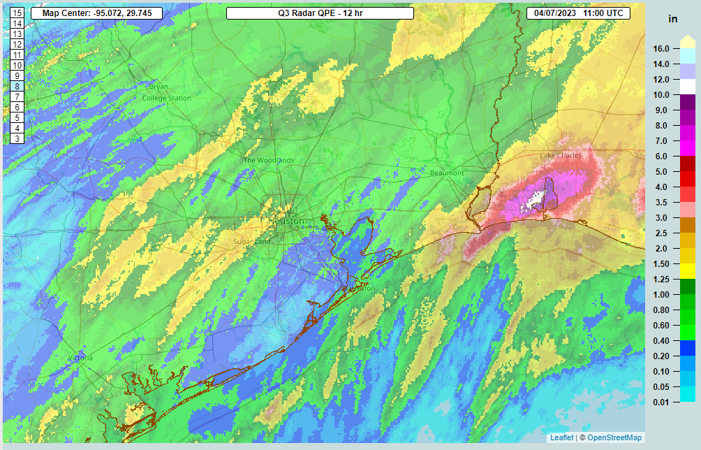
Rain totals since yesterday evening have been certainly manageable by Houston standards with the main issue being minor street flooding and/or ponding. The heaviest rain fell from near Memorial Park through Alief into Sugar Land, with about 2 inches, give or take. Galveston received around an inch of rain, but it’s also been quite breezy there, with winds gusting as high as 49 mph (before 2 AM). We fortunately missed out on extreme rainfall yesterday and overnight. That hit just south of Lake Charles, where as much as 8 to 10 inches of rain fell.
Today starts the transition out of this wetter pattern, setting up a cloudy but overall fair Easter weekend.
Friday
We think the worst of the rain is over for Houston. However, that doesn’t mean all the rain is over. Expect off and on showers, drizzle, or light rain today across the area. Our higher resolution modeling is trying to fire back up a period of slightly heavier rain and storms later today to the west of Houston. So I would not be shocked to see one more round of perhaps some moderate to heavy rain and thunder later today or this evening.
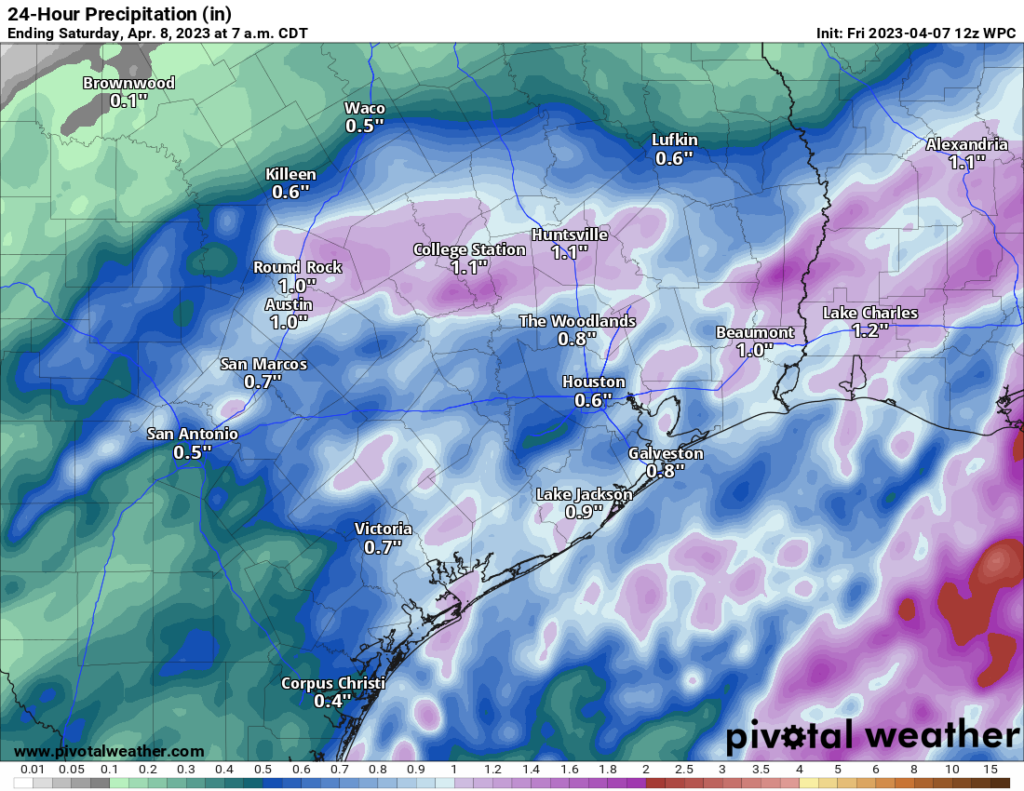
With all that said, we will discontinue the Stage 1 flood alert. We do think some minor ponding is still possible, especially in areas that have seen a good bit of rain since Wednesday, but for the most part, we should be able to manage what’s left to come without too much trouble. As always, use care with the wet roads.
Outside of rain, today looks cloudy and cool. Temperatures will warm only a bit from where they’re currently sitting (50s from Houston N & W, 60s S & E of Houston).
Saturday & Sunday
We can’t completely rule out rain tomorrow, but at this point it looks like any chances will be mostly in the morning and mostly minor in nature. Expect a good deal of clouds for Saturday, with morning lows in the 50s, warming into the low-70s.
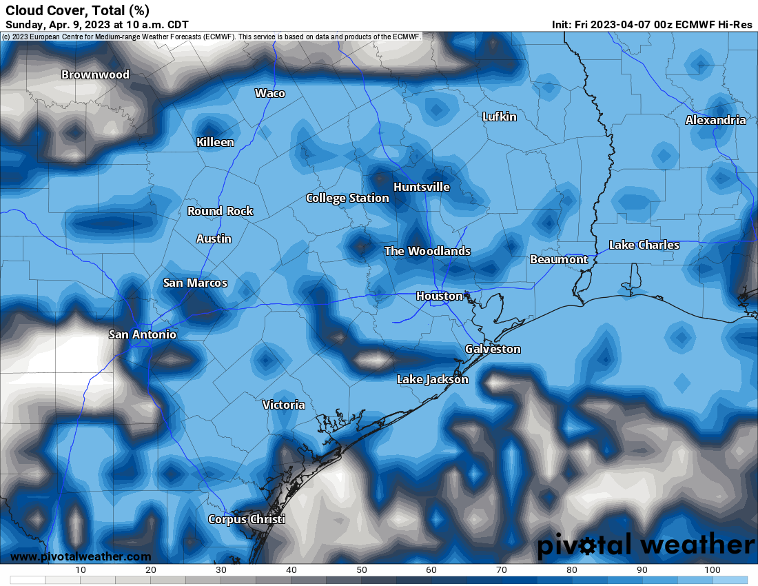
The biggest problem this weekend will be cloud cover. We are going to have a lot of low level moisture “trapped” under an inversion (or “cap”) in the atmosphere. In addition, we’re going to have middle and high level clouds overhead too. On Sunday, we lose those higher clouds, so hopefully the sun will scour out some of the low clouds during the late morning or afternoon.
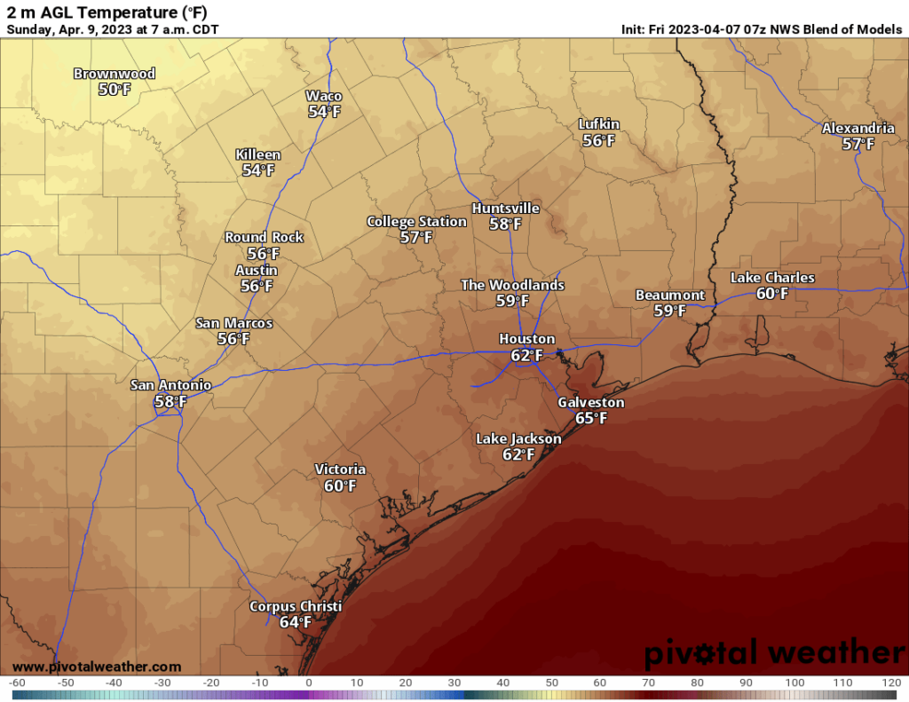
So, for Easter Sunday, expect morning clouds giving way to some afternoon sunshine. We’ll have morning lows, as seen above, generally in the 50s to low-60s. The afternoon will depend on sunshine, but we will call it mid-70s on average for now. Rain chances won’t be quite zero, but they are low.
Monday & Tuesday
For Monday, we may be able to squeeze out a few showers in the area, but skies will be partly sunny for the most part. Morning lows will be near 60, with highs in the mid-70s once more. Tuesday looks very similar, so we’ll simply copy and paste Monday’s forecast for now, but we may need to downgrade Tuesday a bit when we get closer.
Mid to late next week
The rest of next week looks pretty decent here in Houston. I would suspect we see increasing sunshine and also increasing temperatures, along with slowly increasing humidity. Look for highs in the 80s and lows in the 60s by the end of the week. We may want to watch for slightly higher shower chances Wednesday, but overall it looks fine right now.
One item of curiosity: The Gulf of Mexico may see some shenanigans next week. While we aren’t looking at anything serious, and we are not looking at anything in Texas right now, we may be looking at “a thing.”
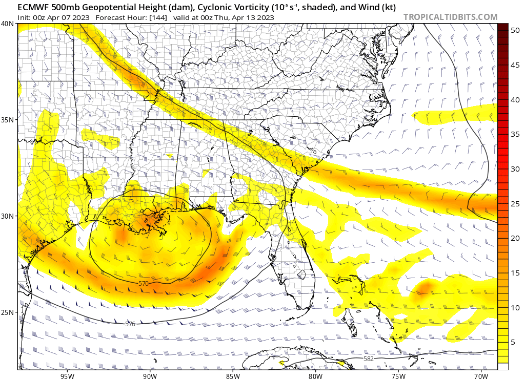
Models have been pretty consistent in some type of surface low pressure developing under an upper level low pressure system in the north-central Gulf and slowly working inland between New Orleans and Panama City, FL. It’s not tropical in nature, as other meteorological processes are driving this, but it could bring some rain and modestly gusty winds to parts of the Gulf Coast well east of our area later next week. There has never been a tropical storm that has formed in the Gulf in April that we know of, and frankly, this system is probably too close to the coast to have enough time to pull that transition and feat off. Still, if you are planning a trip to the eastern Gulf Coast next week, keep tabs on the forecast and maybe prepare for some less than desirable beach weather.


Meso-low packed a bit of punch last night and early this morning.
8” in the Lake Conroe area as well….
Don’t worry, Eyewitless News has deployed their mobile units this morning to catch the first drop of rain falling in Houston on video thereby keeping your family safe.
Not much activity here (Ellington) last evening, and only 1/4″ in the rain gauge. Send more, we need it.
Is there anywhere that we can see 12- or 24-hour radar tracks? For instance, the path of last night’s storms seen on radar? My husband and I are both subscribers and weather geeks.
Try this: https://www.ncei.noaa.gov/maps/radar/ It may work for your purposes!
I love to see “shenanigans” used well.
I am unsure how to report this. There is a post with unauthorized sales on your FB post of 23 December 2022. FB will not let me tag you, or report it directly to you from there.