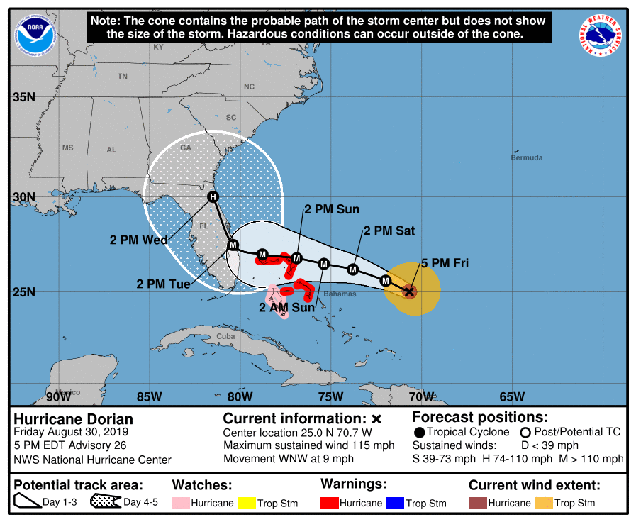
In Thursday afternoon’s post on Hurricane Dorian, we called attention to the high uncertainty in the track for the storm—and that remains the case this afternoon. Before discussing this, let’s just note that Dorian has reached Category-3 status, and will likely be a major hurricane at a Category 3, 4, or potentially even 5 level as it approaches Florida on Monday.
The problem for trying to determine where Dorian goes is that steering currents fall apart over the weekend, and so Dorian’s forward speed is likely to slow to a few miles per hour. This means that it could stall, or wobble offshore, before finally getting pulled in some more definitive direction. At some point it will find the western edge of a high pressure system and get pulled north, but the big question is whether that happens 50 or 100 miles off the Florida coast, along the Florida coast, or inland. Here’s the official track forecast as of 4pm CT—they’re basically splitting the difference.
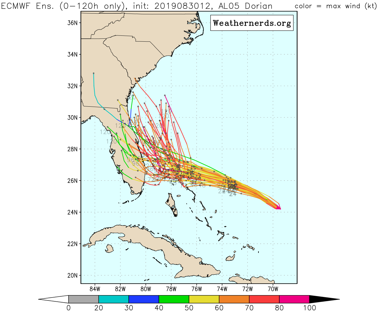
This afternoon’s ensemble output from the European model suggests that, more likely than not, Dorian’s center will remain off the Florida coast. But we will want to see this model trend continue for another 12- to 24-hours before having too much confidence in such an outcome. Nevertheless, what we are seeing now is a good trend.
In terms of impacts, obviously it’s much better if the storm stays offshore. But unfortunately, given all of the uncertainty, most of the Florida peninsula, as well as Georgia and the Carolinas need to be prepared for the possibility of high winds and heavy rainfall early next week. Hopefully as the track gets better defined, we’ll be able to clear some areas of significant threats.

Will you provide updates, even though it’s not a threat to Texas, this weekend until Dorian makes landfall?
In the first diagram with the cone, what do the letters M and H stand for along side the time of day?
Thanks for the updates on this hurricane.
“H” means hurricane (category 1 or category 2–winds 74-110 mph); “M” means major hurricane (winds exceeding 111mph)
Look at the box on the lower right side of diagram. It lists the different wind speeds with an S, M, or H depending on the wind speed.
M= major hurricane
H= hurricane
S= tropical storm
D= tropical depression
Looks to me like the cone of uncertainty for days 4 and 5 has gotten even larger than it was earlier today. Let’s hope for the best. The GFS also has Dorian skirting the Florida coast:
https://www.tropicaltidbits.com/analysis/models/?model=gfs®ion=us&pkg=mslp_pcpn_frzn&runtime=2019083018&fh=108
Eric…very insightful info…thanks for taking the time to provide what you guys see and expect backed by data and your experience…I know lots of folks and have interest on the space coast I’m concerned about…
Again, thanks for the Dorian updates. Late Friday night predictions seem a bit encouraging for those of us with loved ones on the east side of Florida.
Thank you for no hype updates. I’m from Brevard county where it has a high possibility to hit and my son drove home to Houston from college in Melbourne Florida yesterday just in case. I hope it steers clear and this is just a long fun weekend for him. 🙂 Thanks again!!!
You batteling troughs explanation is the exact opposite of Florence hurricane stationary place over North Carolina
A compare contrast of these last two storms is called for.
Florence over North Carolina low water temps could not support this cane.