Summary: We are hoisting a Stage 1 flood alert for areas northwest of Houston that should see heavy rain later today. Street flooding is a good bet in those areas. Houston and points south and east will see substantially less rainfall. Things quiet down and cool down tomorrow.
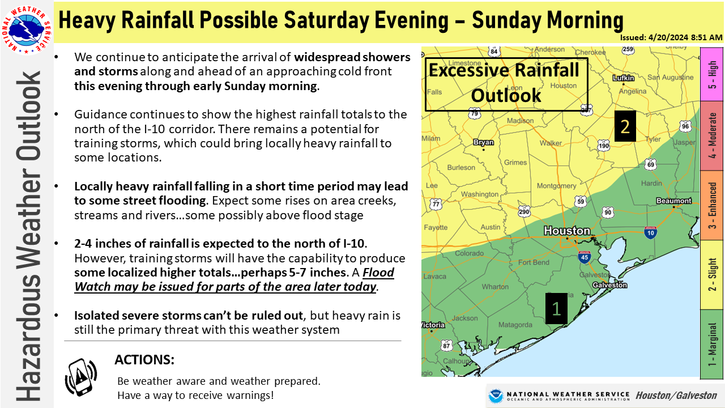
Good morning! We covered the forecast mostly fine yesterday, but now that things are in focus, we can fine tune some details for you for today. First off, we are going to issue a Stage 1 flood alert on our Flood Scale for areas northwest of Houston. This means that we expect street flooding in spots, and it’s possible that we see some decent rises on some of the creeks or rivers in those areas. We could see enough rain to impact the Spring or Cypress Creek watersheds, among some others with rises or minor flooding. Also, the larger river systems north or northwest of Houston (Brazos, San Jacinto, Trinity) could see some decent rises.
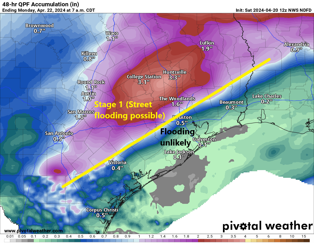
Unique about this particular setup: Areas south and east of Houston may see minimal rainfall. Some places may even see no rain at all.
Here are a few more notes about this event.
Timing: There are already a few showers south of Victoria moving toward Matagorda, and through early afternoon a handful of isolated showers are possible. Most folks will be fine though. Between about 2 and 6 PM, we expect more isolated showers or storms anywhere in the area, eventually focusing northwest of Houston by evening in the areas of concern noted above. If you’re attending the Dynamo game this evening, I’m not too worried, but don’t be entirely shocked if it rains a bit or there is a brief lightning delay at some point. The worst rains north and west of Houston will be from about 6 PM through midnight, with everything eventually getting pushed east overnight and out of the area by morning. Some clouds or light rain will be possible Sunday morning.
Rain totals: You can see the forecast above, but there are risks. Houston and points south and east will see an inch or less, probably less than a half-inch in most spots. As you progress north and west from Downtown Houston, we should quickly see totals of 1 to 3 inches. In extreme northwest Harris County, Montgomery County, portions of Waller County, and north of there, expect 2 to 4 inches. A few locations in those areas will likely see 4 to 7 inches of rain, if not a bit more. This is where we are most concerned with flooding.
Again, there will likely be a sharp cutoff between 1 to 2 inch rains and minimal rain somewhere in the Houston area.
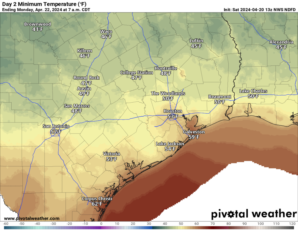
And Sunday? Cooler! Look for breezy conditions and temperatures stuck in the 60s for most of tomorrow. Some light rain or a few showers may linger in the morning, with gradual PM clearing. Overnight lows into Monday morning still look to be in the 40s and 50s.
Should anything serious change, we’ll update you later. Otherwise, just stay safe and make sure you stay weather aware, especially northwest of Houston later today.

is high wind expected with any of these storms?
According to the Weather Channel, winds will be 10 to 20 mph for Houston.
Those numbers could change depending what part of the city your in btw
Hopefully the Pecan Grove bubble will burst and we will get some hard rain.
Sunday temperatures “stuck in the 60’s” is sweet music to my ears
Out of curiosity, what’s creating this wall that is going to mean those of us closer to the coast are going to see so little rain from this system?
Same question!! Unusually it’s not addressed here. Please do tell!!
Wondering the same thing. I did notice on the model forecasts a pocket of 850 mb level warm dry air moving up across the gulf into our area right as the cold front moves through, so maybe that is producing a capping inversion as it reaches the coast and hits the cold front, causing the storms to dissipate?
As far as the areas to see heavier rains , where would the Kingwood area fall in terms of storms/heavy rains?
I’m in Kingwood too, Stephani. We’re right on that yellow line in the precip map, so it’s a bit of a coin flip regarding flooding. That said, my neighborhood (and much of Kingwood) tends to flood easily.
Is there a possibility of hail?
Space City Weather and the Weather Channel does not mention any hail.
I think NOAA mentions a marginal risk of severe weather including hail. A very low risk.
these guys never get it right, at the end of the day you will see no rain.
You mean just like the post literally says?
Wrong Robert…we got a nice downpour in The Woodlands. Everything is nice and lush now!
Then why are you reading their posts?
Disappointed again. I long the days when it use to rain at least an inch once a week all year. That was so long ago I hardly recall. I watched all that red on the radar around Dallas with envy.
As cool front comes through Friendswood at 11pm we saw what looked and felt like snow!!!??? Floating, not falling like raindrops or sleet, but surely moist and cold on skin. Is that even possible?