Almost summer-like conditions today, rain possible Friday, still gorgeous after

Good morning. It’s quite muggy out there again today, and don’t look for any relief until tonight.

TODAY

Who is ready for temperatures in the upper 80s? That’s going to be possible today with a strong southerly flow ahead of a cold front. We should see partly cloudy skies and a chance of scattered showers ahead of the front, which should reach Houston sometime around sunset, or shortly after. But it will be well after sunset before we see much cooler air.
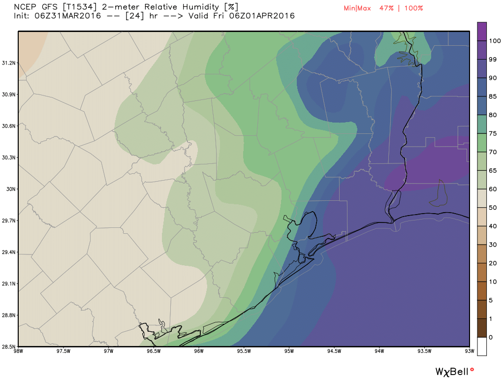
Relative humidity forecast for midnight tonight shows the approximate position of the cold front at midnight. (Weather Bell)

See full post

Warm, muggy, and icky—but what a weekend after this mess

It’s a pretty blah morning across the region as mist and light showers and muggy air hang over the region. And that’s just how it’s going to be.

TODAY

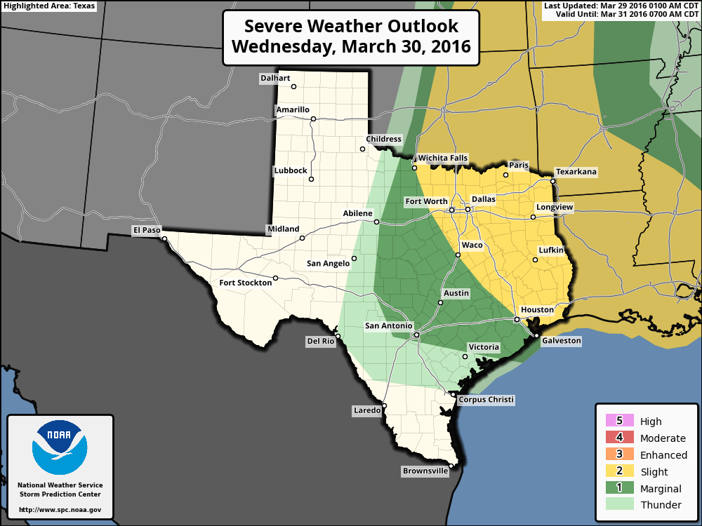
An upper level storm system will move into Texas today, bringing with it a chance of severe weather. Right now the most favorable area of hail and damaging winds is well to the north of Houston, but we can probably still expect to see a few thunderstorms in the metro area during this afternoon and early evening hours. Otherwise we’ll continue to see warm (about 80 degrees) and misty conditions.

Area of severe storm probabilities later today. (NOAA)

See full post

Storms possible Wednesday before a gorgeous weekend

Good morning. Lows have only fallen into the 60s this morning, and with moisture returning from the Gulf of Mexico we are setting up for the possibility of rain showers for the next few days.

TODAY

With moisture comes clouds, so we’ll see mostly cloudy conditions today, and likely only scattered rain. Highs will climb into the mid- to upper-70s.

WEDNESDAY

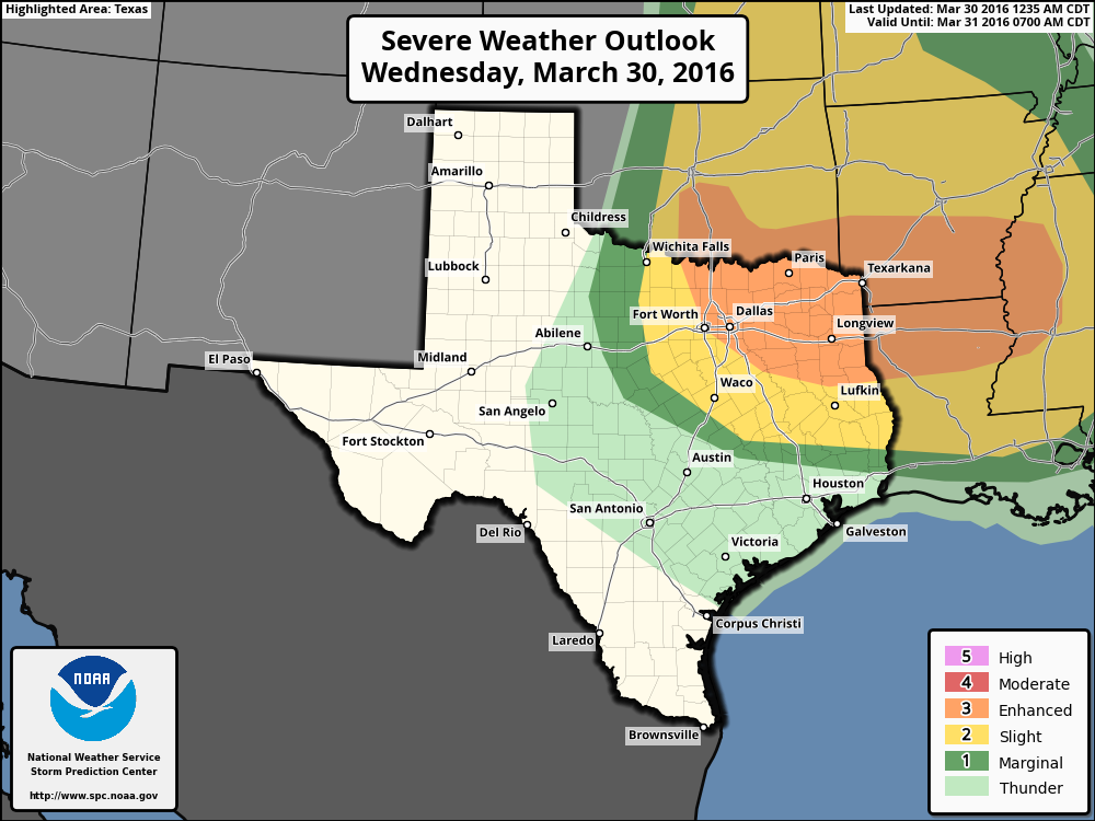
The arrival of an upper-level system on Wednesday could bring more severe weather. The concern isn’t so much heavy rain, as I don’t think most areas will get more than a few tenths of an inch of rain, if that. However there will be enough energy to produce some strong thunderstorms, and Houston has been placed into a “slight” chance of severe weather by NOAA’s Storm Prediction Center. Conditions for storms will likely be most favorable during the afternoon and early evening hours. Highs will be near 80 degrees.

Storm outlook for Wednesday. (NOAA)

See full post

Gorgeous today, but storms are possible later this week

It took awhile last night, but cooler air finally did move into the Houston metro area, and temperatures have fallen to around 50 degrees this morning across most of the city.

TODAY

As expected, today will be gorgeous, with highs in the low 70s, lots of sunshine and dry air. Too bad it’s Monday!

TUESDAY

We’ll begin to see the return of Gulf moisture late on Monday, and that will lead to the possibility of some scattered showers on Tuesday afternoon. This will also bring daytime temperatures back to around 80 degrees. I’ll also be watching the approach of a low pressure system in the upper levels of the atmosphere now located near Washington state (see map below). This will have the potential to cause some problems on Wednesday.

A storm system now over the Pacific Northwest could track toward Texas by the middle of the week. (Weather Bell)

See full post