Sizing up Houston’s tax day floods—all hail our reservoirs

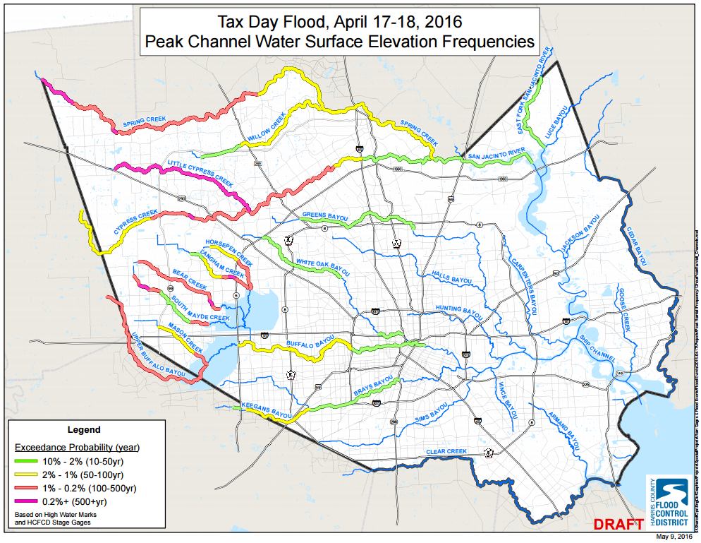
The Harris County Flood Control District (HCFCD) has released their second report on the Tax Day Flood event last month. There isn’t anything shockingly new in this report, but it is an interesting read and brings the historic event into greater focus. I’ve scoured it and pulled a few interesting nuggets and images. (Note: For larger versions of the images just click on them.)

Large stretches of Western Harris County creeks and bayous saw 100 to 500 year flood levels exceeded. (HCFCD)

See full post

Muggier now for Houston, but the weekend looks pretty nice

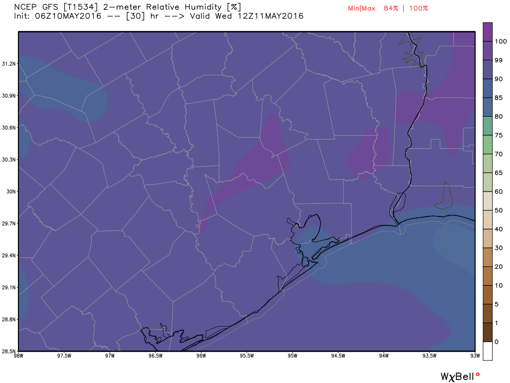
Good morning. It’s a muggy start to the morning, with near 100 percent humidity across much of the area this morning and low temperatures in the low 70s.

TODAY and WEDNESDAY

Although there’s some moisture in the atmosphere, a capping inversion should preclude any shower activity over the Houston metro area. We’re going to see partly sunny skies, and temperatures for both today and Wednesday will likely rise into the mid- to upper 80s. Probably the most defining feature of the day will be winds. Although we won’t see the extreme gusts we saw Monday morning in parts of Houston, we should see gusts above 15 to 20mph on both days.

Like on Tuesday morning, we'll see relative humidity on Wednesday morning in the 99 to 100 percent range. (Weather Bell)
Like on Tuesday morning, we’ll see relative humidity on Wednesday morning in the 99 to 100 percent range. (Weather Bell)

See full post

This week Houston will begin transitioning to summer

After a nearly perfect week of weather, we’re now at the point where Houston is going to transition into summer. For most of this week we’ll see lows fall only into the low 70s, and fairly strong southeasterly winds. Hello, humidity.

TODAY

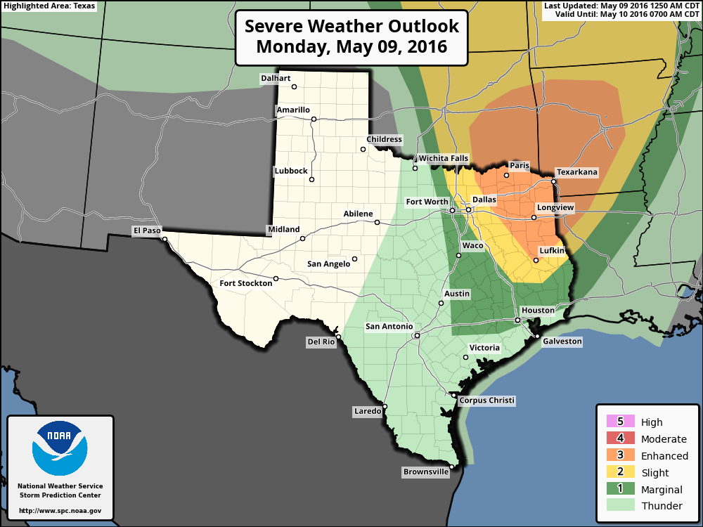
An area of mostly light rain is moving through Houston this morning and the other noticeable thing is that overnight lows have gotten quite muggy, falling only into the low 70s. The light rain should end during the next couple of hours. Later today an upper-level system will move across northern and east Texas. By this afternoon and evening this could bring some showers and thunderstorms into Houston, especially to the north of the city. Severe weather chances will be greatest in the Texarkana area.

Severe weather outlook for Monday. (NOAA)

See full post

A few more pleasant days before “almost summer” arrives next week in Houston

It’s another beautiful morning across the Houston area, with lows in the upper 50s across the northern half of the city, and the low 60s closer to the coast. But these temperate spring days won’t last as summer looms.

TODAY 

Lots of sunshine with highs in the low 80s. By late tonight we will probably see winds begin to swing back around, and come out of the Gulf of Mexico, heralding the eventual return of moisture.

SATURDAY

A little bit warmer to start the day thatn Friday, in the low- to mid-60s across the city. But still nice, with mostly sunny skies and highs in the low 80s. A few clouds are possible.

SUNDAY

That southerly breeze continues to pick up, with gusts to about 20 mph. Under partly sunny skies we’ll see temperatures in the low 80s. Some slight rain chances, but I’d bet against it for almost everyone.

See full post