Two days, two immense Texas storms

Reminder: Braniff Davis, who is finishing a master’s degree in meteorology from San Jose State University, has joined Space City Weather as a contributor. He will be moving to Houston soon, and he will help explain the why’s of Houston’s weather, and will also be tracking air quality and related issues for the site. Please welcome him and feel free to give him a follow on Twitter!

While people inside the loop didn’t get to experience Thursday’s deluge, it was truly unprecedented–especially for the weather station in Brenham, which measured an astounding 16.62 inches of rain:

(Courtesy NWS Houston/Galveston)

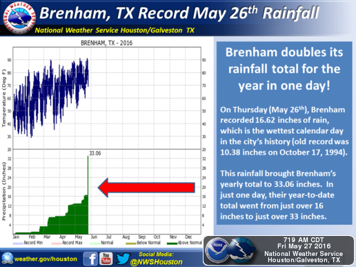
To give you an idea of how much rain that is, consider this: since July 1, 2015, San Jose State University, where I currently work, has recorded 16.02 inches of rain–in an El Niño year!

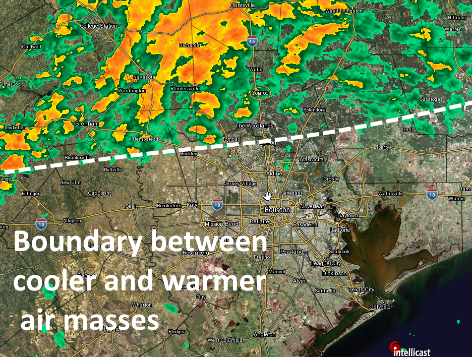
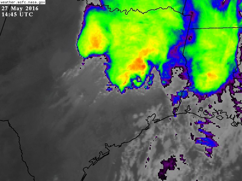
Fast forward 24 hours later, and the region felt like Bill Murray in Groundhog Day. Another system, though faster moving and not as intense, flooded the northern metro region once again on Friday. What caused these intense, long-lasting storms?


MESOSCALE CONVECTIVE SYSTEMS

The region experienced so much rain thanks to what’s called a backbuilding mesoscale convective system. Below is a GOES-13 satellite infrared video of Thursday’s system, from Dan Lindsey:

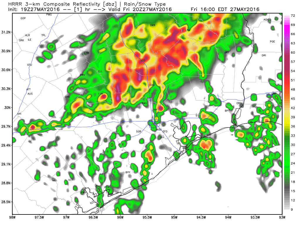
Let’s break down the science behind these massive storm systems. A mesoscale convective system (MCS) is a large, organized, slow moving group of thunderstorms. These storms are largely seasonal–for Texas, most MCS events occur in May & June. Inside the MCS, several thunderstorms are developing and dissipating at the same time. Tropical, moist air, moving northward from the Gulf in a low-level jet stream, provides the energy the system needs to survive and persist for several hours. Eventually, the system dies down, usually overnight–but it can leave behind moisture and atmospheric vorticity (essentially areas of “spin” in the atmosphere), which can actually cause future thunderstorm outbreaks if the atmosphere remains unstable. This is why, on Friday, another MCS flooded the region:

satgif3
Friday’s thunderstorms on satellite. (NASA)

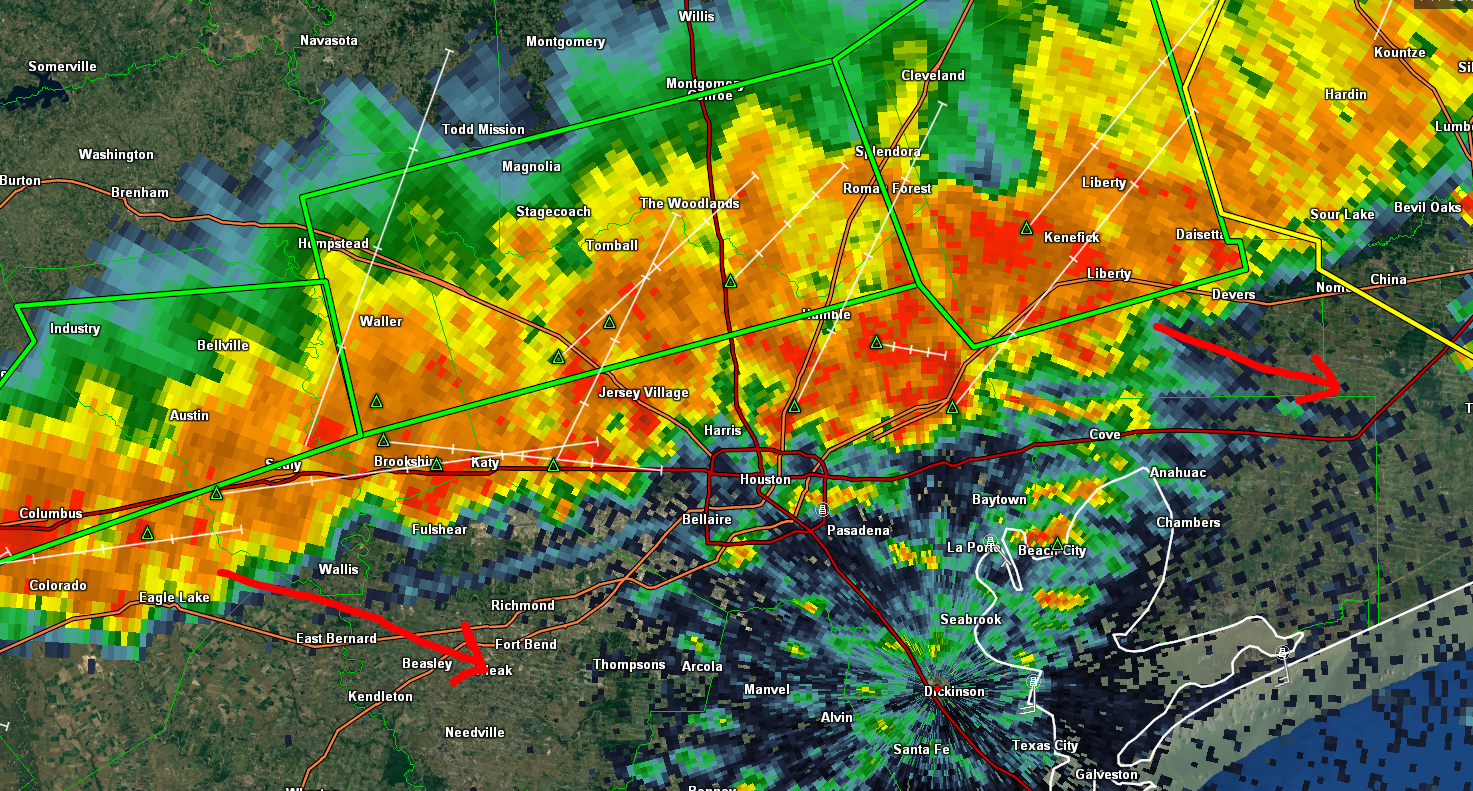
The backbuilding of the MCS development is the reason why these storms appear to stop moving, or move very slowly. Backbuilding occurs when thunderstorms begin to form behind other thunderstorms, upstream of the storm’s motion.  It is often caused by the outflow boundary, or gust front, providing the lift needed to create more convection. This also acts to slow the forward movement of the MCS. You can see this backbuilding in Thursday night’s radar loop:

May26radar
Radar loop for May 26, 2016 (UCAR)

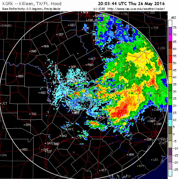
A line of thunderstorms continually builds “backwards” from east to west, between The Woodlands and Austin, creating the appearance of a stationary system. Compare this to the thunderstorm approaching from Kerrville (labeled ERV on the left side of the loop) in the more typical west to east pattern. This constant backbuilding leading to repeated rounds of thunderstorms causes “extreme” flash floods associated with MCS events.

In an eerie coincidence, one year ago this past week, the Memorial Day floods were caused by a larger, longer lasting, mesoscale convective system. As we are still in the midst of the MCS “season”, it’s a good idea to stay extra plugged into the forecast when thunderstorms are possible.

Ordering up a quieter Saturday

After back to back days of misery for many in the Houston area once again, we *may* finally have a quieter day (or more) to exhale here. Today looks drier and calmer. Unfortunately, we still have residual problems to discuss and more storms down the road. But for now, let’s revel in the goodness of dry weather. Read on for the latest.

See full post

Another Round of Severe Flooding North of Houston

I guess maybe this is round 3? 4? I’ve lost count. Either way, another slow moving, training area of heavy 1-2″ per hour rainfall continues north and west of Houston this afternoon. The radar as of 4 PM looks like this:

4 PM radar shows heavy rain and thunderstorms sliding south and east into Houston (GR Level 3).

For most of the afternoon, this has been slow to move. While it’s still crawling, the heaviest rainfall is actually showing signs of progress south and east. For those of you looking to get a jump start on getting out of town for Memorial Day Weekend, I suggest you hang tight. Heavy rain is arriving in Downtown Houston as I write this, and areas south and east of the city, largely spared this week, will see heavy rain and thunder as well this evening.

Up north, it’s a disaster in spots, with another 3-6″ falling in the Spring Creek Basin, including The Woodlands and surrounding areas. This has forced Spring Creek to near or above record levels at both FM 2978 and Highway 249, higher than Tax Day by one foot or more.

Afternoon rainfall through 4 PM. (Harris County Flood Control)

The rain should begin to taper off through early evening up that way thankfully. Heavy rains will march south and east, and if the latest HRRR model is to be believed, they’ll be offshore by late evening. Fingers crossed.

HRRR model forecast through evening shows rain finally, mercifully pushing offshore and ending. (Weather Bell)

We’ll have an update on the rest of the weekend in the morning (I’ll be active on Twitter through evening), but I think it can only get better from here. Be safe, be smart, never drive through flooded roadways, and take your time if you absolutely have to travel this evening around Southeast Texas.

Posted: 4:10 PM Friday by Matt Lanza

Storms firing up north of Houston again today, may sag southward

Most of the Houston area has remained shower-free this morning, but we’re becoming concerned about a boundary between warmer (to the south) and cooler air masses that has set up a bit to the north of Interstate 10 today. Its position at 11:45am CT is shown below.

Approximate position of boundary at 11:45am CT. (Intellicast)

We’ve seen storms form north of this boundary today, including over already hard-hit areas of southwestern Montgomery County, and this should continue. That’s because there’s an ample flow of moisture and warmth coming from the south-southwest which is helping to feed storm development. As the day progresses we could see this boundary sag further south, bringing some heavier storms into the central Houston metropolitan area.

There is a lot of uncertainty in the forecast, but even a few more inches of rain across northern Harris, southern Montgomery, Waller and Grimes county would prove very troubling. And the prospect of heavier rains moving southward into the central Harris County area later this afternoon to start off the Memorial Day weekend isn’t particularly appealing either. We’ll be keeping a close eye on developments for you.

Posted by Eric Berger at 11:55am CT on Friday