Wetter weather possible before a hot July 4th weekend

After a mostly hot and dry weekend (some areas, particularly west of Houston weren’t entirely dry, of course) we’re going to see a pattern change this week, with some better rain chances returning. And don’t begrudge the rain—we’ll need it for what’s ahead.

TODAY

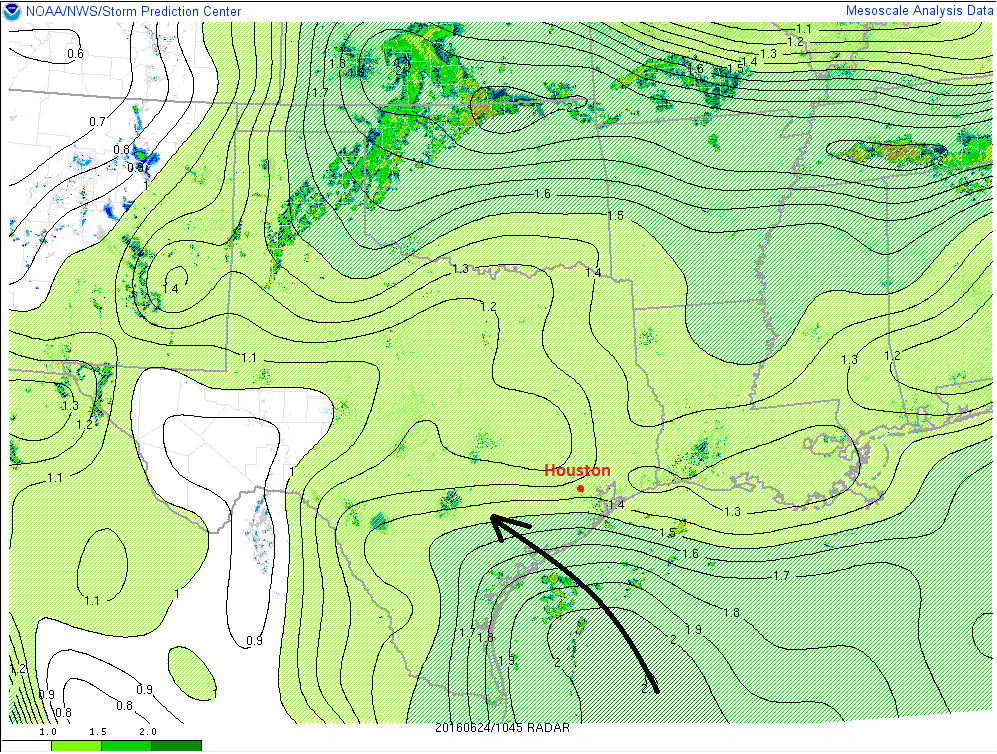
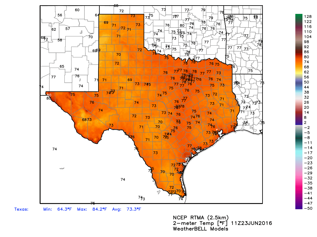
As high pressure to the northeast of Houston continues to move off we should see some slightly better rain chances today, especially when temperatures near their peak levels in the low 90s this afternoon. Some of these showers could be locally heavy, although probably brief. For parts of Houston that don’t see rain (likely a majority of the city) conditions will be pretty hot, with the heat index rising into the low 100s.

TUESDAY

On Tuesday most of the forecast models show a frontal boundary pushing into the Houston region. Now this isn’t going to bring significantly cooler air, but it will bring some instability that should lead to fairly widespread showers, and the potential for some locally heavy rain that might briefly flood some streets. But I’m not anticipating any widespread flooding problems because these storms should develop and then weaken pretty quickly. Highs will depend upon the amount of rain coverage. For most areas accumulations should be well under 1.0 inch.

NOAA rain accumulation forecast for now through Thursday. (Weather Bell)

See full post

The summer doldrums continue

Happy Friday, Houston! Summer may have taken a little time to kick off this year, but we’re definitely locked in the doldrums now, with what you would expect this time of year. Let’s jump into it.

TODAY

Looking at weather maps this morning, we see a pretty rich area of precipitable water (PWAT) approaching the Coastal Bend to our south. In English, that means there’s going to be gradually increasing amounts of moisture available for thunderstorms to pop up this afternoon.

Deeper moisture increasing along the Texas coast as of early this morning. (NOAA/SPC)

So while it has been mostly quiet the last couple days, I expect we’ll see just a few more pop-up storms this afternoon (perhaps this morning along the coast). The best chance for greater coverage of afternoon hit/miss storms will be west of I-45 and south of I-10. The further north and east you go, the slightly drier the air mass stays today, so that should keep pop-up storms to a minimum. High temperatures will remain hot, into the low 90s, with heat indices into the low 100s.

See full post

Typical summer-like pattern to reign over Houston for awhile

Good morning. It’s Thursday. So we’re edging closer to the weekend, Houston!

TODAY

Houston’s not directly under a ridge of high pressure today, but we’re close enough that any rain showers that do develop should be fairly isolated. For the most part we’re going to be hot, humid and sunny with highs in the low- to mid-90s. Heat index values may climb into the low 100s.

Texas is seeing typical summertime lows for late June this morning. (Weather Bell)

See full post

A few isolated showers, but mostly hot and humid until the weekend

Good morning. A few streamer showers are moving northward quickly through Houston this morning, but with high pressure building these rains should come to an end later this morning.

TODAY through FRIDAY

It’s not like the suffocating ridges of high pressure that Houston sometimes sees during the summer (thank goodness) but moderately high pressure should keep the region mostly dry, sunny and warm during the next three days. Look for high temperatures in the low- to mid-90s with only some isolated showers.

Houston will remain on the southern edge of high pressure over the next few days. (Weather Bell)

See full post