November-like weather coming to Houston for this weekend

Good morning. We’re going to see another day or so of moderate temperatures with fairly humid air before really dry, fall-like weather arrives in Houston. Then it’s going to be beautiful, November-like weather for awhile.

Election Day

A large upper-level disturbance moved into Texas on Monday night from Mexico, but the bulk of the storm activity related to this system this morning has developed over central parts of the state, and for the most part I expect any significant rains today to remain west and southwest of the Houston metro area. High temperatures should be in the mid-70s under mostly cloudy skies. Bottom line: Weather should not disrupt voting activity in Houston at all.

Wednesday

A cool front will move through Houston sometime tonight, and this will bring some drier air into the region, which will help cool down our nights and eventually make for some really fantastic weather. Highs on Wednesday should be in the mid-70s under mostly cloudy skies, with lows falling into the upper 50s for northern parts of the metro area, and the lower 60s for coastal regions.
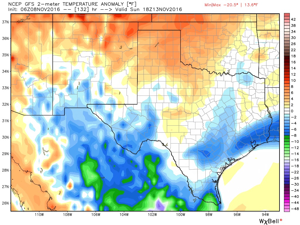
Temperatures will be near normal for most of the week, but by Sunday they could fall 4 to 6 degrees below normal. (Weather Bell)

See full post

Much needed rain arrives, cooler weather ahead—Oh my!

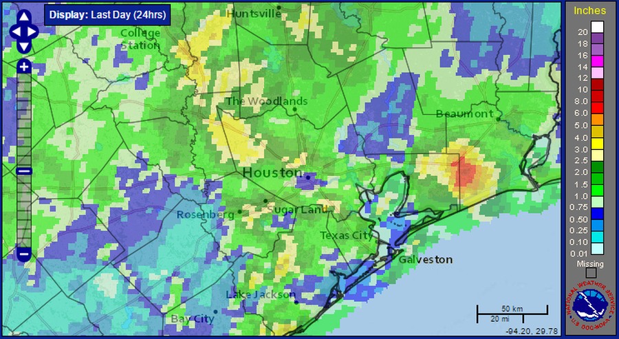
A solid mass of showers and embedded thunderstorms moved through the Houston area on Sunday evening and during the overnight hours, dropping 1 to 3 inches. Although the storms produced some brief street flooding, our dry soils mostly welcomed the rain. Here’s a graphic showing accumulations across the region:

Estimated rainfall accumulations from Sunday through Monday morning. (NOAA)

As these storms have pushed off to the east they have left a broad area of sinking air in their wake, which should limit the formation of additional rain showers at least this morning.

Today

The primary question today is whether an additional round of storms will move through Houston. While there is an area of disturbed weather over northern Mexico that will drift north today, I’m not convinced will see another bout of showers due to this sinking air left behind from the Sunday night system. In any case, if it does rain, we probably won’t see additional showers until later this afternoon or evening. Highs should be in the upper 70s under cloudy skies.

Tuesday and Wednesday

Houston won’t experience a classic cold front this week, but fairly persistent winds from the northeast at the surface should eventually bring some drier and cooler weather into the region. Highs on Tuesday and Wednesday should settle into the mid-70s, and overnight lows should fall back into the low 60s for most areas except the immediate coast. With more moist air above the surface we can’t rule out a few showers and thunderstorms developing, but I’m not expecting any well organized storm systems.

Your eyes do not deceive you, those are highs for Thursday. (National Weather Service)

See full post

Savor all the daylight you can this weekend

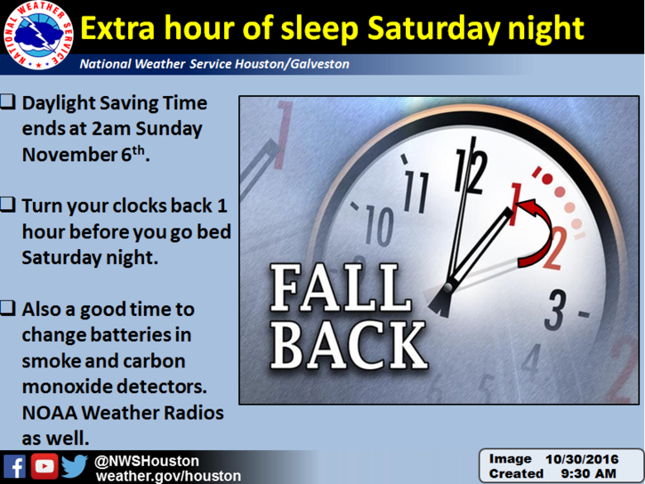
A friendly reminder from us at Space City Weather: This weekend marks the end of Daylight Saving Time. Importantly, we get an extra hour of sleep Saturday night. Hopefully you take full advantage of mostly nice weather Saturday to enjoy that extra hour.

Let the time honored tradition of complaining about it getting dark early begin! (NWS Houston)

Today

Today will mark the transition to a kinder, gentler air mass for early November. A weak cold front, though a front nonetheless, will sag south through the region today. It could very well set off a few showers or thunderstorms as it drops south, though nothing widespread is expected. Temperatures will peak in the mid 80s this afternoon. You may notice slightly lower humidity by evening, particularly if you live northeast of Houston.

See full post

More on Houston’s cooler future

Houston’s got some nicer weather coming for a few days this weekend before we get a little more unsettled next week. I want to go more in depth on the potential for a pattern change starting in mid-November, so there’s a pretty detailed section on that below. Let’s jump in.

Rest of Today

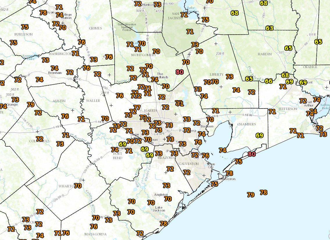
We’re starting off warm again this morning across the region. Galveston is likely to at least tie their record for warmest morning low for this date (74° in 2000).

Another extremely warm morning in Southeast Texas for November. (NOAA)

Expect a mild afternoon with high temps in the low 80s. Scattered showers on Monday focused west of I-45, and then yesterday, they focused mainly between Houston and Lake Charles. Today? There is an organized line of weakening thunderstorms southeast of Dallas this morning, but I don’t quite think those will make it here. Best chance for some steadier rain though would be northwest of a Conroe to Hempstead line this morning. The air over Southeast Texas is pretty stable, so while there will likely be some isolated to scattered showers and storms this afternoon, especially north or west of the city. I’m guessing most of us will stay dry, but your best bet today is to carry an umbrella as an insurance policy, knowing there’s probably a good chance you won’t need it.

See full post