Day one of heavy rainfall in Houston is unfortunately delivering

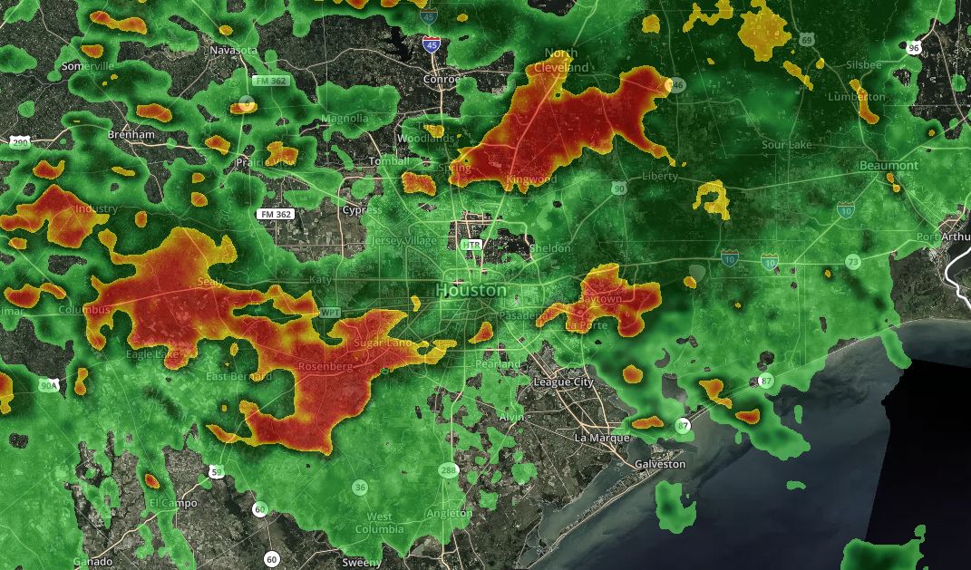
It’s been a day in Houston, with some very heavy rainfall across parts of the city. If you live in Kingwood, congratulations, so far you’re the big winner with about 6+ inches of rain. With lots of street flooding in the area, it’s a mess trying to get home this evening along I-59 north, as well as I-59 south toward Sugar Land.

Houston radar at 4:20pm CT is covered by slow-moving showers. (kktv.com)

Most of the high-resolution model forecasts indicate that the current widespread activity should die down this evening, by 6 to 9 pm, which should coincide with the loss of daytime heating. From that point on, we will hopefully see a reprieve from heavy rainfall during the overnight hours.

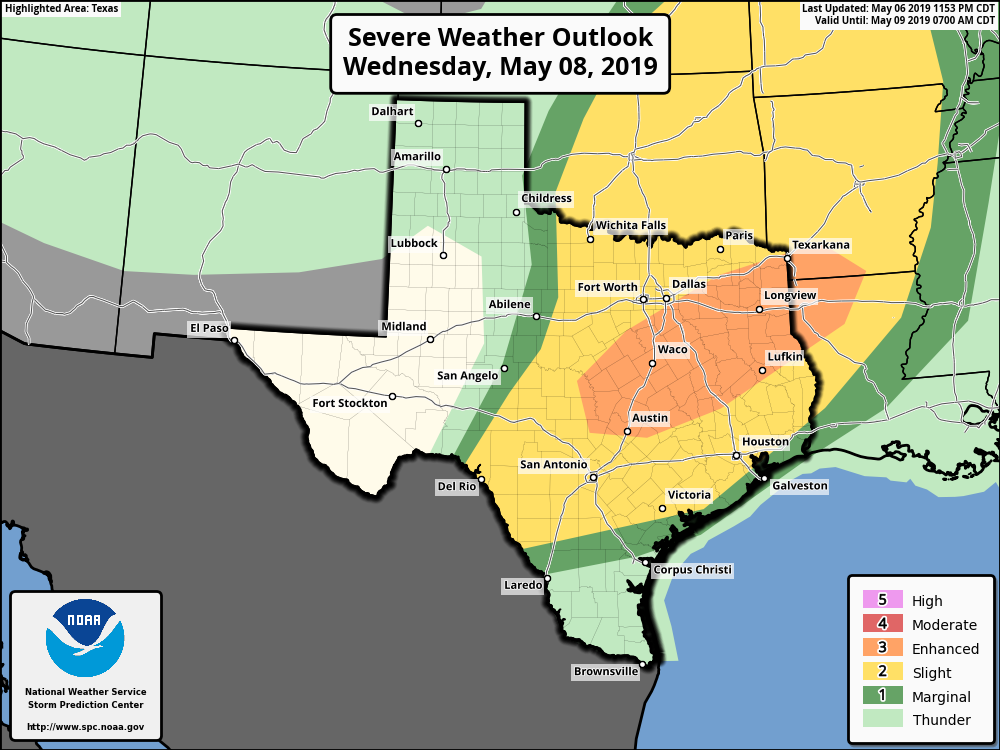
Wednesday is a bit of a crapshoot. There is a scenario, which I’d probably lean toward, that keeps most of the heavy rain away from Houston as a cold front remains north of the metro region—including away from Kingwood and surrounding areas hard hit on Tuesday. But frankly, given the intensity and widespread nature of the storms Tuesday I don’t have great confidence in the forecast for Wednesday. Hopefully the forecast is a bit more clear in the morning.

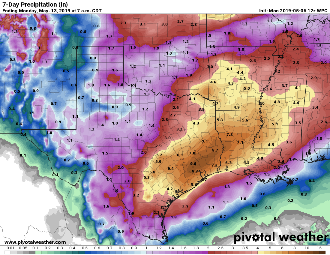
From now through Saturday it’s going to be a day-to-day thing.

Storms, heavy rain, coming to Houston over the next five days

The radar is mostly quiet this morning across the region, but that will soon change with the onset of showers and thunderstorms later today. From there on we will enter a very wet, and somewhat unpredictable period, during which rainfall should peak from Thursday evening through Saturday. Below, we do our best to assess this mess, and use our new flood scale for the first time.

Tuesday

Generally, we expect rain showers and thunderstorms to develop south and west of Houston this morning, and then migrate north of I-10 later today. But admittedly, that is just a guess. The high-resolution models we use to predict the development of these small-scale storm systems have been failing us of late, so we don’t have great confidence in these storms. Accumulations of 0.5 to 1.5 inches are possible for some areas today, while parts of the region are likely to see no rainfall at all. Highs will only reach about 80 degrees. Lighter rain will be possible Tuesday night, but most of the region should see a break.

Severe Weather Outlook for Wednesday. (NOAA)

Wednesday

The weather story for Wednesday will be the propagation of an upper-level system across northern Texas, which will drive the potential for severe weather over parts of Texas, including Austin, and East Texas (see map above). It remains to be seen how close these storms come to the Houston metro area, but Waller, Walker, and Montgomery counties could well see damaging winds and hail in addition to 1 to 2 inches of rainfall. Southern parts of the Houston region may not see too much rain Wednesday.

See full post

Introducing the Space City Weather Flood Scale

Ever since Hurricane Harvey, a lot of people living in and around Houston become nervous at the mention of widespread, heavy rainfall. The mere suggestion of even minor flooding heightens tension. And after surviving Harvey, we certainly understand why.

In the months after Harvey, Matt and I got together to try and determine what, if anything, we could do to help ameliorate this situation. Eventually, Matt hit upon the idea of a “flood scale” that residents of the greater Houston area could use to calibrate their concerns about upcoming flood events. Over time, the scale evolved into a rating from Flood Stage 1 (street flooding) through Flood Stage 5 (Hurricane Harvey). Here’s what we came up with:

Space City Weather Flood Scale.

This scale is not officially sanctioned by any government organization. Nor are we seeking to usurp any authority from the National Weather Service—they command our highest respect in issuing flood watches and warnings. Rather, we felt there was a need for something like this, in advance of significant weather, to help our readers set expectations and manage their own anxieties. So we’re providing the scale as such a service. It remains a work in progress.

In truth, there are many, many ingredients that will determine the impact of a flood: the total amount of rain, intensity of hourly rainfall rates, how long the rains last, the preexisting saturation of soils, the time of year, and more. This scale attempts to incorporate all of those factors into the ranking the impact of a flooding event. It is not perfect, nor purely quantifiable, but is does represent our best attempt to determine what residents can expect.

So why are we introducing this scale now? Because we anticipate needing it for the coming Thursday through Saturday period. Absent a major change in the forecast models, we’ll begin to use the flood scale beginning in Tuesday morning’s post. For what its worth, our overall thinking hasn’t changed, we continue to see the potential for 3 to 10 inches of rain through Sunday morning for the Houston region.

Yeah, we have concerns about heavy rainfall this week

After a stunning Sunday, the sunshine is mostly going to disappear for some time, and Houston faces a significantly wetter period in which we may have some flooding concerns. There is, frankly, not much confidence in any of the forecast models at this point, but all point to a period of on-and-off heavy rainfall due to a moist atmosphere and meandering fronts.

NOAA seven day rainfall forecast for Texas, through next Sunday. (Pivotal Weather)

The bottom line is that the region could see from 4 to 10 inches of rain—roughly speaking—over the next seven days, but it’s hard to pin down the best days and locations for accumulations at this time. On a day-to-day basis we may have concerns about street flooding. We also have concerns about the Trinity (which already will near major flood stage Wednesday near Liberty) and Brazos (already forecast to reach a minor flood stage Friday morning at Richmond) rivers, as these rains could add multiple inches of rains to those basis. Then, as the week wears on, our grounds may become increasingly saturated and vulnerable to heavy rainfall events that move past street flooding and into yards. Overall, this will be a week to pay attention to forecasts, and we’ll do our best to stay on top of what appears to be a dynamic situation. Please clap—I resisted saying it was a fluid situation.

Monday

We can have the most confidence in our weather for Monday. We’ll see a mix of sunshine and clouds today, and the additional sky cover should help to limit temperatures in the mid-80s. This is probably the last day, for a week or so, that we can definitively say it will not rain. Also, after drier air filtered into the region this weekend, an onshore flow today will begin to pump moisture back into Houston, setting the stage for wetter days ahead. Lows Monday night will fall into the lower 70s for most.

Tuesday

On Tuesday, a disturbance in the mid-levels of the atmosphere will bring a healthy chance of rainfall into the region, with most of the rains likely falling during the daytime hours. Rain accumulations across Houston will probably range from 0.25 to 2.0 inches, although some areas will undoubtedly see less, and some more. Our biggest concern is that some areas will see heavy rainfall during this time as the overall dynamics do not favor severe storms, for the most part.

See full post