Good morning. October has begun like September ended—hot. However there is now strong confidence in the arrival of a cold front early next week, probably Monday evening or night, that will bring substantially drier and cooler air into the region. We’ll discuss just how cool below.
Wednesday
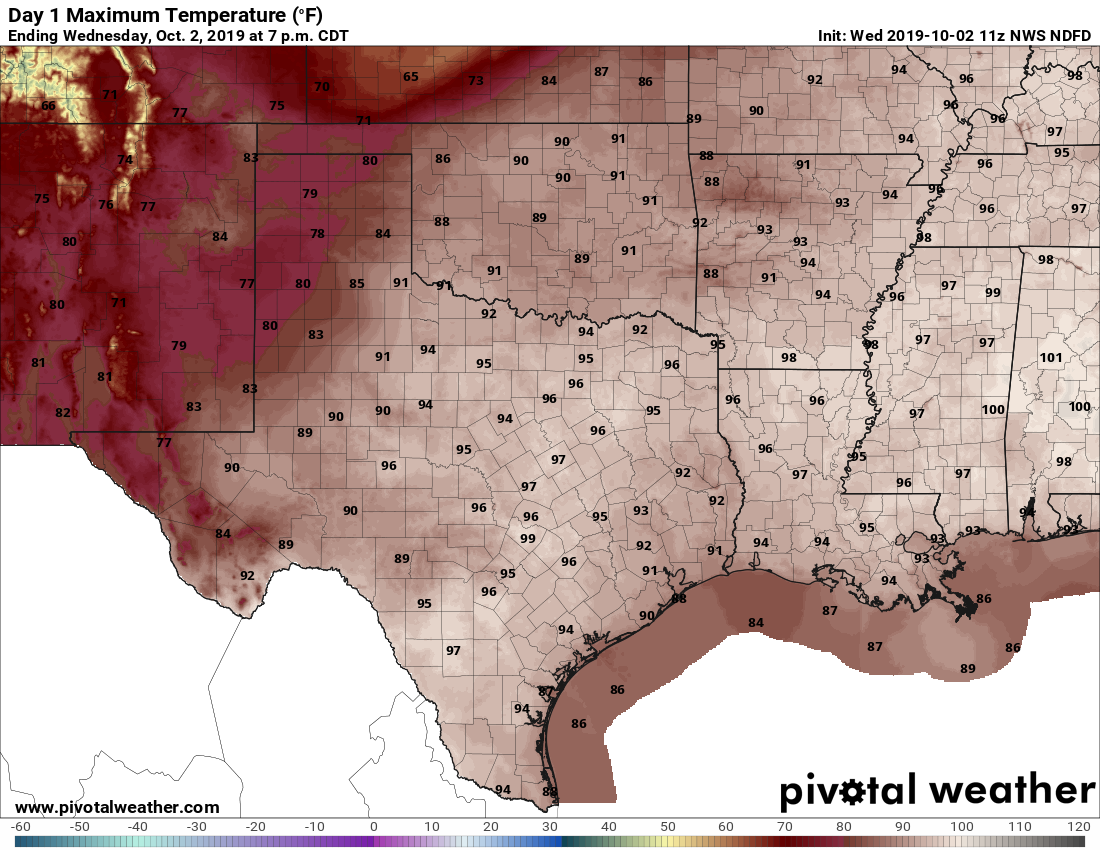
This will be another warm day for the region, with high temperatures generally in the low 90s to possibly mid-90s for far inland areas. With rising moisture levels, we will likely see some scattered shower development south of Interstate 10 before noon, which should migrate north during the afternoon hours. These storms should produce light to moderate rainfall, and keep moving. Skies otherwise will be mostly sunny.
Thursday
This should be another day like Wednesday, with mostly sunny skies and some scattered showers.
Friday
As high pressure backs off somewhat, temperatures on Friday should maybe hold at “only” about 90 degrees. Skies should remain mostly sunny, with rain chances of perhaps 10 to 20 percent.