Tropical Storm Isaias is bearing down on the Mid-Atlantic and Northeast today, and as that storm exits, we actually look to settle down into a period of calm for a bit in the tropics. All good things must come to an end however, and as we go into the back half of August, we will begin to refocus our attention on the entirety of the Atlantic basin. For now, let’s enjoy the respite.
Tropical outlook in a sentence
No meaningful tropical activity is expected over the next week, although conditions will likely begin to get more active by August 15th or so.
Isaias
Isaias experienced a bit of a renaissance last night, ramping up to a moderately strong category 1 hurricane as it made landfall near Ocean Isle Beach, NC.
3 days of #Isaias… from the Bahamas to Virginia, from hurricane to tropical storm to hurricane to tropical storm. It also became the *5th* named storm of the season to make US landfall already. https://t.co/O5tXQxhxEP@UMiamiRSMAS @capitalweather pic.twitter.com/mEoJGBcPYN
— Brian McNoldy (@BMcNoldy) August 4, 2020
Since last evening, Isaias has raced northward and been downgraded to a tropical storm. The center is over the Mid-Atlantic this morning, heading toward Upstate New York or western New England by evening. Along its path will be flooding rains, strong winds, and some tornadoes still to come for places including Philadelphia and New York City.
Behind Isaias
 In the Atlantic, we actually have no real disturbances of note behind Isaias. Yes, there is the disturbance dubbed Invest 94L, which is a few hundred miles southwest of Bermuda this morning. That one is unlikely to do much and is certainly not a threat to the U.S. There may be a tropical wave that emerges in the Bay of Campeche this weekend, but that is not expected to develop at this time as it likely moves into Mexico.
Meanwhile, off Africa, we are seeing some waves push across the continent and off the coast that look pretty robust.
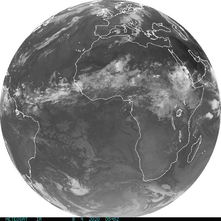
None of these are expected to develop, but it’s not entirely out of the question that something could develop. Either way, anything emerging off Africa today would be at least 10 to 14 days away from us here, so we couldn’t tell you anything with any specificity anyway. That said, at least for the next week or so, none of these waves appears to be a serious candidate for any kind of meaningful development.