After a much needed wet spell, Houston returns to sunny skies for awhile

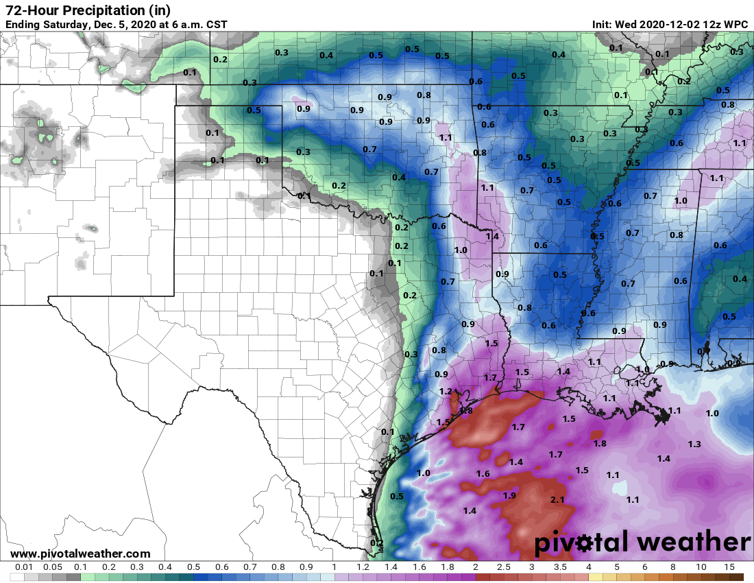
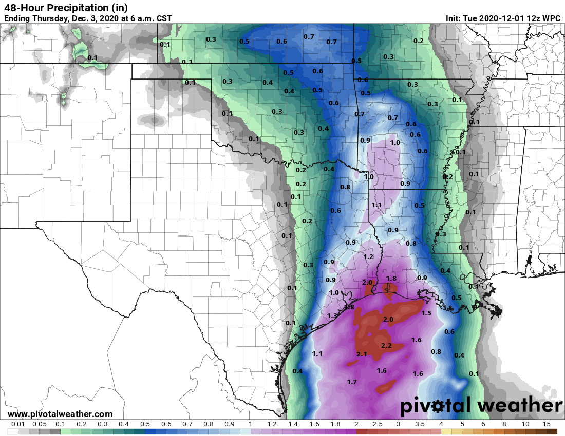
A cold front has pushed through Houston, and the region will now see a period of sustained cooler weather and drier air. The front’s arrival was preceded by fairly widespread showers on Wednesday, capping a wet period over the last six days. During this time frame the metro area generally received 3 to 7 inches of rainfall, which will really benefit our trees. After what had been a really dry fall in terms of precipitation, the Houston region is now set up pretty well headed into a La Niña winter, which are typically drier than normal.

Temperatures are quite a bit cooler this morning compared to Wednesday morning. (Weather Bell)

Thursday

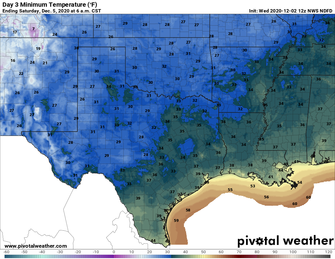
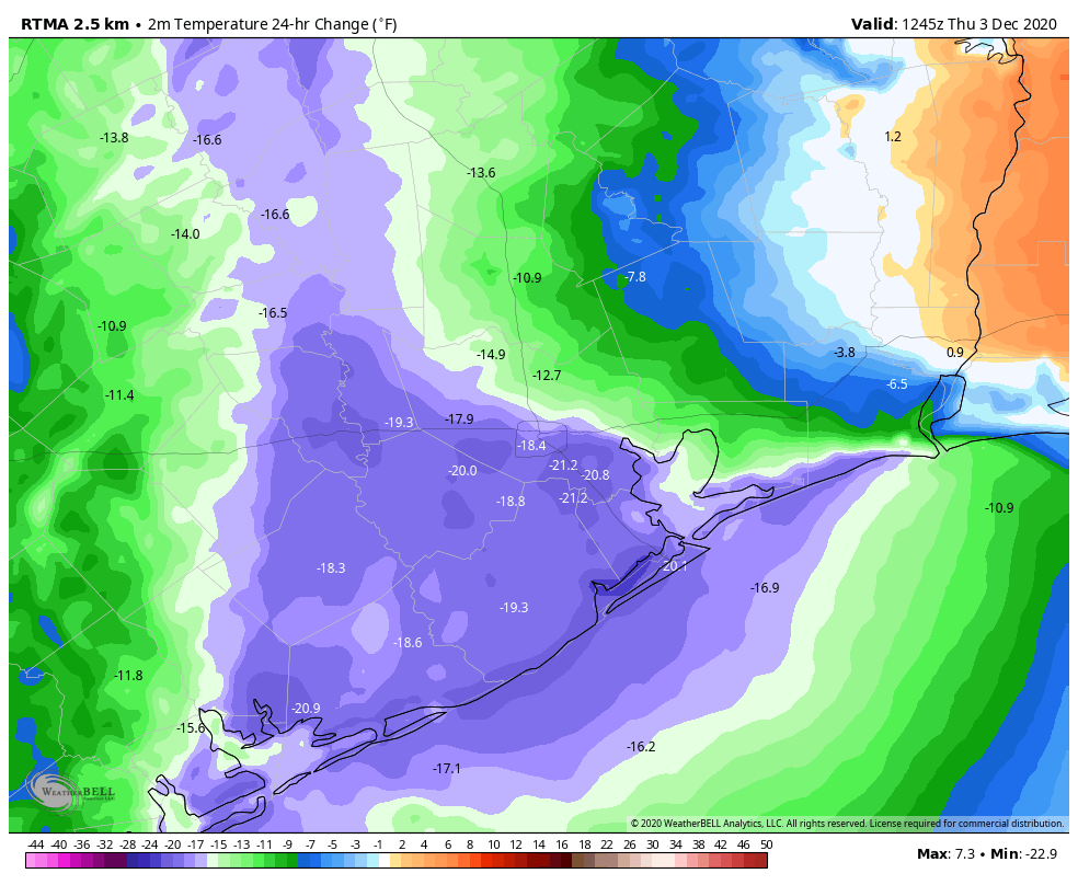
Speaking of winter, it’s back. Temperatures are generally in the 40s this morning, and although skies will clear from west to east this morning, most of the region likely won’t warm past the mid-50s. A northerly breeze at 10 to 15 mph will make things feel quite cool. Moderate northerly winds will continue tonight, as low temperatures fall to around 40 degrees in the city of Houston. I don’t think outlying areas will see a light freeze, but areas north and west of the city will fall into the 30s.

Friday

A day a lot of like Thursday, albeit with lessening winds.
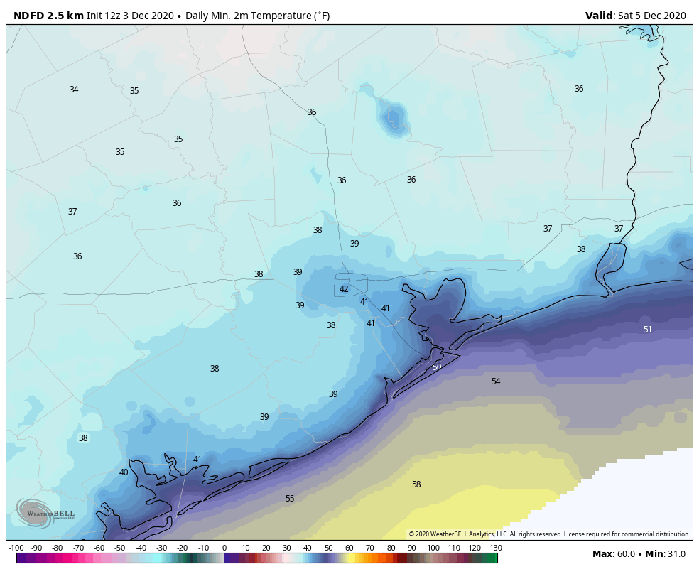
Saturday and Sunday

Do you have outdoor plans this weekend? If so, you’re in luck. High temperatures should moderate some, rising into the low 60s. Overnight lows will generally fall into the 40s. And with high pressure dominating we should see partly to mostly sunny skies throughout the weekend.

Saturday will likely be the coldest morning of the next seven days for the region. (Weather Bell)

Next week

The general pattern for next week seems fairly clear—Monday and Tuesday should remain on the cooler side of things before a general warming trend begins from Wednesday onward. Highs likely will reach 70 degrees by Thursday or so. Rain chances seem minimal from now until at least next Friday, further underscoring the importance of the rain Houston received over the last six days.

Widespread rain today, followed by a spell of sunny, winter-like weather

The Houston region will see warmer weather today ahead of our next cool front, but the bigger story will be the potential for widespread rainfall. It looks like most of the area will see 1 to 3 inches between this morning and the evening before a front scours moisture from our region. This will set the stage for cooler and sunnier weather in the days ahead, including a splendid, winter-like weekend.

Wednesday

Houston’s radar is lighting up this morning as a reasonably moist atmosphere combines with favorable upper level conditions. Much of the region should see on-and-off rain showers today, but for the most part these should come at manageable rainfall rates of 1 inch per hour or less. A few locations may see more than 3 inches of rain today, and the most likely spot for that is along the coast. In addition to the rain, we may see the potential for some damaging winds, but the overall threat for that, along with any tornadoes, is fairly low. Highs today should reach nearly 70 degrees for most areas, with the front arriving in late afternoon for western parts of the region, and early evening closer to the coast. As the front moves in, any lingering showers will end. Lows tonight will drop into the 40s for most.

NOAA rain accumulation forecast for now through Friday. (Pivotal Weather)

Thursday and Friday

We’ll see a pair of mostly sunny, cool days with highs likely somewhere in the 50s, and overnight lows around 40 degrees. I think outlying areas such as College Station will remain just above freezing on these nights, but it will be fairly close.

Saturday and Sunday

The weekend should see continued mostly sunny skies, with highs perhaps a bit warmer, reaching 60 degrees, or the lower 60s. Nights will remain chilly as the region falls under a drier flow of air. We can probably expect lows in the low 40s. These are about the averages one would expect to see in January.

Saturday morning will probably be the coldest morning of the upcoming spell of weather. (Pivotal Weather)

Next week

Cooler weather will remain in the cards through the middle of next week, most likely. We may see a warming trend back toward highs of around 70 degrees by the second half of next week, but it’s definitely going to feel like winter around these parts for awhile after today. Time to unbox those sweaters!

Also, after today, there should not be much rain to speak of for the next 7 to 10 days.

December starts with a freeze for many, but temperatures will soon moderate

Good morning and welcome to December. The final month of 2020 has started out cold—the city will not hit its record low of 26 degrees for this day, but much of the region is seeing a light freeze this morning. Houston’s official station, at Bush Intercontinental Airport, bottomed out at 30 degrees. This will be the coldest morning of the week, although Houston is likely to see cool nights with lows in the 40s or 50s for quite a while as we transition from a fall-like pattern into one more like winter with more consistent fronts.

December has stared on the chilly side with cool temperatures Tuesday morning. (Weather Bell)

Tuesday

It’s difficult to discern, but our light winds have shifted to come from the southeast, and as high pressure moves off we will see a moderation in temperatures today. Expect highs to climb into the low- to mid-60s under mostly sunny skies. Low temperatures tonight will only drop into the 50s as clouds build over the area, which will lead to increasing rain chances tonight and especially on Wednesday.

Wednesday

The combination of an upper-level low pressure system and a moist flow off the Gulf of Mexico will amp up our rain chances during the pre-dawn hours of Wednesday, through the afternoon hours as a cold front advances toward, and passes through the area. We can’t rule out some damaging winds in stronger storms. In terms of rainfall accumulations, I expect that areas north and west of Interstate 69 will likely see about one-half inch of rain, give or take; and areas south and east—closer to the coast—will generally see 1 to 2 inches of rainfall. Highs on Wednesday should get into the mid-60s before the front passes, with lows dropping to around 40 degrees overnight in Houston—cooler for inland areas, and warmer along the coast.

Rain accumulation forecast for now through Wednesday night. (Pivotal Weather)

Thursday and Friday

These should be a pair of mostly sunny days, with highs in the mid-50s and lows of around 40 degrees in Houston.

Saturday and Sunday

A reinforcing mass of drier air will move into the region Friday morning, and this should help keep our skies on the partly to mostly sunny side through the weekend. Right now I think we’re looking at highs of about 60 degrees for both days, but there is still some wiggle room in that forecast.

Next week

Our weather looks to remain on the cool side through the middle of next week, or so, before we may see a warmup of daily highs into the 70s or so.