After warming, Houston will see two fronts this weekend to cool us down

Good morning. Houston will continue to see a slow warming trend heading into the weekend before the arrival of two cold fronts nudge the region back into winter-like weather. Unfortunately, we’ll likely see some decent rain chances over the weekend until the second front pushes completely through.

It’s a cold, winter-like morning across Texas on Wednesday. (Weather Bell)

Wednesday

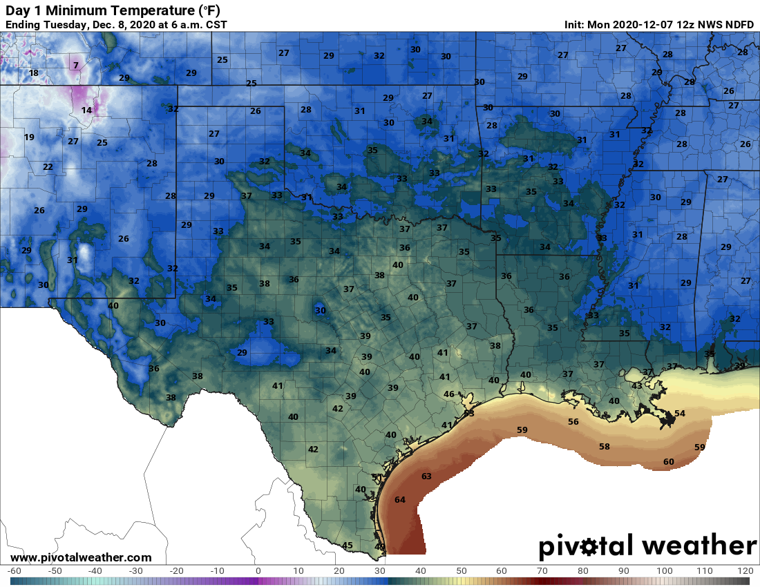
Lows are starting out in the low- to mid-40s today, and we’ll warm into the mid- to upper-70s under sunny skies. Our nearly calm winds will shift to come from the south later today or tonight, and that will mark the beginning of an onshore flow. Low temperatures tonight will be around 50 degrees in the city itself, with cooler conditions inland, and warmer near the coast.

Thursday

Skies should again be mostly sunny, and temperatures should again climb into the upper 70s. However, with continuing light, southerly winds we’ll start to see humidity levels creep up, and Thursday night’s temperatures should only drop into the low 60s for most.

Friday and Saturday

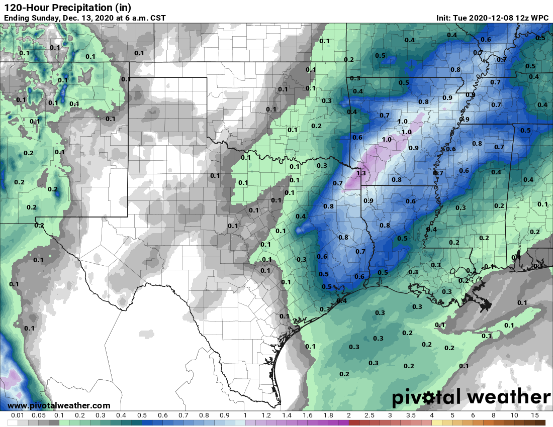
The pattern becomes more complex by the end of the work week, as an upper-level low pressure system approaches Houston from the west. By Friday, our atmospheric moisture levels will have increased to moderate levels, and this combined with rising air should lead to widespread rain showers later in the day. I expect these rains to be light to moderate, with accumulations of 0.25 to 0.75 inches for most people. Highs on Friday should reach the mid-70s.

At some point on Saturday, likely during the morning hours, a cold front should push into Houston, likely pushing off the coast around noon. Skies may clear a little bit on Saturday afternoon and evening in the wake of the front.

Rain accumulation forecast for now through Sunday. (Pivotal Weather)

Sunday

Lows on Saturday night will probably drop to around 50 degrees in the city, but then we should see a second frontal passage on Sunday that will bring still colder and much drier air to the region. It’s looking like this second front may produce some additional showers on Sunday, and then dry out quickly as blustery, northerly winds kick into gear. Lows by Sunday night or Monday morning could drop into the upper 30s for areas away from the coast.

Next week

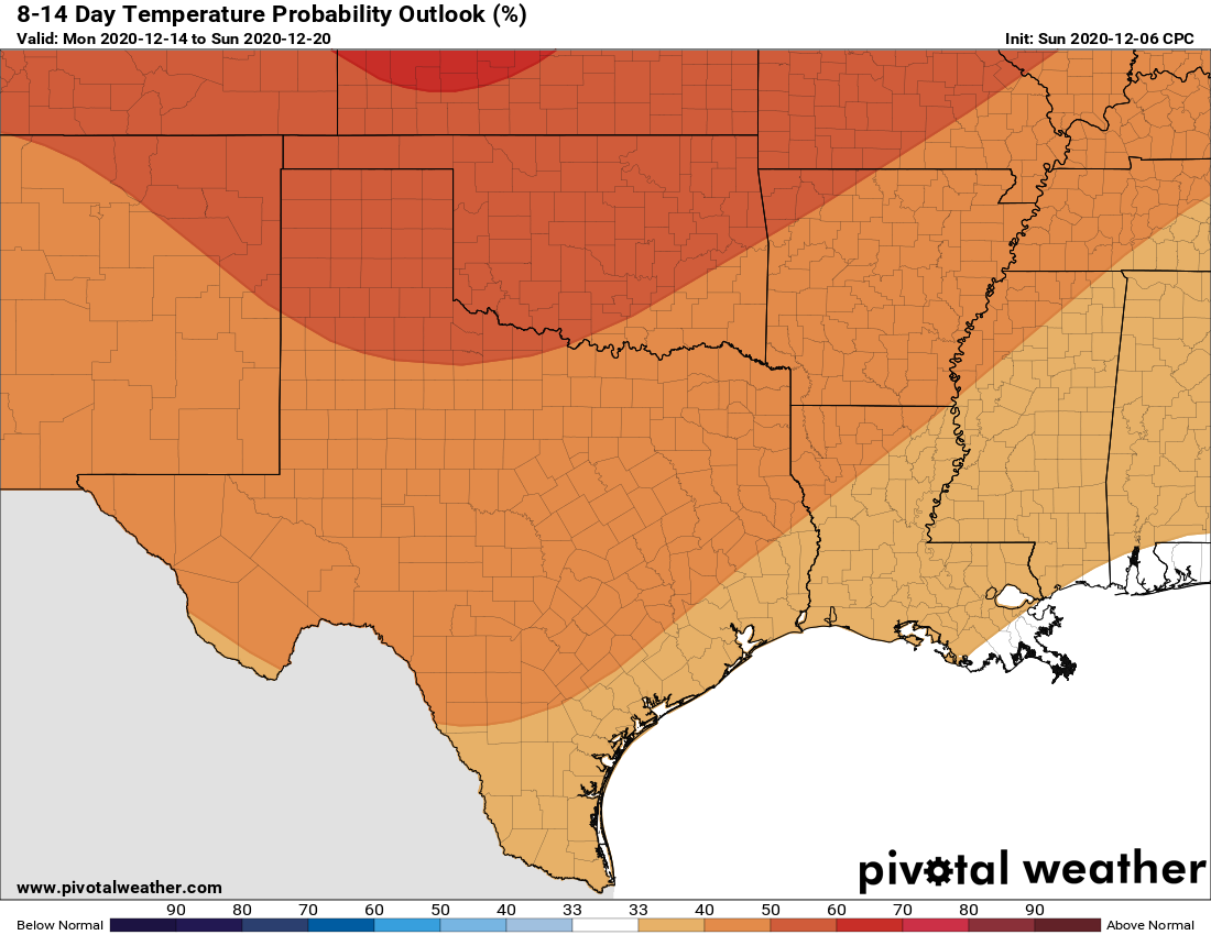
I think the general pattern next week will be one of warming after Sunday’s front, but I don’t have much confidence in the details. I know a lot of you have asked and wondered about Christmas Day weather, but right now it’s just too early to say anything meaningful. We’ll put out a preliminary forecast next Monday.

Houston to see a slow warming trend heading into the weekend

Good morning! I want to thank the teachers at Seabrook Intermediate, and the science program led by Rebecca Rolater, for letting me judge their annual science fair on Monday. It’s been an incredibly difficult year for teachers, so it’s great to see them persevere through the pandemic, and always uplifting to see the creative ideas kids have for projects. It gives one hope for the future. Now, on to the weather…

Houston is starting out this Tuesday quite chilly. (Weather Bell)

Tuesday

Temperatures have generally dropped into the upper 30s to low 40s across much of Houston this morning, and we’ll continue to see pleasant, sunny weather for a few more days as high pressure dominates. Expect high temperatures today to reach around 70 degrees, with light westerly winds. Temperatures Tuesday night will be a few degrees warmer for your location than Monday night.

Wednesday and Thursday

Expect more sunshine, and a modest warming trend, as we get deeper in the week, and our weather will begin to change further by early Thursday, as the onshore flow returns. This will begin to bump up our humidity levels. Otherwise, expect highs in the mid-70s both days, with mostly sunny skies. Overnight lows on Wednesday night will be about 50 degrees, and jump up to 60 by Friday morning.

Friday, Saturday, and Sunday

We’re still not all that confident about our forecast for this weekend. We can say that Friday should be mostly cloudy, with highs in the 70s, and some decent rain chances during the daytime and overnight hours—much of the area could see 0.25 to 0.75 inches of rain. However, we’re still not certain of what happens after that.

NOAA rain accumulation forecast for now through early Sunday. (Pivotal Weather)

It’s possible that a front will barrel all the way into Houston, and off the coast, drying the region out by Saturday morning. Or the front could get hung up northwest of, or on top of Houston. This would lead to continuing moderate rain chances and warmer conditions on Saturday for much of the region. This front, or a secondary push of drier air, will eventually make it through and off the coast, so we expect a cooler and sunny day for Sunday, with highs perhaps struggling to reach 60 degrees.

Next week

There is a fair amount of discrepancy in the models about how cold things will get early next week in the wake of the front. For now, I think lows in the city itself will probably get down to around 40 degrees by Monday morning or so. Another front may push through on Tuesday night, to keep the region on the cooler side for a few more days.

Sunny, winter-like weather will prevail until Thursday for Houston

Good morning. December has started out on the chilly side, with average temperatures generally running about 5 degrees below normal since the start of the month. The question is, will this trend continue? As you may recall, seasonal forecasts predicted a generally warmer than normal winter for the region. This probably still holds as I think the middle of December will likely bring warmer weather—with a sustained stretch of highs in the 70s—but right now I’m not seeing any evidence in the models of abnormally weather for weeks on end. I guess we’ll just have to see how things unfold.

Monday

Conditions are clear and cool this morning, with temperatures generally in the 40s across the region. We’ll see a splendid winter day, with highs climbing into the mid-60s for much of Houston, along with sunny skies, and light northerly winds. With clear skies and light winds prevailing overnight, lows on Monday night may drop into the upper 30s for a few areas north and west of Houston, but generally most of the city should remain the 40s.

Expect a chilly morning on Tuesday. (Pivotal Weather)

Tuesday and Wednesday

Temperatures will warm slightly, with a pair of sunny days expected. Highs will reach about 70 degrees both days, with lows both nights generally in the upper 40s—although the coast will probably only fall into the low 50s. Dry air will prevail. However, by Wednesday evening or so, the onshore flow will return, and this will presage warmer nights and better rain chances later in the week.

Thursday and Friday

With southerly winds, we may start to see some clouds on Thursday, but rain chances should hold off until Friday. Highs likely will reach the mid-70s on Thursday, but the overnight temperature will be much warmer, likely only dropping into the low- to mid-60s for much of the metro area. Friday will see more clouds and healthy rain chances. Right now I’m expecting only modest accumulations, with 0.25 to 1 inch of rain for most of the area. Highs Friday should again reach into the low 70s.

Saturday and Sunday

The weekend outlook remains a bit uncertain. The most likely scenario is that a cold front pushes into the region by late Friday night or early Saturday morning, leading to sunny and cooler weather for both weekend days. But the ensemble members of both the GFS and European models are not fully bought in—so for now our forecast is a “probably.” If the front stalls before pushing through Houston, Saturday may end up rather warm and potentially rainy before the front more definitively pushes through on Saturday night or Sunday.

NOAA’s outlook suggests Houston will see generally warmer than normal weather during mid-December. (Pivotal Weather)

Next week

Houston will probably see something of a warming trend by Tuesday or so of next week and after that it may be a bit before we see another front. This is the time where I could see a week or so of warmer weather in the December 15 to 20 range—but we’re now getting to the point where forecasting becomes highly speculative.

A spectacular stretch of nice winter weather is on the way for Houston

We are headed for a relatively quiet weekend in southeast Texas, after a lot of active, changeable weather lately. With the exception of a minor hiccup tomorrow, we are in for quite a stretch of weather. More in a second.

Yesterday, Eric touched on the recent rains being of benefit to our area, and the latest drought monitor update certainly highlights this. The Houston region saw drought coverage drop from near 90 percent a week ago to only 41 percent this week.

The rains of the last week or so have put a major dent in drought in the Houston region, and this doesn’t even include Wednesday’s rain. (Drought Monitor)

And in reality, it’s actually even lower than that, as the rains from Wednesday were not included in this update. So look for drought conditions to minimize even a bit more next week. We can stop discussing drought for awhile now.

Today

Look for sunshine for much of today. There will likely be some high clouds passing through at times, but it should not be much worse than that. We will see highs in the 50s with a bit less wind than yesterday.

Weekend

A more robust area of high clouds will overspread the area tonight. We’ll call it mainly clear, but by sunrise tomorrow, it could be partly to mostly cloudy. Moisture gradually increases tomorrow, and we will likely see some light rain or passing showers break out, particularly south of I-10. We’ll probably see a good setup for “virga” later tomorrow and tomorrow night as well, rain falling aloft but evaporating before it hits the ground. We’ve got enough moisture aloft, but dry air will still be attempting to win out at the surface. So if you check radar this weekend, it may look worse than what reality is on the ground.

Moisture begins to thin out on Sunday, which means we should see mostly sunny skies develop.

Look for lows in the 40s in the city and at the coast Saturday morning, with 30s in outlying areas. Highs on Saturday will struggle a bit due to cloud cover and may limp into the 50s in spots.

Depending on how much cloud cover we see tomorrow, high temperatures may just barely reach the mid-50s. (NWS forecast via Weather Bell)

Clouds will keep lows in the 40s in most spots on Sunday morning, followed up by a nice afternoon with highs near 60 degrees.

Early next week: Glorious

Monday and Tuesday look sunny and rather pleasant. Expect highs near 60 degrees on Monday and perhaps a few degrees warmer on Tuesday. Lows should be in the upper-30s or 40s. Wednesday looks good as well right now. There may be a dry front that reinforces cooler, drier air over us Tuesday or early Wednesday, and that would also reinforce sunshine.

When the nice winter weather hits Houston… (3Below: Tales of Arcadia)

To be honest, at this point, Monday through Wednesday of next week will be cool days, but they may be some of the nicest you could ask for in winter in Houston.

Later next week

Onshore flow finally kicks back in on Thursday or Friday, which should allow for clouds and warmer temperatures to come back. We may also see some morning fog. Our next storm system should arrive around this time, bringing a chance of rain probably focused on next weekend. Our next front will probably follow at some point Sunday or Monday. More on that next week. Enjoy the weekend!