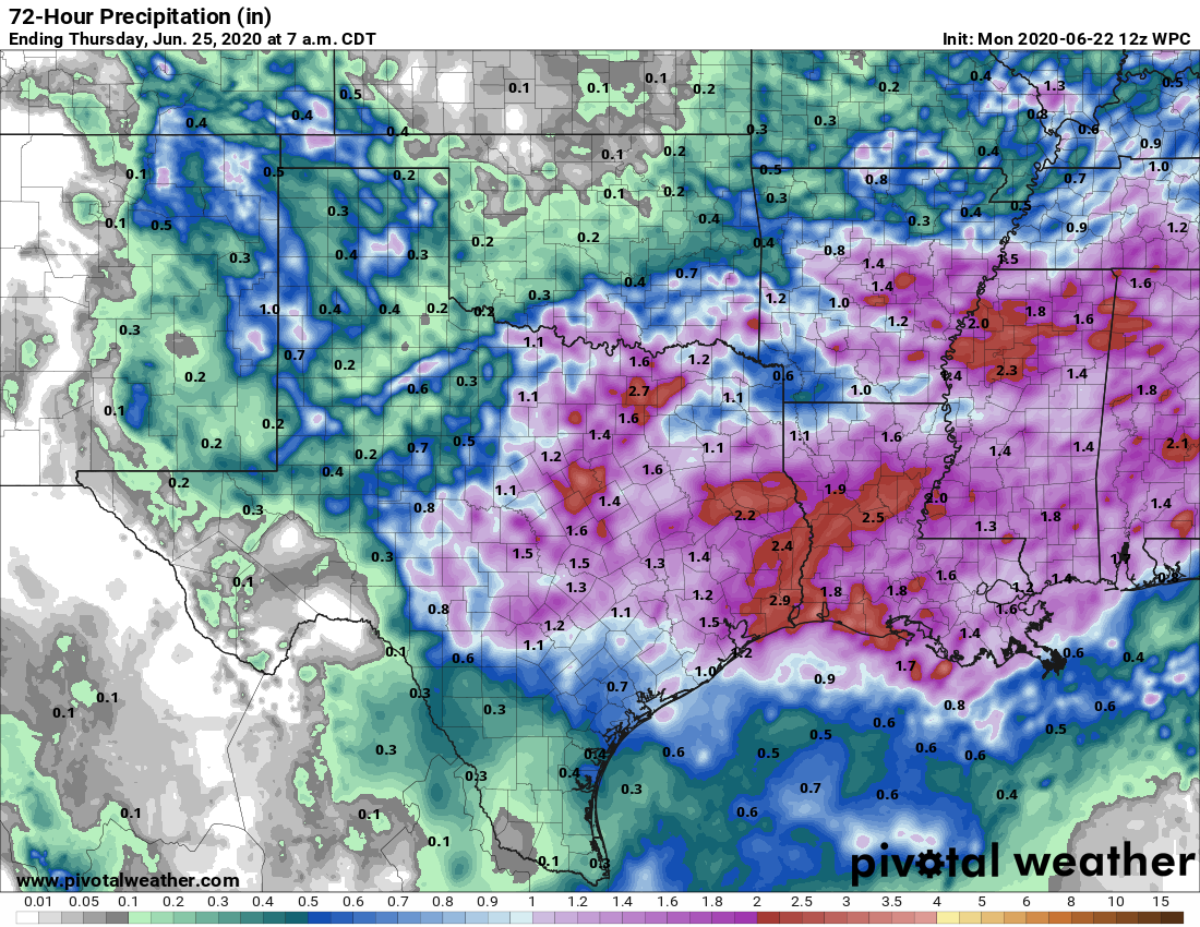
Good morning. While we anticipated widespread rainfall on Monday, the intensity of the storms that developed over central Houston—in one area near downtown rainfall rates briefly exceeded a rate of 4 inches per hour—was not expected. Overall it’s a good reminder of the potential of heavy rainfall from the kinds of moist air we can see during summertime along the Gulf Coast. The potential for heavy rainfall will continue through Thursday, after which it should slacken some due to the arrival of Saharan dust.
Tuesday
We have all of the ingredients needed for heavy rainfall today, but we think storms will develop a little bit later in the day than on Monday. The first thing we’re watching is a complex of thunderstorms currently near the I-35 corridor that will move east into the Houston region later today. We expect this to weaken. Later this morning, showers should develop offshore, and move inland. And finally, tonight, a weak front will sag into Houston. Sadly this won’t bring any cooling, but it will serve as a focus for additional storm development.

Some models show this front moving slowly, and then hanging up along the coast. This could lead to a scenario where coastal counties pick up a fair amount of rain tonight and into Wednesday morning. Widespread rain totals for today and tonight will probably be about 1 to 3 inches for most of the area, but some isolated areas—most likely between Interstate 69 and the coast—may pick up as much as 5 additional inches of rain.
Wednesday
After whatever mess of storms that develops overnight weakens or moves off by around sunrise on Wednesday, it is possible that any new development later in the day will be more scattered in nature due to a worked-over atmosphere. Mostly cloudy skies should continue to keep temperatures in the upper 80s.