Nice Friday, warmer weekend, but back to winter by later next week

Happy Valentine’s Day, an important day in southeast Texas weather history! We have at least a couple more nice days ahead before some pretty significant changes slowly evolve next week.

Today

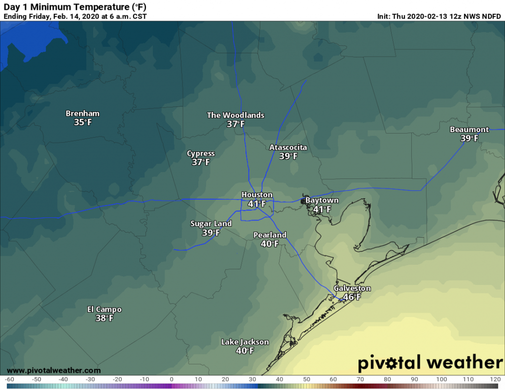
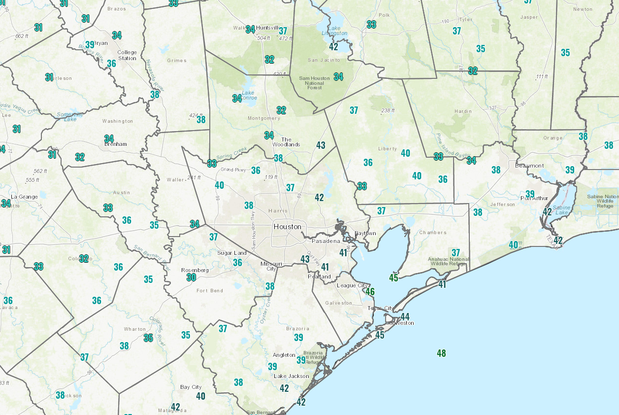
It’s a bit cold this morning. Temperatures are in the upper 30s to low 40s on average. A few isolated spots north of The Woodlands or out by Rosenberg in Fort Bend County are near or below freezing this morning.

Temperatures as of 5:30 AM Friday are in the 30s and 40s, with a few locations near freezing on the edge of the Houston metro area. (NOAA)

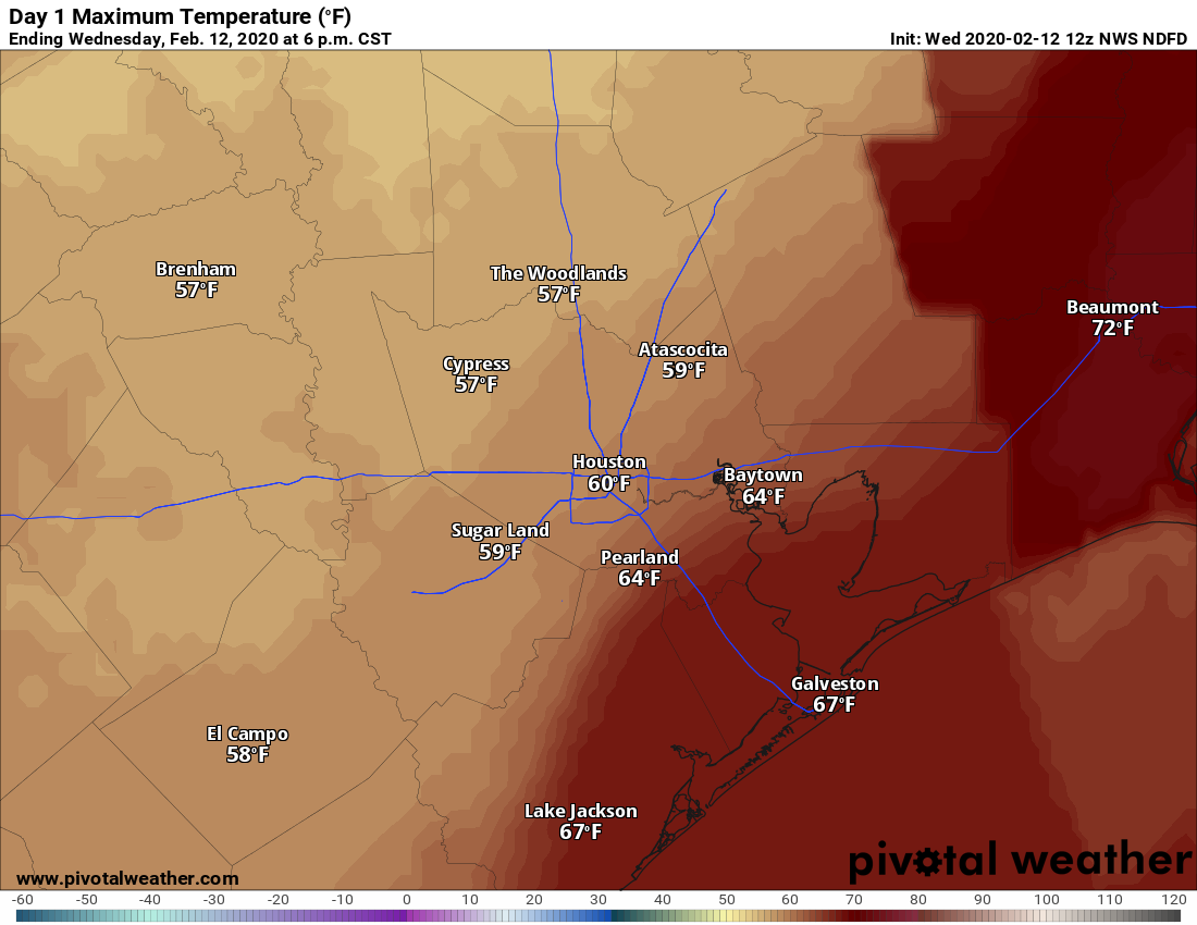
The chilly temps are partially because skies are clear, which means gorgeous weather is expected today. Sunshine should dominate with mostly light winds, though a bit breezy at times still on the Gulf and in the bays. High temperatures will warm up to near 60 degrees.

Saturday

Tonight will be cool, but temperatures will be a few degrees warmer than this morning’s lows. Look for 40s in general, followed by sunshine once again for Saturday. Clouds should become a bit more noticeable as the day goes along, and high temperatures will be a bit milder. We should top off in the 60s in most spots, perhaps near 70 if clouds are slower to arrive.

Sunday

Clouds thicken up Saturday night and Sunday. With the clouds could come a few showers, especially south and east of Houston. Additionally, some fog may develop by Sunday morning in spots. Otherwise, it will just be mostly cloudy and mild, with highs reaching into the 70s after morning lows in the 50s.

See full post

Winter returns for a bit, and the weekend outlook improves

What a difference a day makes. With clearing skies and dry air, lows this morning have fallen into the 40s across the Houston area. Our forecast for the weekend continues to improve as well, now with at least some sunshine possibly breaking out over the area and diminishing rain chances. Looking a bit further ahead, a stronger front may bring a bit more of a prolonged period of cooler weather next week.

Thursday

Sunshine will prevail for most of the day Thursday, with high temperatures likely holding in the upper 50s. Northerly winds will blow at about 10 mph, gusting perhaps a bit higher, which should be enough to keep a decent chill in the air. Clear skies and light winds will push overnight low temperatures down into the 30s for most inland areas of Houston—although the entirety of the metro area will probably remain above freezing.

Expect a cold night Thursday night across Houston. (Pivotal Weather)

Friday

Another pleasant winter day, with sunny skies and high temperatures near 60 degrees. Winds shifting to come from the east should allow for Friday night’s low temperatures to settle in about five degrees warmer than Thursday night.

See full post

One more day in the soup before the sun returns

This is our last day with gray, soupy weather before a front clears us out on Wednesday night. But as we’ve been saying, the forthcoming winter interlude will only last a couple of days. Enjoy the sunshine while it lasts!

Wednesday

Conditions this morning depend upon where you live, with much warmer conditions in the low 60s right along the coast, where a warm front has pushed back on shore, and lows of around 50 degrees well inland, where the front has not yet reached. Highs today will mostly be in the 60s, with temperatures on the cooler end inland and warmer along the coast. A series of showers—mostly light but possibly with a few heavier thunderstorms—should move through the area this morning and clear by later this afternoon.

High temperatures Wednesday will vary by location. (Pivotal Weather)

For the most part, rainfall totals should be under one-half inch, but we can’t rule out some higher, isolated totals especially north of I-10. A cold front finally pushes through Houston late Wednesday night, dropping lows into the 40s overnight.

Thursday

This will be a mostly sunny, cool day with highs likely in the upper 50s. A northerly breeze gusting up to 20 mph will make it feel a bit cooler. Thursday night will be the coldest night of the week, with lows in the mid- to upper-30s possible for inland areas, with temperatures around 40 in the city.

See full post

A front moved offshore, but not for long

Houston’s forecast will continue to be a gray, wet mess for the next couple of days before sunshine returns on Thursday. Unfortunately, this sunny weather will be short-lived with the return of clouds and some rain showers as early as Saturday.

Tuesday

A cold front has pushed just offshore, leading to northerly winds across the metro area and temperatures ranging from the mid-40s north of the city to around 60 degrees right along the coast this morning. The front will slowly lift back to the north today, allowing winds to shift to come from the east. To be frank, it’s not clear how slowly this front will pull back today, and so our temperature forecast is somewhat uncertain. Generally highs will probably get into the low 60s across the region, although areas north and west of Houston will be cooler.

High temperatures Tuesday will depend on the position of the front. (Pivotal Weather)

Skies will remain gray today, with the possibility of light rain. We can’t rule out a thunderstorm, but for the most part any showers in Houston today should be light as they move from west to east. Accumulations for most will be about a tenth of an inch or less. Low temperatures tonight will probably only fall a few degrees from daytime highs.

Wednesday

Frankly, we have a lot of questions about Wednesday’s weather as well, because there is just not great agreement on when the next strong front pushes into Houston and off the coast. Highs on Wednesday will likely get somewhere into the 60s, but again there could be a pretty sizable difference in temperatures between west (cooler) and east Houston. Rain chances will be pretty high on Wednesday, but again I expect accumulations to be reasonable, with most areas receiving one-half inch or less.

See full post