Houston’s on-and-off stormy pattern will continue for awhile

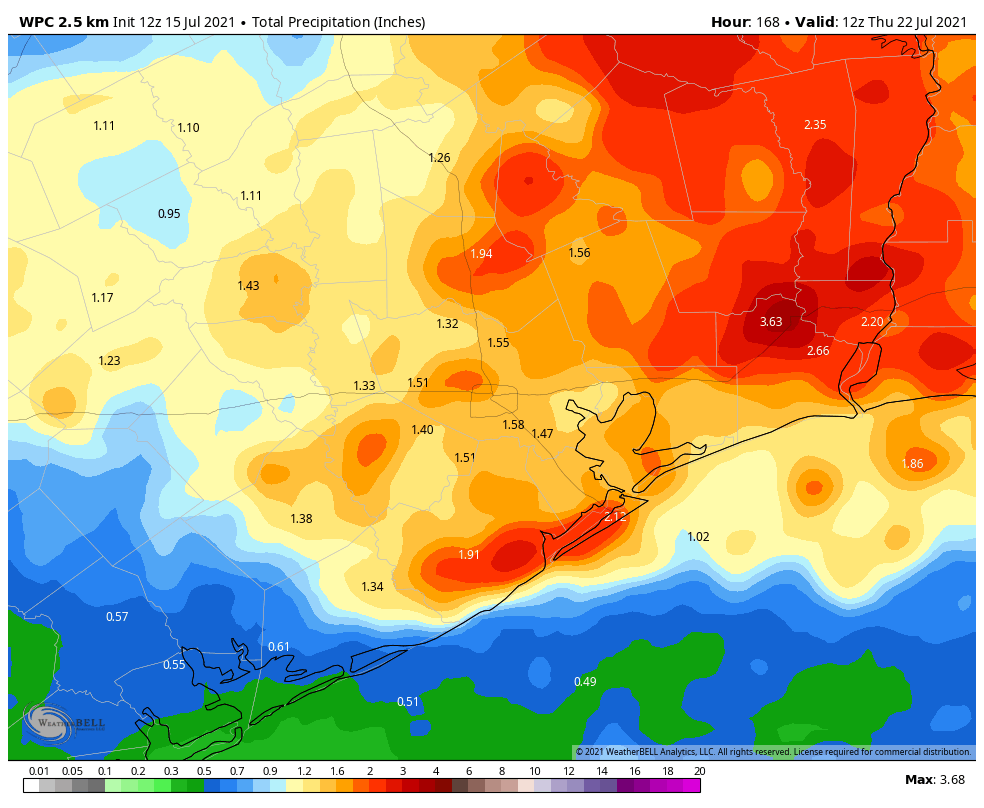
Good morning. If you’ve come to read this in hopes of learning when Houston’s wet pattern will break, I’m afraid we’re going to disappoint you. The short answer is: Not any time soon. Houston is going to see daily rain chances through at least the middle of next week as our region remains open to Gulf moisture and rising air.

Thursday and Friday

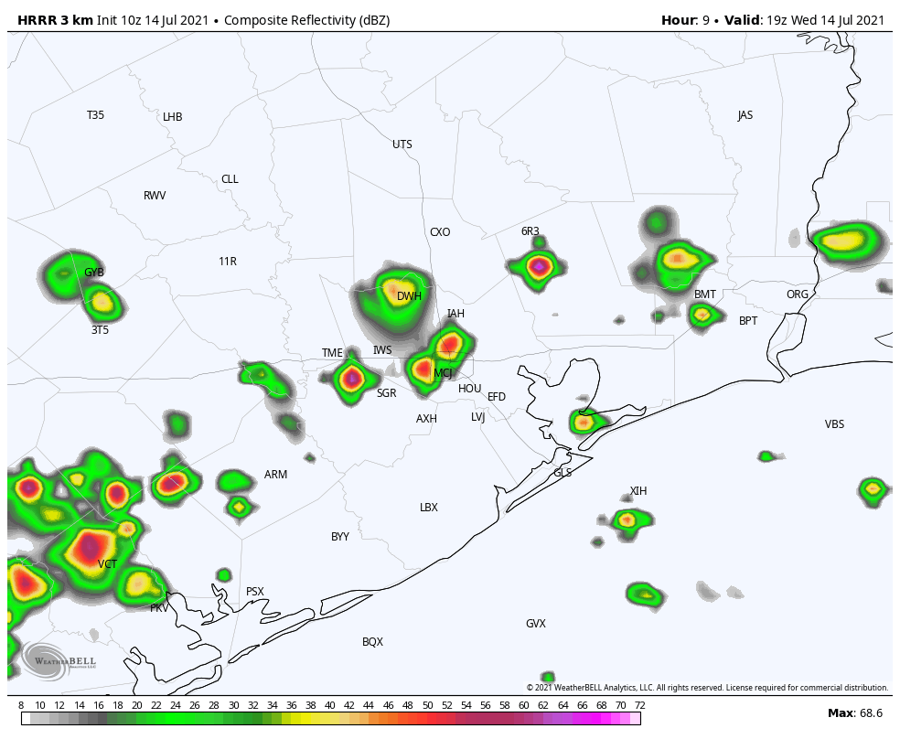
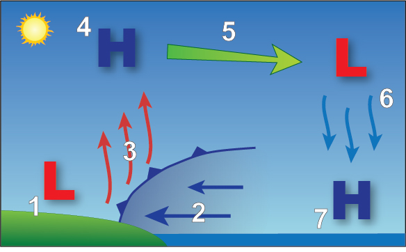
Our best-guess forecast for the next two days is that conditions will be a lot like we experienced on Tuesday and Wednesday. Effectively, this means we’re likely to see showers and thunderstorms develop closer to the coast during the late morning hours and then slowly migrate inland during the afternoon hours. These storms are driven as the sea breeze moves inland from the coast, and combines with warmer surface temperatures to lift moisture higher into the atmosphere where it can condense. You can learn more about the sea breeze, and how it affects our weather during the summer, here.

In the late morning and early afternoon, water is cooler than land, so at the surface air flows onshore. As this air moves inland it is heated and rises, producing the lift needed for showers to develop. More information. (National Weather Service)

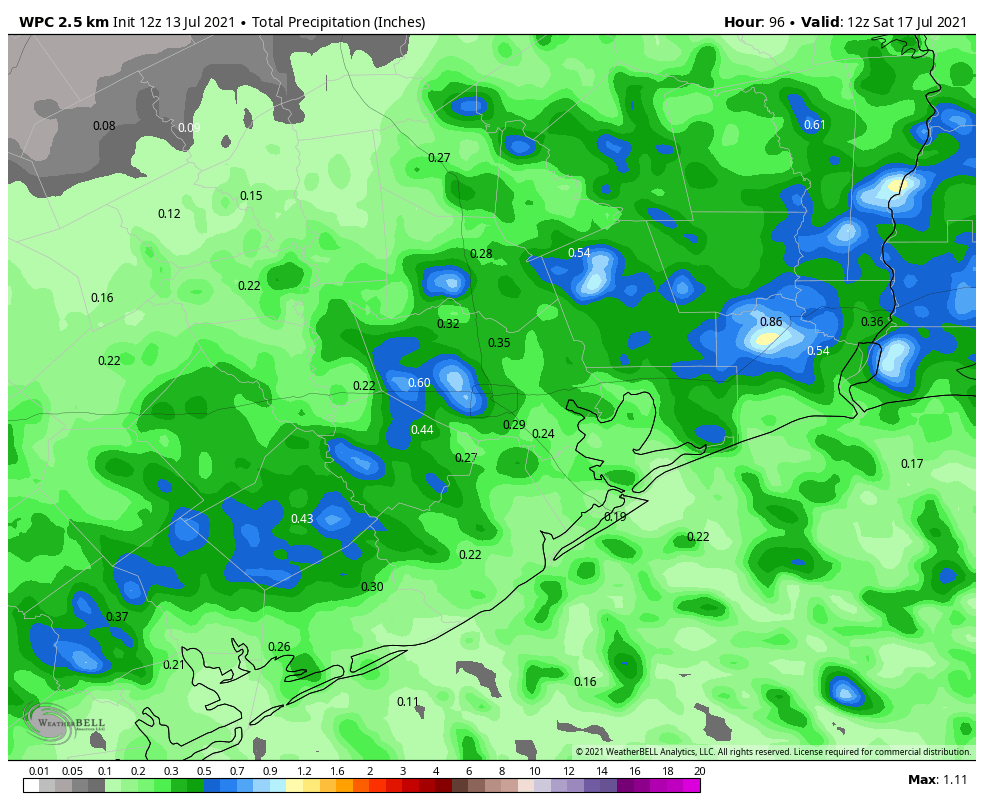
Anyway, these showers will be hit or miss, but some areas may pick up 1 to 2 inches of rain while nearby you just see gray skies and hear thunder. Highs will generally be limited to about 90 degrees with a mix of partly sunny skies. Winds should come out of the south at 5 to 10 mph.

Saturday and Sunday

The overall setup will not change this weekend, although it does look as though the moisture available for storms to develop will decrease slightly. This means there will probably be fewer showers and thunderstorms for you to dodge this weekend, but the threat is unfortunately not going to go away during the afternoon hours. Again, this activity should driven by the sea breeze. Highs will otherwise be in the low 90s for much of the area, with mostly sunny skies.

NOAA rainfall accumulation forecast for now through Wednesday. (Weather Bell)

Next week

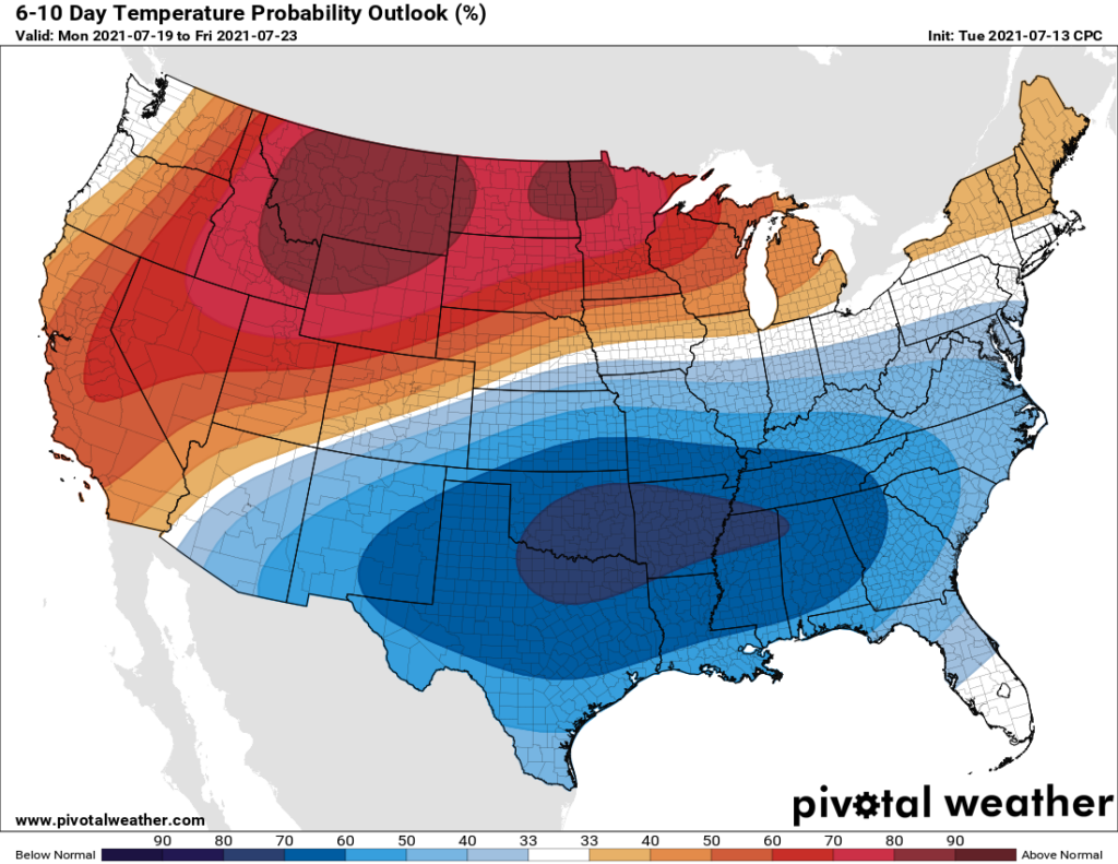
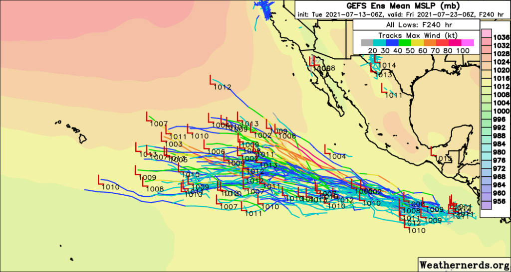
This pattern should persist into Monday, after which time we may see conditions actually become more favorable for rainfall on Tuesday and Wednesday. While the details are fuzzy, we can expect a low-pressure system to push rain chances higher into mid-week, and this should help to keep temperatures on the low side for our region, perhaps around 90 degrees.

Finally, by about Thursday or so, the models generally agree that our region should begin to see fewer showers and thunderstorms. But that is far enough into the forecast such that I don’t have too much confidence in such a prediction yet.

After Tuesday’s storms, more are possible this afternoon

Good morning. Not going to lie—the intensity of some of Tuesday afternoon’s storms across north and west Houston surprised me. There were a few downbursts that briefly brought winds as high as 60 mph to areas such as Jersey Village, Cypress, Copperfield, and elsewhere. Rainfall was quite intense, as well. The overall pattern is similar for today, so we could see more of these localized, intense storms in parts of the region.

Wednesday

Given the atmospheric setup, we should again see scattered showers near the coast this morning, with coverage filling by the middle of the day and during the afternoon hours. High resolution models suggest that strong storms could again form along the Interstate 10 corridor during this time period, and slowly lift north. So while I’m not saying you will see a repeat of Tuesday’s intense storms, it is possible. Highs will otherwise reach the low 90s, with partly sunny skies. Shower activity will wane with the loss of daytime heating.

HRRR model depiction of possible storms on Wednesday at 2pm CT. (Weather Bell)

Thursday and Friday

The overall pattern remains similar. Because Houston will be far enough removed from the influence of high pressure, the combination of warm summertime temperatures and ample Gulf of Mexico moisture will do their thing, and each of these days will bring rain to about 50 percent of the Houston area. Highs should, for the most part, be in the low 90s with partly sunny skies.

Saturday and Sunday

So will this wet and potentially stormy pattern extend into the weekend? The short answer is yes, although for now I still think both days will have lower rain chances, in the 30 percent range, to go along with mostly sunny skies and temperatures in the 90s. But how high is my confidence in this forecast? It’s not sky high, that’s for sure.

Next week

Some models are suggesting an upper-level low pressure system will move toward Texas early next week, and this would act to increase rain chances beginning Monday or Tuesday. I don’t think we’re looking at any kind of a flood situation, to be sure, but it does seem like our overall wet and cooler pattern will extend at least into the middle of next week.

Temperatures next week should be cooler than normal. (Weather Bell)

It’s been an interesting summer so far, as we’ve seen what happens when high pressure doesn’t build directly over our region. There’s still time for this, of course, as we could see a “ridge of doom” in August or even September. And I’m not complaining. The cooler summer has been nice, and I can count the number of times I’ve watered my lawn in 2021 on my Unicorn horns. Which is zero. Because I don’t have a unicorn horn growing out of my forehead.

Eye on the Tropics: Quiet for a bit

After a frenetic start to the 2021 Atlantic hurricane season, we’re settling down into a bit of a quiet period, and I am sure no one is complaining. Last week saw Elsa, which was the earliest “E” storm on record. We’ve already fallen off 2020’s insane pace however, as Fay formed on July 9th last year. Gonzalo did not form until the 22nd of July, indicating that we had a bit of a lull last year too.

Tropical outlook in a sentence

The next 7 to 10 days are not currently expected to produce any organized tropical systems of note anywhere in the Atlantic Basin.

So what’s next?

I thought I would keep this post fairly brief this week. Looking at satellite across the Atlantic, there just isn’t much happening right now.

The Atlantic basin has a couple minor tropical waves but nothing that will significantly develop. (College of DuPage)

The National Hurricane Center is tagging that one system off the coast of New Jersey for a 10 percent chance of development, but, yeah. Moving on.

In addition to a lack of any beefy tropical waves, the Atlantic basin is choked in dust at the moment. Dust doesn’t prevent tropical systems from forming, but it does indicate the presence of drier air, which usually inhibits storms.

Anywhere you see yellow, orange, or red color, it indicates dust or dry air. The Atlantic is full of it. (University of Wisconsin)

We are basically in peak dust season now, as is typical, so this is not terribly surprising.

On top of all that, if you look out in fantasyland on the GFS or European models and ensembles, you can’t even scrounge up some make-believe activity. Even the usually turbocharged Canadian ensemble only has one or two members showing minimal systems in the Atlantic over the next 2 weeks. So it’s quiet, and model agreement is strong for that. Without going into too much detail here, this is true for good reason: The background environment over the Gulf, Caribbean, and Atlantic is not favorable for tropical development right now or over the next 10-plus days. What is happening in the background is helping to “suppress” thunderstorm development a bit. That doesn’t mean something can’t spin up, but the overall base state of things right now is hostile toward tropical systems, which is good news for all of us.

This may change in the final days of July and first few days of August, so I do expect we’ll have something to talk about when you see this post on July 27th (due to schedules we won’t be posting next Tuesday). But there is no sign of anything right now.

Where activity is busy is in the Eastern Pacific. There are two areas of high probability development over the next 5 days, and there may be more to follow beyond that.

While the Atlantic is quiet, there will likely be a handful of substantial systems in the East Pacific. None are a threat to land for now, and none are expected to reach Hawaii at this time. (Weathernerds.org)

Everything is currently projected to head out into the open ocean, away from Mexico, and not reach Hawaii so that is also good news.

That’ll do it for this week. Hopefully our next tropical post is equally quiet!

After Monday’s reprieve, summer-like weather returns

It would be wrong to say Monday’s weather in Houston was pleasant, but after a weak surface front moved through the region Monday evening was certainly “July nice.” The change was subtle, but dewpoints dropped a few degrees, with temperatures following suit. The result was just about as nice an evening in July as you’re ever likely to experience. It won’t last—the boundary is already washing away—but it’s also reminder that fall is only a couple of months away.

Chart showing a drop in temperatures and dewpoints on Monday afternoon at Bush IAH. (NWS)

Tuesday

The passage of the front on Monday also spurred scattered, but in some cases fairly strong storms along and north of Interstate 10. Today the focus should shift closer to the coast, with some isolated to scattered showers popping up during the afternoon and early evening hours along with the sea breeze. (They will not be as intense as Monday). Otherwise, we should see mostly sunny skies today, with highs in the lower 90s, and winds shifting to come from the southeast.

Wednesday, Thursday, and Friday

As we get deeper into the week rain chances may improve a little bit on Wednesday and Thursday. Why? Because atmospheric moisture levels should rise a little, and our region won’t be directly under the influence of high pressure. I don’t think overall rainfall accumulations will be high, but I think you’ll have about a 40 percent chance or so of seeing a shower on each of these days, particularly during the afternoon and evening hours. Highs will be in the low 90s, with a mix of sunshine and clouds.

NOAA rain accumulation forecast for now through Friday night. (Weather Bell)

Saturday and Sunday

At this point, although the forecast remains subject to change, the weekend looks reasonably nice for Houston. I think we’ll see partly to mostly sunny skies, with highs generally in the low 90s. With the humidity, of course, it will still feel plenty hot. Both days will be subject to the potential for some passing showers and thunderstorms, but I’d peg overall chances at about 30 percent each day. So yeah, we’re cautiously optimistic about outdoor activities this weekend.

Next week

Rain chances may begin to increase by Monday or Tuesday of next week as our atmosphere turns a little more unsettled, but I don’t think we’re looking at anything too crazy in terms of accumulations. Matt will have more for you on the tropics in a post later today, and the news on that front remains positive.