Warm weather continues for the next week or so for Houston

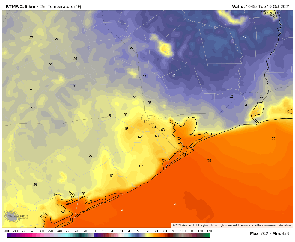
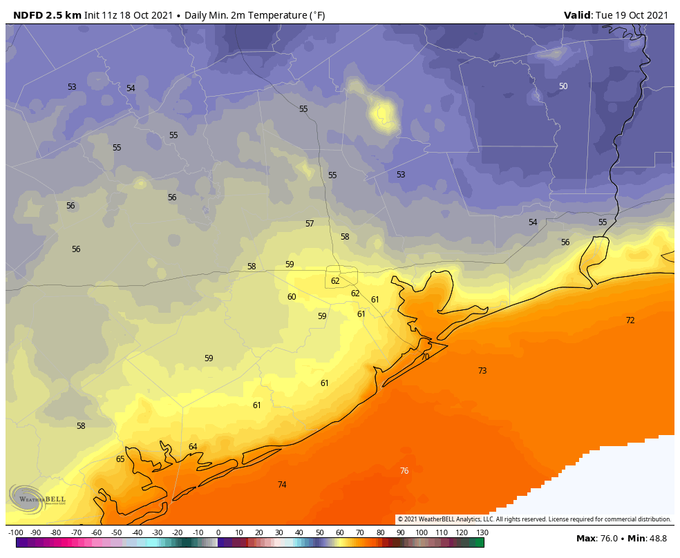
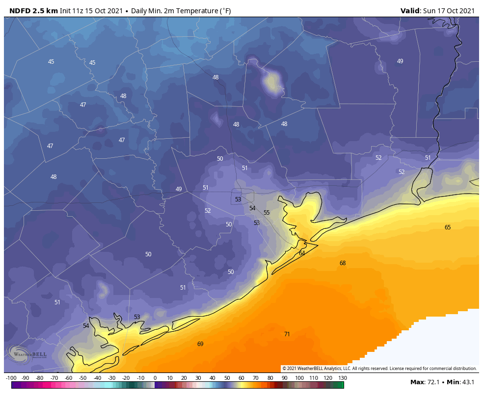
Temperatures are notably warmer this morning, with lows ranging from about 60 degrees well inland to the upper 70s along the coast. We’ll now remain in this warmer, and largely rain-free pattern, for about a week. Our next front will not arrive until next Wednesday or Thursday.

Wednesday

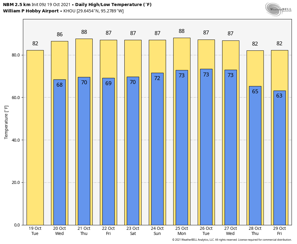
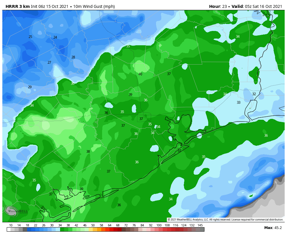
Winds will be light today, out of the east at about 5 mph. And with slightly lower pressures over the Gulf of Mexico we may see the development of a few more clouds. This will lead to a partly sunny day, with highs in the mid-80s. There may be a few, brief-lived showers east of Houston, but the vast majority of the region should see no rain at all. Low temperatures tonight will drop to around 70 degrees.

High temperature forecast for Wednesday. (Weather Bell)

Thursday and Friday

Both of these days should see mostly sunny skies, with highs in the mid- to upper 80s. Rain chances will be near zero with light easterly winds. Overnight lows will be around 70 degrees.

Saturday and Sunday

Our mostly sunny weather continues into the weekend with only slight modification. In response to departing high pressure, winds will turn more southerly, and increase to 10 to 15 mph with some higher gusts. This will bring a 10 or 20 percent chance of showers into the forecast each day, but for the most part I’d expect sunshine and highs in the upper 80s. A good weekend for the beach in late October? Why not.

Temperatures will be above normal next week until the front arrives. (Pivotal Weather)

Next week

Warm weather, with a mix of sunshine and clouds, continues next week. Rain chances start to nudge up on Tuesday and Wednesday ahead of a cold front that should arrive later on Wednesday or Thursday. It’s still too early to have much confidence in the details, but we should see some significantly drier air and cooler nights.

Choose your own adjective for Houston’s weather ahead: Boring, benign, or balmy?

Good morning. Our air remains pleasantly dry this morning, but that will begin to change as the overall flow turns more southeasterly. This will set the stage for a warm, but benign period that should run through the middle of next week, without too much variation. It looks like our next front won’t arrive until around Thursday of next week.

Low temperatures at 5:45am CT Tuesday are pleasantly cool for the region. (Weather Bell)

Tuesday

Except for central Houston and southern areas, low temperatures this morning have managed to drop into the 50 for most of you. This will be our last night in the 50s for awhile, however, as the flow from the Gulf of Mexico returns today. This will mean increasing humidity levels—although we’re not anticipating a return to ultra sultry weather—and rising temperatures. Highs today should reach the low 80s, with a mix of sunshine and clouds. Rain chances are 10 percent, or less. Lows tonight will only drop into the 60s for inland areas, and low 70s along the coast.

Wednesday, Thursday, and Friday

These days will all be similar, with partly to mostly sunny skies. Highs will depend upon how much sunshine peeks out during the afternoon hours, but most locations should wind up in the mid- to upper-80s. Nights will remain warm, in the 60s to lower 70s. Rain chances are basically nil.

Saturday and Sunday

The weekend should bring more of the same, although the onshore flow becomes a little more pronounced. Highs still will likely fall somewhere in the mid- to upper-80s, but nighttime temperatures could rise a degree or two, and increasing dewpoints should make it feel that little bit more sticky outside. Each day will probably see some sunshine, and some clouds, and while rain is unlikely we can’t rule it out.

So what is it: Boring, benign, or balmy? (Weather Bell)

Next week

This warm but not exactly hot pattern should persist into next week. Rain chances finally start to increase about a week from now, but we’re not anticipating anyting too wet. The global models are in pretty good agreement about a strongish front arriving by later next week, perhaps around Thursday. While I’d never have too much confidence in a nine-day forecast, the signal for something to shake up this weather pattern has been fairly consistent.

One more cool day before our region warms up for awhile

Good morning. After an absolutely stunning weekend we’ll begin to see a warming trend this week. Eventually highs will settle into the mid- to upper-80s by Thursday or so, with lows in the upper 60s. Little rain, if any, is expected this week. Our next significant cold front is probably about 10 days away.

Monday

This will be the last “cold” morning for awhile, with temperatures ranging from the upper 40s for far inland areas to low 60s right along the coast. The transition to warmer weather will begin as high pressure begins to move away from the area, off to our east, allowing for light southeasterly winds to return. Today is still going to be splendid, however, with sunny skies and highs in the upper 70s. Low temperatures tonight will be 5 to 10 degrees warmer for most locations than Sunday night.

Low temperatures for Tuesday morning should offer one more taste of fall. (Weather Bell)

Tuesday

A weak low pressure system will drift into the coast from the Gulf of Mexico on Tuesday, and it’s really only worth mentioning because this will bring the region its only noticeable chance of rain during the work week. And even then, rain chances are probably only on the order of 10 or perhaps 20 percent. Mostly, this should be a mostly sunny day, with highs in the low 80s. Lows Tuesday night will be in the upper 60s.

Wednesday, Thursday, and Friday

These days should all see mostly sunny skies, with highs in the upper 80s. It won’t exactly be Houston-hot, as dewpoints should be in the upper 60s rather than low- to mid-70s. But this sure will not be fall-like, either.

Saturday and Sunday

There remains a small chance that a weak front will push into Houston this weekend, but the more likely scenario is that it fails to reach our area. Highs this weekend, therefore, should remain in the mid- to upper-80s, with mostly sunny skies, and slight rain chances on the order of 10 to 20 percent.

NOAA rain accumulation forecast for now through Sunday. (Weather Bell

Next week

There appears to be very little in the way of a pattern change for the next 10 days, with the global models both suggesting the next front is unlikely to arrive before around October 28, ten days from now. It’s far too early to have any confidence in a forecast for Halloween.

Strong front on tap for later today, with a breezy influx of drier air to follow

Good morning. A strong cold front remains on track for Houston later this afternoon and evening, which will bring a few sunny days and much drier and cooler air to the region. My only real concerns right now are the potential for scattered showers this evening along with the front, and breezy conditions overnight into Saturday.

Friday

Today’s the last hot day for awhile. High temperatures away from the coast should reach about 90 degrees, and this probably will be the last time this occurs in 2021. (Emphasis on probably). Skies will be partly sunny with light westerly winds. The front itself should reach northwest Harris County late this afternoon, perhaps around 4 to 6 pm, push into central Houston shortly thereafter, and reach the coast by 8 or 9 pm tonight.

HRRR model forecast for wind gusts at midnight tonight. (Weather Bell)

Some scattered showers will be possible inland this afternoon, and a broken line of storms may form as the front nears the coast due to the availability of more moisture in the atmosphere. In the front’s wake, winds will be gusty overnight, possibly reaching 30 mph or above. Temperatures will fall with the front and its northerly air, likely reaching the 50s by Saturday morning.

Saturday

The strongest wind gusts will begin to fall back by sunrise, but we should still see breezy conditions on Saturday with gusts of about 20 mph from the north and northwest. Skies will be sunny, with highs in the mid-70s, and overnight lows on Saturday night will likely be the coldest for the region since April, with some inland areas reaching the 40s.

Low temperature forecast for Sunday morning. (Weather Bell)

Sunday

Skies should be mostly sunny on Sunday, and with light winds this day should be nearly ideal for outdoor activities. Highs will be in the mid-70s and overnight lows probably a couple of degrees warmer than Saturday night.

Next week

We’ll see a gradual warm-up next week, with highs in the 70s again on Monday and possibly Tuesday before rising into the low- to mid-80s by Wednesday and Thursday. The models are about 50-50 on whether another cold front pushes into the region next Thurday or so, but regardless our next real chance of rainfall after this evening’s frontal passage probably will not come until that time frame.

It’s been a long, long summer as always Houston. So enjoy this weekend. You’ve earned it.